Last updated 23.10.2026
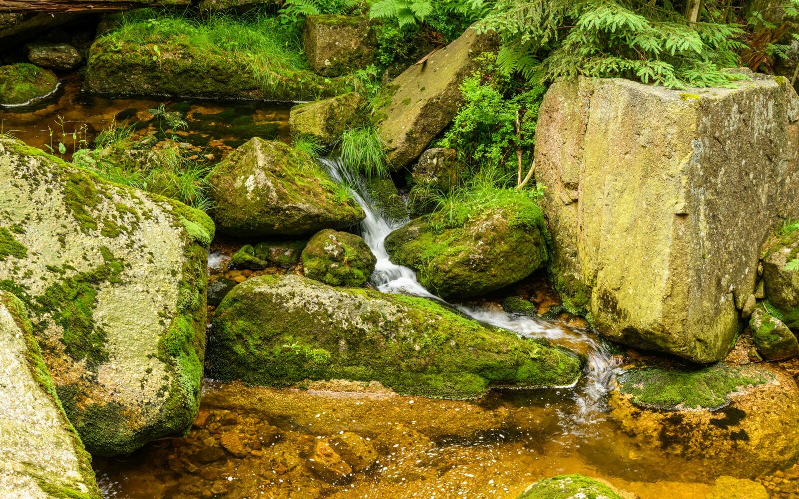
Ask a British walker to name a waterfall in the Czech Republic and you will usually get silence, then a guess about Prague. The country is not built for waterfalls: it has no glaciers, no big vertical drops and very few rivers that fall off anything. Which is exactly why the Rešov Waterfalls (Rešovské vodopády, roughly “RESH-ov”) are worth the detour. On the little river Huntava in northern Moravia, a two-hundred-metre slot of rock has been cut into the hillside, and the path does not skirt it — it goes down into it, over timber walkways, stone steps and small viewing platforms, right beside the water.
The whole thing is free, it is open all year, and the classic circuit is 3.8 km (2.4 miles). That is the catch and the appeal at once: this is not a full day’s mountain walk, it is a spectacular twenty minutes wrapped in an hour and a half of forest. Below you will find eight routes, from a version short enough for a five-year-old to a fifteen-kilometre traverse to a hilltop castle ruin, plus the practical bits nobody tells foreign visitors: which trail colour actually goes through the gorge (almost every source gets this wrong), how the Czech waymarking system works, and how to get here from Ostrava, Kraków, Vienna or Prague.
Rešov Waterfalls at a glance: routes, parking and trail colours
- Where: on the river Huntava beside the hamlet of Rešov, part of the village of Horní Město (“Upper Town”), Bruntál district, northern Moravia. Roughly 10 km from Rýmařov and 60 km from Olomouc.
- The standard route: from the car park in Rešov through the gorge and back, 3.8 km (2.4 miles) with about 220 m of ascent and the same descent, one and a half to two hours.
- The short version: down to the lower cascades and back, 2.8 km (1.7 miles) and about 175 m of climbing.
- Entry: free. This is a national nature reserve with no gate, no ticket office and no opening hours.
- Parking: visitors report around 40 CZK (about £1.40) for the whole day at the restaurant in Rešov. You cannot park at the waterfalls themselves.
- Difficulty: short but not level. Wooden steps, footbridges and stone stairways, slippery when wet. A pushchair will not get through.
- Trail colours: green runs through the gorge itself, red drops from Rešov down to the mill, and yellow is only a link across to Ruda and Křížový vrch. Most websites get this back to front.
- When to come: most water in spring during snowmelt and after heavy rain. Most people on summer weekends between 10am and 4pm.
What the Rešov Waterfalls actually are
The Huntava rises near Stříbrné Hory above Horní Město and, along its upper course, has carved a deep rocky valley full of cascades and several genuine falls. These are the highest waterfalls in the Nízký Jeseník — the Low Jeseník highlands, the gentler, forested cousin of the high Jeseníky mountains to the west. The full system of steps drops a little over twelve metres, with the biggest single fall somewhere around nine or ten. On a national scale, Rešov ranks as the eighteenth highest waterfall in the Czech Republic and the tenth by volume of water.
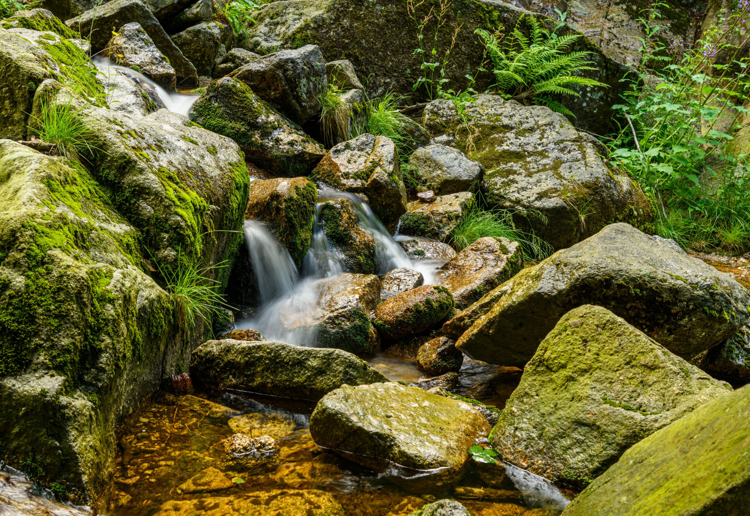
The gorge itself is about two hundred metres long and six to ten metres wide, with rock walls rising up to twenty metres above the stream. The most striking block is called Čertova stěna, the Devil’s Wall, and it stands around thirty-five metres. The site has been protected since 1966 and has held the status of a national nature reserve since 2013, covering 71.6 hectares. What is being protected is the original spruce-and-beech woodland with its ferns, and the moss communities on the permanently shaded rock faces.
For a visitor, two things follow from all of that. First, the experience is short and concentrated: you can walk the gorge in twenty minutes, but you will stop at every platform, so allow far longer. Second, you must stay on the marked paths — no shortcuts over the rocks, no scrambling down into the stream bed for a better photograph. This is the strictest category of protection Czech law has, and rangers do check.
Getting to the Rešov Waterfalls from abroad
Nobody flies to the Czech Republic specifically for a 3.8 km walk. Rešov works as a half-day stop on a wider trip through Moravia and Silesia, or as a detour on the way to the high Jeseníky and Praděd, the highest mountain in Moravia. Here is how the region connects.
Nearest airports
- Ostrava (Leoš Janáček, OSR) is the closest, roughly 100 km away, about an hour and a half by car. Flights are limited and mostly seasonal, so check what actually operates before you build a trip around it.
- Katowice (KTW), in southern Poland, is around 250 km and about three hours’ drive, and is very often the cheapest option from the UK.
- Kraków (KRK) is roughly 290 km, three and a half hours, and has far more UK routes than anywhere on the Czech side.
- Prague (PRG) is about 260 km to the west, three to three and a half hours by car, and is the easiest airport to reach but the least convenient for this corner of the country.
- Vienna (VIE) is a similar distance, around 260 km, and makes sense if you are combining Moravia with Lower Austria.
The nearest sizeable Czech cities are Olomouc (about 60 km, an hour), Ostrava (an hour and a half) and Brno (about 115 km, under two hours). Olomouc is the obvious base: a genuinely handsome baroque university city that most foreign visitors skip entirely, with fast trains to Prague and a UNESCO-listed plague column in the main square.
By car, and the Czech motorway vignette
Driving is by far the simplest way to do this walk. Car hire is straightforward and cheap by British standards at Prague, Ostrava, Brno and Olomouc, and the roads on the way are quiet.
One thing to sort out before you set off: Czech motorways require an electronic vignette. It is not a windscreen sticker any more — you register your number plate online at the official government portal and it is checked by camera. From 1 January 2026 the prices for a standard petrol or diesel car are 230 CZK for one day (about £8), 300 CZK for ten days (about £10) and 480 CZK for thirty days (about £16.50); the annual is 2,570 CZK. Plug-in hybrids under 50 g CO₂/km pay a quarter of that. Hire cars from Czech branches usually come with a valid vignette already, but confirm it at the desk — the fines are not trivial.
The good news is that the final approach to Rešov uses ordinary regional roads, on which no vignette is needed. You will only need one for the motorway sections: the D1 and D35 if you come from Prague or Brno, or the D48 and D46 from the north-east.
From Rýmařov it is roughly ten kilometres via Horní Město. The last stretch into Rešov is a narrow lane, and in winter it is not gritted to the standard of a main road, so allow for that.
By train and bus
Trains get you as far as Rýmařov on line 310 from Valšov, a fourteen-kilometre branch line worked by diesel units. You change at Valšov off the main Olomouc–Opava line, and to reach that you would typically travel Prague–Olomouc first, which takes a little over two hours on a fast train.
Buses then run from Rýmařov via Horní Město and stop in Rešov right beside the car park, which is unusually convenient — the bus stop and the trailhead are the same place. The catch is frequency. There are few services and even fewer at weekends. Always check the timetable in advance, and above all note the time of the last bus back, or you will be walking.
If you would rather not depend on buses at all, route 5 below walks from Rýmařov station area to the waterfalls entirely on one waymark colour, which is the neatest car-free solution to the whole problem.
Parking, entry fees and what the day costs
You drive into the hamlet of Rešov, a settlement of 37 people sitting at around 550 m above sea level, about three kilometres south of Horní Město. There is no car park at the waterfalls and there never will be, because no road goes there. Leave the car up in the village and walk the last fourteen hundred metres.
- The main car park is at the edge of Rešov on the Horní Město side, by Restaurace Rešov (address Rešov 92). It is large, gravelled and takes campervans. Visitors report a charge of about 40 CZK (roughly £1.40) for all-day parking, so bring small change in cash — do not count on a card reader.
- There are two further overflow areas in the village signed “P Rešovské vodopády”. On summer weekends these fill first.
- There is no entrance fee. The reserve is freely accessible all year round, with no barrier and no opening times.
- The bus stop is immediately beside the car park, so drivers and bus passengers start and finish at the same point.
Add it up and a visit to the Rešov Waterfalls costs, for two people in a car, roughly the price of a coffee. The only other spend is lunch, and for that you need to plan (see below), because there is nothing at all in the gorge.
How Czech trail waymarking works — and the colour everyone gets wrong
This is where foreign visitors and, frankly, most Czech websites come unstuck. Before the specifics, the system itself is worth two minutes of your time, because once you understand it you can navigate anywhere in the country without a map.
The Czech network is maintained by the KČT (Klub českých turistů, the Czech Hiking Club) and it is one of the oldest and densest waymarking systems in the world — roughly 40,000 km of it. The marks are painted 10 × 10 cm squares of three horizontal stripes: white, colour, white, on trees, rocks, walls and posts. An arrow-shaped version of the same mark means the route turns.
The crucial point for anyone used to Alpine or Scottish conventions: the colour says nothing about difficulty. It indicates the rank of the route in the network:
- Red — main long-distance routes, often ridge lines and the backbone of a region.
- Blue — other significant, usually long routes.
- Green — regional and local routes of medium importance.
- Yellow — short links, connectors and shortcuts between the above.
At every junction stands a rozcestník, a signpost. It carries the place name, the altitude in metres, and boards listing the destinations in each colour with distances in kilometres and, for uphill sections, walking times in hours. Navigate by junction names rather than by colour alone and you will not go wrong.
The three colours around the Rešov Waterfalls
Now the specifics — and read them carefully, because they contradict a lot of what is published online. Three colours meet here and each has a job:
- Green (the long route from Rýmařov and its railway station out to Dlouhá Loučka) is the one that runs through the gorge itself. It passes from the Nad vodopády junction, via the Rešovské vodopády signpost, down to Fialův mlýn. Northwards it continues through the hamlet of Skály to Horní Město and Rýmařov.
- Red (the long route from Šternberk to Bedřichov pila) is the access path. From Rešov it drops steeply and briefly to Fialův mlýn, and on the far side it climbs from the Nad vodopády junction towards Tvrdkov, Bedřichov and Rabštejn. Downstream it follows the Huntava valley towards Valšovský důl and Sovinec.
- Yellow (U Strálecké myslivny — Rešov — Křížový vrch) is the village connector. It links Rešov to Ruda and to Křížový vrch, where there is a well-known Way of the Cross.
The four junction names you actually need are Rešov (bus, 545 m), Fialův mlýn — Fiala’s Mill, at 400 m — Rešovské vodopády (430 m) and Nad vodopády, meaning “Above the Waterfalls”, at 460 m. Learn those four and you will find your way even if your phone dies, which in a wooded valley with patchy signal is a real possibility.
One more orientation point that changes how the day feels. From Rešov the path goes down first and only then up through the gorge. That means the hardest climb is at the end of your walk, not the beginning — a hot afternoon slog of nearly 150 vertical metres back up to the car. Coming from Horní Město it is the other way round.
Eight Rešov Waterfalls hiking routes, from twenty minutes to a full day
Everything below starts from, passes through or ends at the same two-hundred-metre gorge. What differs is how much walking you wrap around it and whether you finish where you started.
1. The short circuit from the car park in Rešov
Distance: 3.8 km (2.4 miles) · Ascent: about 220 m up and 220 m down · Time: 1.5 to 2 hours with photo stops · Difficulty: easy but uneven · Start and finish: Rešov car park · Type: there and back through the gorge
| Waypoint | Distance | Altitude |
|---|---|---|
| Rešov, car park and bus stop | 0.0 km | 545 m |
| Fialův mlýn (junction) | 0.97 km | 400 m |
| Rešovské vodopády (signpost) | 1.40 km | 430 m |
| Nad vodopády (junction) | 1.91 km | 460 m |
| Back at Rešovské vodopády | 2.43 km | 430 m |
| Back at Fialův mlýn | 2.86 km | 400 m |
| Rešov, car park | 3.83 km | 545 m |
Section by section: from the car park, follow the red waymarks, which drop sharply along a forest track into the valley as soon as you pass the last houses. In just under a kilometre you lose around 145 vertical metres — every one of which you will pay back on the way home. At the bottom, at the Fialův mlýn signpost, switch to green and turn upstream along the Huntava.
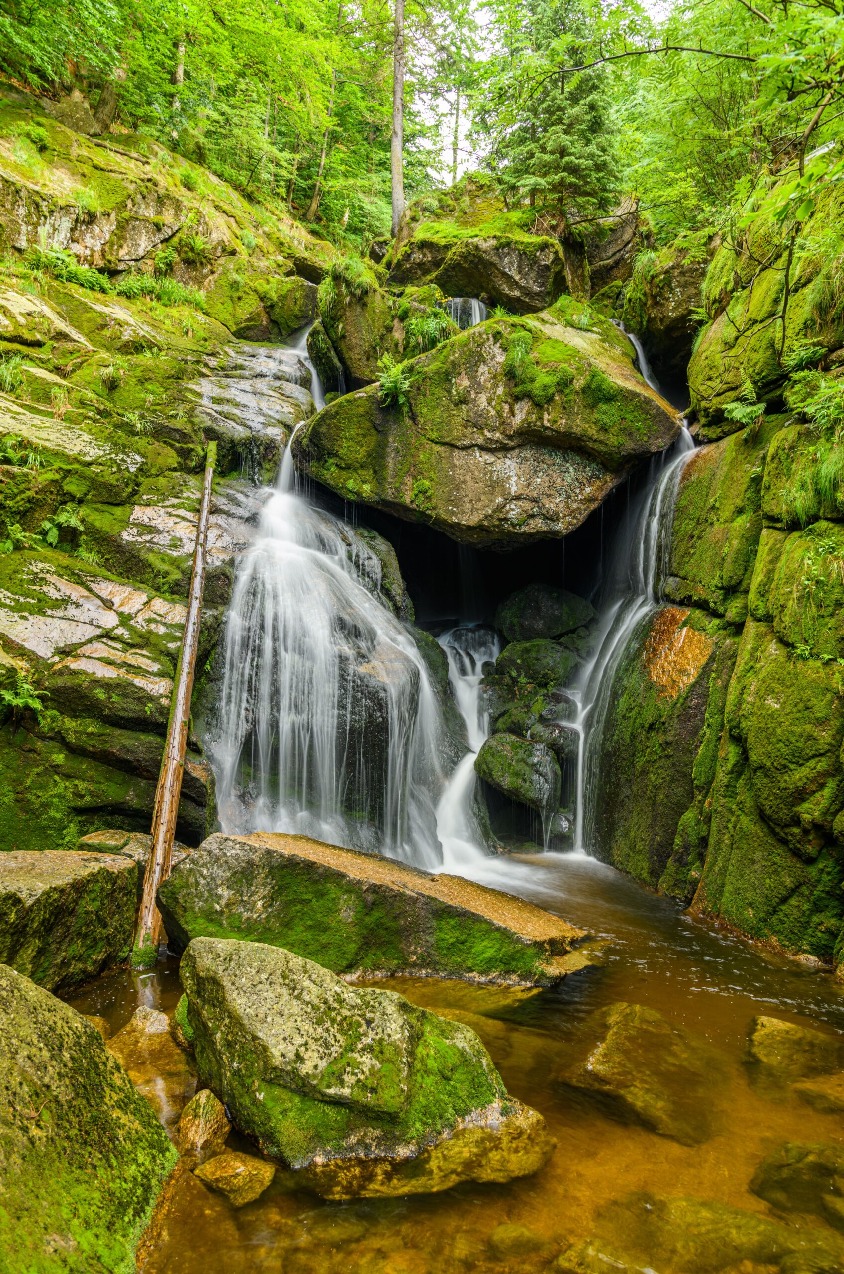
The next 400 metres are the best of the whole outing. The path holds the floor of the gorge, alternating timber footbridges, stone and wooden steps, and stretches of walkway suspended directly above the water. Small viewing platforms have been built at the most interesting points. At the Rešovské vodopády signpost you are standing beneath the main fall.
From there, continue on green for another half a kilometre up to the Nad vodopády junction. The gorge ends here and the forest opens out. You return the way you came, which sounds dull and is not: seen from above, looking down, the canyon reads completely differently. Save something for the last kilometre — on a warm day, the climb back to Rešov is the hardest part of the route by a distance.
Transport and parking: leave the car in Rešov, finish at the same spot; the bus stop is next to it. Food and drink: only up in Rešov by the car park, nothing in the gorge — fill your bottle before you drop down. Points of interest: the Devil’s Wall above the gorge, the remains of Fiala’s Mill, and the moss growth on the north-facing canyon walls.
2. The shortest version with small children: the lower cascades only
Distance: 2.8 km (1.7 miles) · Ascent: about 175 m up and 175 m down · Time: 1 to 1.5 hours · Difficulty: easy underfoot, testing on a toddler’s patience · Start and finish: Rešov car park · Type: there and back
| Waypoint | Distance |
|---|---|
| Rešov, car park | 0.0 km |
| Fialův mlýn | 0.97 km |
| Rešovské vodopády, main fall | 1.40 km |
| Back at Fialův mlýn | 1.84 km |
| Rešov, car park | 2.81 km |
Section by section: identical to route 1 as far as the main fall, where you simply turn round instead of carrying on up to Nad vodopády. You save a kilometre and fifty vertical metres and lose nothing of the main attraction. Head back down green to Fialův mlýn, then red uphill to Rešov.
The descent from Rešov is a woodland track, stony and steep in places. A child who can walk three kilometres over rough ground unaided will have a fine time. You cannot get a pushchair down here, not even an all-terrain three-wheeler. Several flights of wooden and stone steps lead into the gorge, plus walkway sections where there is a handrail on one side only. With a child under three, bring a carrier.
Transport and parking: as for route 1. Food and drink: pack a picnic — there is nothing to buy in the gorge or at the mill. Points of interest: for children, the walkways over the water and the cascades work best, because you can hear the water hammering into the rock.
3. The circuit from Rešov via Ruda and Křížový vrch
Distance: 10.9 km (6.8 miles) · Ascent: about 445 m up and 445 m down · Time: 3.5 to 4.5 hours · Difficulty: moderate · Start and finish: Rešov car park · Type: circular
| Waypoint | Distance | Altitude |
|---|---|---|
| Rešov, car park | 0.0 km | 545 m |
| Fialův mlýn | 0.97 km | 400 m |
| Rešovské vodopády | 1.40 km | 430 m |
| Nad vodopády | 1.91 km | 460 m |
| Back at Fialův mlýn | 2.86 km | 400 m |
| Ruda, junction by the lime tree | 5.16 km | 535 m |
| Ruda (bus stop, restaurant) | 5.70 km | 525 m |
| Křížový vrch | 6.41 km | 589 m |
| Back at Ruda, junction by the lime tree | 7.66 km | 535 m |
| Rešov, car park | 10.93 km | 545 m |
Section by section: do the gorge exactly as in route 1 and come back to the mill — that accounts for the first three hundred metres of climbing. From Fialův mlýn continue on green for another three hundred metres or so downstream, then turn off onto yellow at the junction. Yellow heads west up the side valley and climbs to Ruda. The junction by the lime tree is a classic village crossroads, five minutes from the bus stop and the pub.
From the village, climb on yellow to Křížový vrch (589 m), Cross Hill. A Way of the Cross leads up it, restored by the people of Ruda, and it is the reason not to skip this diversion. Return the same way to the lime tree, then yellow back eastwards, past the junction near the mill, and finally red up to Rešov.
Where people go wrong: at the junction between Fialův mlýn and the yellow route. Green carries on along the valley; yellow turns right and uphill. If you have been walking flat beside the stream for ten minutes, you have missed the turning.
Transport and parking: a circuit, so you return to the same car park. Buses do serve Ruda (stop: Tvrdkov, Ruda, restaurace), so the route can be cut short. Food and drink: the restaurant Pod Křížovým vrchem in Ruda, plus a seasonal kiosk, Zahrádka u Pandy, by the gamekeeper’s lodge. Check opening in advance — rural Czech pubs are often shut midweek. Points of interest: the Way of the Cross at Ruda and the views from Cross Hill over the Low Jeseník.
4. From Horní Město on green: the top-down version
Distance: 5.7 km (3.5 miles) one way, 9.4 km there and back · Ascent: 140 m up and 240 m down one way · Time: just under 2 hours one way · Difficulty: easy · Start: Horní Město, the Skály hamlet · Finish: Rešov · Type: linear
| Waypoint | Distance | Altitude |
|---|---|---|
| Skály (signpost, Horní Město) | 0.0 km | 650 m |
| Nad vodopády | 3.74 km | 460 m |
| Rešovské vodopády | 4.25 km | 430 m |
| Fialův mlýn | 4.69 km | 400 m |
| Rešov, car park | 5.65 km | 545 m |
Section by section: the entire walk follows green waymarks, which makes it the simplest of the lot to navigate. From Skály — a part of Horní Město with its own bus stop, the name meaning “The Rocks” — you descend just under four kilometres through woodland into the Huntava valley. The gradient is gentle and the track wide. At the Nad vodopády junction you join the top end of the gorge and walk it downwards.
That is the real argument for this variant. You see the gorge in reverse order, the cascades unfold beneath you one after another, and the main fall arrives as a much more dramatic finale. From Fialův mlýn, the last red section climbs the final 145 vertical metres or so into Rešov.
Transport and parking: this is a two-car or bus-assisted route. Leave the car in Rešov and take the bus up to Horní Město for the start, or the reverse. If you would rather not wrestle with timetables, walk it out and back (9.4 km, roughly 3 hours). Food and drink: in Horní Město; nothing en route. Points of interest: Horní Město is an old mining settlement with a geological trail and reminders of its ore-mining past.
5. Walking to the Rešov Waterfalls from Rýmařov via Horní Město
Distance: 10.0 km (6.2 miles) · Ascent: about 230 m up and 290 m down · Time: 3 to 3.5 hours · Difficulty: easy but long · Start: Rýmařov main square · Finish: Rešov · Type: linear
| Waypoint | Distance | Altitude |
|---|---|---|
| Rýmařov, main square | 0.0 km | 590 m |
| Skály (Horní Město) | 4.39 km | 650 m |
| Nad vodopády | 8.13 km | 460 m |
| Rešovské vodopády | 8.64 km | 430 m |
| Fialův mlýn | 9.07 km | 400 m |
| Rešov, car park | 10.04 km | 545 m |
Section by section: the best choice if you arrive by train and do not want a car in the equation at all. From the square in Rýmařov, the green waymarks run without a break all the way into the gorge, so you never change colour the whole day. The first four and a half kilometres climb gently to the hamlet of Skály; beyond that it is exactly as described in route 4.
Transport and parking: Rýmařov is served by railway line 310 from Valšov, where you change off the Olomouc–Opava main line. Walk out to the waterfalls, and get the bus back from Rešov or Horní Město. Check the connections beforehand — weekend services are thin. Food and drink: in Rýmařov and in Horní Město; nothing in the second half. Points of interest: the historic core of Rýmařov, the chapel V Lipkách and the mining heritage of Horní Město.
6. Down the Huntava valley to Sovinec castle: a full day’s traverse
Distance: 11.3 km (7.0 miles) · Ascent: about 420 m up and 480 m down · Time: 3.5 to 4.5 hours, not counting the castle tour · Difficulty: moderate · Start: Rešov · Finish: Sovinec · Type: linear
| Waypoint | Distance | Altitude |
|---|---|---|
| Rešov, car park | 0.0 km | 545 m |
| Fialův mlýn | 0.97 km | 400 m |
| Rešovské vodopády | 1.40 km | 430 m |
| Nad vodopády | 1.91 km | 460 m |
| Back at Fialův mlýn | 2.86 km | 400 m |
| Valšovský důl | 8.88 km | 305 m |
| Sovinec (castle, bus stop) | 11.25 km | 490 m |
Section by section: walk the gorge first, as in route 1, and come back to Fialův mlýn. From there follow green a short way downstream and pick up red, which runs down the Huntava valley. The next six kilometres are a quiet forest track beside the water with almost nobody on it, because the great majority of visitors turn round at the falls.
Valšovský důl (305 m) is the low point of the day. From there, red climbs just under two and a half kilometres and 185 vertical metres up to Sovinec castle, one of the largest castles in Moravia and well worth building time into the day for.
- Sovinec admission, 2026: self-guided visit without a guide 120 CZK (about £4) for adults, 80 CZK (£2.75) for children aged 4 to 14, students and seniors, family ticket 360 CZK (about £12.50).
- Guided tour (the basic circuit, roughly 60 minutes) 180 CZK (about £6), concessions 120 CZK, family 540 CZK (about £18.50).
- During cultural events 210 CZK (about £7), concessions 140 CZK. Children under three go free.
Transport and parking: this is a linear route, so you need the bus back from the stop Sovinec, hrad, or a second car. Turning it into a circuit means walking back the same way, which comes to 22 km. Food and drink: Motorest Krmelec near Valšovský důl and refreshments at the castle in season. Nothing in the valley. Points of interest: the confluence of the Oslava and the Huntava, the deep meandering valley, and Sovinec castle itself.
7. Over Tvrdkov to Rabštejn castle: the longest version
Distance: 15.1 km (9.4 miles) · Ascent: about 700 m up and 480 m down · Time: 5.5 to 6.5 hours · Difficulty: demanding, for both length and climb · Start: Rešov · Finish: Rabštejn ruins · Type: linear
| Waypoint | Distance | Altitude |
|---|---|---|
| Rešov, car park | 0.0 km | 545 m |
| Fialův mlýn | 0.97 km | 400 m |
| Rešovské vodopády | 1.40 km | 430 m |
| Nad vodopády | 1.91 km | 460 m |
| Tvrdkov (bus stop) | 4.45 km | 630 m |
| Bedřichov pila | 10.62 km | 415 m |
| Bedřichov, gamekeeper’s lodge | 12.41 km | 475 m |
| Rabštejn ruins | 15.08 km | 769 m |
Section by section: climb out of the gorge on green to the Nad vodopády junction and there change to red, which rises for two and a half kilometres to Tvrdkov (630 m). Beyond Tvrdkov, red crosses wooded ridges and drops to Bedřichov (Bedřichov pila, 415 m). Be warned: this is the longest and least interesting stretch of the day.
From Bedřichov there remain just under five kilometres and 350 vertical metres on red to Rabštejn (769 m), the highest-situated castle in Moravia. The ruin is freely accessible and free of charge, and around it spreads the rock area of Přední and Zadní Skály, with nine towers up to twenty metres high. There are views over the surrounding country from the walls.
💡 Tip: Fifteen kilometres one way is a lot when the first two are comfortably the finest. If what you actually want is both destinations rather than the walking in between, do the gorge from Rešov in the morning, drive round to Bedřichov, and walk up to Rabštejn separately in the afternoon. You will save three hours of forest track.
Transport and parking: you can get a bus back from Bedřichov or Oskava, where there is also a signpost at the stop. Services are sparse, so check them first. Food and drink: a restaurant in Oskava and a chalet near Rabštejn; nothing on the ridge. Top up your water in Tvrdkov. Points of interest: Rabštejn, first recorded in 1318; the Rabštejn nature reserve with its scree woodland and beech forest; and the climbing towers.
8. The big circuit over Špičák, for strong walkers
Distance: 17.2 km (10.7 miles) · Ascent: about 560 m up and 560 m down · Time: 5.5 to 6.5 hours · Difficulty: demanding on length · Start and finish: Rešov · Type: circular
| Waypoint | Distance | Altitude |
|---|---|---|
| Rešov, car park | 0.0 km | 545 m |
| Rešovské vodopády | 1.40 km | 430 m |
| Nad vodopády | 1.91 km | 460 m |
| Špičák (summit) | 8.61 km | 778 m |
| Tvrdkov (bus stop) | 12.77 km | 630 m |
| Nad vodopády | 15.30 km | 460 m |
| Rešov, car park | 17.22 km | 545 m |
Section by section: the opening is the same — up through the gorge to Nad vodopády. From there take red northwards, but instead of turning off at Tvrdkov, keep going to Špičák (778 m), one of the highest points in this part of the Low Jeseník. You pass the Dobřečov junction on the way. The return is on red via Tvrdkov and back past the waterfalls down into Rešov.
It is an honest full-day walk on forest tracks. The views are occasional rather than continuous — this is terrain of wooded hills, not bare ridges. Anyone who wants proper ridge walking and kilometres above the treeline should head west into the high Jeseníky instead; Rešov is a different kind of day out and does not pretend otherwise.
Transport and parking: circular, returning to the car park in Rešov. Food and drink: nothing at all on the route, so carry water for the whole day. There is a bus stop at Tvrdkov if you want to cut things short. Points of interest: Špičák as a viewpoint, the deep forests of the Low Jeseník, and the village of Dobřečov.
All eight routes compared
| Route | Distance | Ascent / descent | Time | Type |
|---|---|---|---|---|
| 1. Short circuit from Rešov | 3.8 km (2.4 mi) | 220 m ↑ / 220 m ↓ | 1.5 to 2 h | there and back |
| 2. Lower cascades with children | 2.8 km (1.7 mi) | 175 m ↑ / 175 m ↓ | 1 to 1.5 h | there and back |
| 3. Rešov – Ruda – Křížový vrch | 10.9 km (6.8 mi) | 445 m ↑ / 445 m ↓ | 3.5 to 4.5 h | circular |
| 4. From Horní Město on green | 5.7 km (3.5 mi) | 140 m ↑ / 240 m ↓ | just under 2 h | linear |
| 5. On foot from Rýmařov | 10.0 km (6.2 mi) | 230 m ↑ / 290 m ↓ | 3 to 3.5 h | linear |
| 6. Huntava valley to Sovinec | 11.3 km (7.0 mi) | 420 m ↑ / 480 m ↓ | 3.5 to 4.5 h | linear |
| 7. Via Tvrdkov to Rabštejn | 15.1 km (9.4 mi) | 700 m ↑ / 480 m ↓ | 5.5 to 6.5 h | linear |
| 8. Big circuit over Špičák | 17.2 km (10.7 mi) | 560 m ↑ / 560 m ↓ | 5.5 to 6.5 h | circular |
Steps, walkways and pushchairs: what the gorge is really like
This is the single most common question and the answer is unfortunately unambiguous. You cannot take a pushchair into the gorge. The access track down from Rešov is a stony, steep woodland path, and inside the gorge itself you meet wooden footbridges, wooden and stone steps and walkways running along the rock. People often ask about ladders, expecting something like the Slovak gorges: there are no proper ladders here, but there are several dozen steps and they are not all the same height, which in practice is what tires legs and unsettles anyone unsure on their feet.
What that means in practice:
- A child carrier or backpack carrier is the only sensible answer for a child who cannot yet manage three kilometres on foot.
- Proper footwear is not a recommendation, it is a requirement. The stone and timber in the gorge are permanently damp, and after rain they are as slippery as soap. Trainers with worn soles are a bad idea.
- It is not step-free. The gorge is inaccessible to wheelchair users and there is no alternative route around it.
- In the wet and in winter, take particular care on the wooden walkways. In hard frost the cascades turn into ice falls and the steps in the gorge ice over.
- Sections of the path are occasionally closed for repairs to the walkways and bridges. In 2024 the trails above the waterfalls were shut for several months. Before you travel, it is worth checking the current state on the village website or by telephone.
Dogs, bikes and what a national nature reserve allows
The Rešov Waterfalls sit inside a national nature reserve, the strictest category of protection in the Czech system. The rules are simple and none of them exists to spoil your day:
- Stay on the marked paths. No shortcuts, no climbing down into the stream bed, no photographs taken from a boulder in the middle of the water.
- Dogs must be on a lead. Letting a dog run free is prohibited in a national nature reserve. The walk itself is perfectly fine for a dog — a reasonably fit animal handles the steps and walkways without difficulty.
- You cannot cycle through the gorge. Leave the bike at the signpost in Rešov or at Nad vodopády. The surrounding forest tracks, on the other hand, are excellent riding.
- Swimming and wild camping are out of the question inside the reserve.
- Take your rubbish with you — there are no bins in the gorge.
When to visit the Rešov Waterfalls
The Huntava’s flow varies a great deal, and with it what the falls look like. The most water comes in spring during the snowmelt, roughly from mid-March to May, and after heavy rain. In a dry summer the steps narrow to a trickle and the photographs look distinctly modest. If water is the point of your trip, come one or two days after a decent downpour.
- Spring (March to May): most water, upland meadows in flower, few people. The best time by some margin.
- Summer (June to August): the gorge stays pleasantly cool, but at weekends between 10am and 4pm it is busy and you will be squeezing past people on the walkways. Arrive before nine or after five.
- Autumn (September to October): the beeches in the canyon turn and it is considerably quieter than in summer. Flow is usually middling.
- Winter: ice falls and frozen steps. Beautiful, but risky without microspikes. The access path from Rešov tends to get trodden into sheet ice.
💡 Tip: On summer holiday weekends the car park in Rešov starts filling from about half past nine. Turn up at eight and you will walk the gorge practically alone and park without hunting for a space. The afternoon wave arrives around three and is usually thinner.
Food, water and where to stay near the Rešov Waterfalls
There is nothing to buy at the waterfalls or in the gorge. Your last chance is up in Rešov, and after that only in the surrounding villages:
- Restaurace Rešov by the car park, with a summer terrace open daily from 11am in season, quick food and souvenirs. Note that the business is up for sale in 2026, so treat its opening hours with caution.
- Penzion Nad Vodopády in Rešov, a few hundred metres from the car park.
- Pod Křížovým vrchem in Ruda, on route 3.
- Motorest Krmelec near Valšovský důl, on route 6.
- A proper choice of food and shops is in Horní Město and above all in Rýmařov.
Fill your bottle before you head down. There is no drinking water source in the gorge, and however clear the Huntava looks, it is not drinking water.
For an overnight stay, Rýmařov makes the most sense: it is a decent base for Praděd and the rest of the Jeseníky as well as for the waterfalls. See places to stay in Rýmařov → If you want to sleep as close to the falls as possible, look in Horní Město: accommodation in Horní Město and nearby → For a longer stay in the region, the district town works well too: accommodation in Bruntál →.
What to bring
- Sturdy boots with decent grip. The gorge is damp all year round.
- Water for the whole walk — there is nowhere to refill.
- Small change in Czech crowns for the parking. Cards are not much use here.
- Insect repellent in summer; the mosquitoes down by the water are reliable.
- Microspikes in winter, because the steps in the gorge freeze.
- A tripod, or at least something to brace against, if you want silky long-exposure water. Even at midday the canyon is gloomy.
Where to go next
If the Rešov Waterfalls have whetted your appetite for this part of the country, the obvious next steps are all within an hour or two.
- The high Jeseníky: ridge walks, Praděd and long full-day mountain routes, a completely different scale to the Low Jeseník.
- Kralický Sněžník, on the Czech–Polish border, with its summit routes and the famous elephant sculpture.
- Easy family walks across the Czech Republic, if you are looking for more short outings with children.
- Demanding mountain routes for longer, harder days on your feet.
- The mountain ranges of the Czech Republic: an overview of what to look for in each of them.
- Getting out into nature away from the main tourist corridors.
- Road trips by car, if you are putting a whole weekend together in this region.
- Cycling routes: the forest tracks of the Low Jeseník are outstanding on two wheels.
Frequently asked questions
How long is the walk to the Rešov Waterfalls?
From the car park in Rešov it is 1.4 km one way to the falls. The standard route through the whole gorge up to the Nad vodopády junction and back is 3.8 km (2.4 miles) with about 220 metres of ascent, and takes one and a half to two hours. The shorter version, going only to the lower cascades, is 2.8 km.
Is there an entrance fee at the Rešov Waterfalls, and what does parking cost?
There is no entrance fee. The national nature reserve is freely accessible all year round, with no ticket office and no opening hours. The only thing you pay for is parking in the hamlet of Rešov, where the main car park sits by Restaurace Rešov at the edge of the village on the Horní Město side; visitors report about 40 CZK (roughly £1.40) for the whole day, payable in cash. Two further overflow areas in the village are signed “P Rešovské vodopády”. You cannot park at the waterfalls themselves, as no road goes there.
Which trail markings lead to the Rešov Waterfalls?
The gorge itself is followed by the green waymarks, running from the Nad vodopády junction past the Rešovské vodopády signpost down to Fialův mlýn. The descent from Rešov to the mill is on red, and red also climbs from Nad vodopády towards Tvrdkov. Yellow is only a link across to Ruda and Křížový vrch. Navigate by the junction names Fialův mlýn, Rešovské vodopády and Nad vodopády, and remember that in the Czech system the colour indicates the rank of the route, not its difficulty.
Can you get to the Rešov Waterfalls with a pushchair?
No. The access path from Rešov is a stony, steep woodland track, and the gorge itself is a sequence of wooden steps, footbridges and walkways. With a small child, bring a carrier. The gorge is inaccessible to wheelchair users and there is no alternative route around it.
Is the Rešov Waterfalls walk suitable for children?
Yes, for children who can manage three kilometres over uneven ground unaided. The best option is the shortened version to the main fall and back, which is 2.8 km. Sturdy footwear is essential, because the steps and walkways are usually damp and slippery. The hardest part is the final climb back up to Rešov.
When do the Rešov Waterfalls have the most water?
In spring during the snowmelt, roughly from mid-March to May, and one or two days after heavy rain. In a dry summer the flow drops sharply and the falls weaken noticeably. In winter the cascades turn into ice falls.
Can you reach the Rešov Waterfalls by public transport?
Yes. There is a bus stop in Rešov right beside the car park, served from Rýmařov via Horní Město, though there are few departures and even fewer at weekends. By train you can reach Rýmařov on line 310 from Valšov, changing off the Olomouc–Opava main line, and walk the remaining 10 km on the green waymarks.
Do I need a Czech motorway vignette to drive there?
Only for the motorway sections of the journey, not for the final approach, which uses ordinary regional roads. If you use the D1, D35, D46 or D48 you need an electronic vignette registered to your number plate. From January 2026 a standard car pays 230 CZK for one day, 300 CZK for ten days (about £10) and 480 CZK for thirty days. Hire cars from Czech branches normally come with one, but check at the desk.
Potřebujete pomoct s cestováním?
-
Ubytování 🏨
Vyberte si to nejlepší ubytování, ať už jste kdekoliv, přes Booking.com. -
Půjčení auta 🚗
Auto si snadno najdete přes Booking.com, kde máte často slevu díky ubytování, nebo Rentalcars.com, kde porovnáte nabídky většiny půjčoven. -
Zážitky 🎟️
Přes GetYourGuide.com si vyberete z nejrůznějších výletů i zážitků po celém světě, navíc se zrušením zdarma do 24 h předem.