Last updated 30.8.2026
Slovakia has two Tatra ranges, and almost every English-language guide only tells you about one of them. The High Tatras get the photographs, the queues and the cable car to 2,634 m. The Low Tatras, an hour to the south-west, get the largest cave system in the country, a hundred-kilometre grass ridge with four summits over 2,000 m, and a ski resort called Jasná that turns into a very good summer playground once the snow goes. They are quieter, cheaper and considerably easier to walk in.
This guide covers the whole range in one piece, because in practice you visit it in one piece: the caves in the morning, the Chopok cable car in the afternoon, a lake and a waterfall on the day it rains, and the ridge if you have four days and a decent pair of legs. Everything below is grouped by what you actually do rather than by category, and the practical details come from the Slovak Caves Administration and the Low Tatras National Park (NAPANT) rather than from other people’s blogs.
Things to do in the Low Tatras: the short version
- Start with the caves. Demänovská jaskyňa slobody, known in English as the Cave of Liberty or the Cave of Freedom, is the most visited cave in Slovakia. Tickets are €15 or €24 (roughly £13 or £20) depending on the circuit.
- Be warned about the Ice Cave. The site manager states that Demänovská ľadová jaskyňa has lost the last remnants of its ice. The name stayed, the ice decoration did not.
- Both Demänová caves close on Mondays and take no reservations at all. It is first come, first served, and no online ticketing exists.
- The Ice Cave is seasonal: open 15 May to 30 September only.
- Chopok cable car from Jasná runs 8:30 to 17:00 daily, every half hour. The last car down from Chopok leaves at 17:00.
- Highest peak: Ďumbier. The national park authority gives 2,043 m, a newer survey quoted on the Slovak Wikipedia gives 2,045.9 m.
- No blanket seasonal trail closure exists here, unlike the High Tatras. Only three yellow-marked sections close, from 1 October to 30 June.
- Slovakia uses the euro, and mountain rescue is chargeable. Save 18 300 and 112 in your phone before you set off.
Where the Low Tatras are, and how they differ from the High Tatras
The Low Tatras (Nízke Tatry in Slovak) sit in the middle of Slovakia, immediately south of the Liptov basin and the town of Liptovský Mikuláš, with the High Tatras visible across the valley to the north. If you are flying in, Poprad is the nearest airport and Bratislava, Košice and Kraków are all realistic road or rail approaches.
The difference between the two ranges is not just height, and it changes the kind of trip you get:
- The High Tatras are alpine. Sharp granite, chained sections, a legal closure of the high trails for seven months of the year and mountain huts you have to book far ahead.
- The Low Tatras are a long grass ridge. Rounded, open, mostly above the treeline, with easy walking underfoot and almost no exposure. The trade-off is that there is no shelter and no shade anywhere on top.
- The Low Tatras have the caves. The High Tatras have none worth the detour. This is the single strongest reason to come here rather than go north.
According to the Low Tatras National Park administration, the range runs east to west for almost 100 km, from a low point of 355 m near Banská Bystrica up to Ďumbier. That length is the one fact that governs your planning: driving from one end to the other takes a comfortable two hours, so you cannot sensibly combine Kráľova hoľa in the east with the Brankovský waterfall in the west on the same day.
The pass of Čertovica splits the range in two. West of it lie the Ďumbierske Tatry, which hold every peak over 2,000 m, both show caves, the lake and the ski resort. East of it the Kráľovohoľské Tatry continue, rounder, grassier and far emptier. If you want views without people, that is the half to aim for.
A few Slovak words will save you time on signposts and websites: jaskyňa is a cave, dolina is a valley, pleso is a mountain lake, chata is a mountain hut and lanovka is a cable car. English-speaking visitors search for “Chopok lanovka” often enough that it is worth knowing which word to type.
💡 Park rules that are actually enforced. Inside the national park you may walk only on marked trails and educational paths, and only from one hour after sunrise to one hour before sunset. Picking plants or berries is banned, so is building cairns, and driving on forest and field tracks is prohibited even where no sign says so. The daylight rule is not a formality: it is what decides how long a day you can plan.
Demänovská Caves: the best thing in the Low Tatras
Slovakia is one of the great cave countries of Europe, and the biggest cave system in the country runs directly under the Demänovská dolina, the valley that also holds the lake, the ski resort and the road to Chopok. Two parts of that system are open to the public, and two more caves sit within easy reach: one on the southern side of the range and one high on the ridge itself.
The figures below come from the Slovak Caves Administration and from the operator of the Cave of the Dead Bats, checked in August 2026. Prices and, more importantly, opening calendars change, so look at the official page before you drive out.
Demänovská jaskyňa slobody, the Cave of Liberty
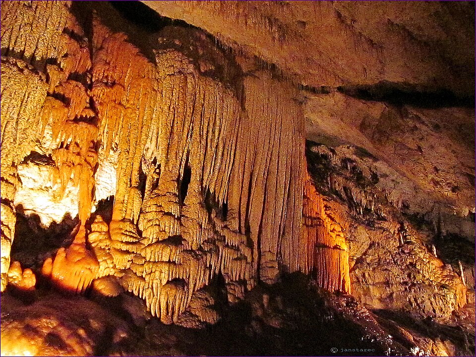
Google will show you this one under two English names, Cave of Liberty and Cave of Freedom, and both refer to the same place. It is the most visited cave in Slovakia and the only stop in this guide where an hour genuinely passes like five minutes. The flowstone cascades, pools and terraced lakes really are as colourful as the photographs suggest, because the underground course of the Demänovka river never stopped running through them.
There are two circuits. The traditional one is 1,150 m long and takes 60 minutes; the long one is 2,150 m and 100 minutes. Admission on the traditional circuit is €15 for an adult (about £13), €8 for children aged 4 to 15 and disabled visitors, and €14 for students and over-60s. The long circuit costs €24 (about £20), or €12 and €22 respectively. The temperature underground holds between 6.1 and 7.0 °C, so a fleece is not a suggestion.
The cave is open all year, closed on Mondays, with entries on the hour from 9:00 to 16:00.
💡 The one thing to know before you go. The Caves Administration states in capital letters on its own site that “REZERVÁCIE VSTUPOV SA NEVYKONÁVAJÚ”, meaning no reservations are taken. There is no online ticketing and no booking by phone. You queue, and in high season you are admitted in groups according to capacity. Aim for the first or second entry of the day and bring cash, because card payment may not be available.
Demänovská ľadová jaskyňa: the Ice Cave has lost its ice
This section is written plainly, because most articles quietly skip it. Demänovská ľadová jaskyňa, the Demänovská Ice Cave, no longer contains any ice. The Slovak Caves Administration says so itself, in the site manager’s own words: “Po ďalšej sérii teplých, pre ľadové jaskyne nepriaznivých zím, prišla Demänovská ľadová jaskyňa o posledné zvyšky ľadu.” After another run of warm winters, unfavourable for ice caves, the cave lost the last remnants of its ice. The administration adds that the ice decoration can now be seen only in older photographs and on souvenirs.
The name survives as a place name, not as a description of what you will see. If you are travelling for the ice, do not go. If a vast underground space with strange geometry and a cold, absolute silence still appeals, it is worth an hour, just with different expectations.
The practical numbers: the tour route is 650 m long and takes about 45 minutes, the entrance sits at 840 m and a zigzag path leads up to it from the car park, so allow another twenty minutes of walking each way. Admission is €12 for an adult (about £10), €6 for children aged 4 to 15 and disabled visitors, €11 for students and over-60s. The temperature runs between 0.4 and 3.0 °C and you feel it immediately.
The crucial difference from the Cave of Liberty next door is that this one is seasonal. The operating calendar has it open from 15 May to 30 September; from October to April it is shut for months at a time. Even in season it closes on Mondays, and as with its neighbour, reservations are not accepted.
Bystrianska jaskyňa, the quiet alternative
On the southern side of the range near Brezno, and with a fraction of the crowds of the Demänová valley. The circuit is 580 m and takes about 45 minutes with practically no ascent, which makes it the most comfortable underground stop in the Low Tatras. Admission is €10 for an adult (about £8), €5 for children aged 4 to 15 and disabled visitors and €9 for students and over-60s. The temperature holds between 5.7 and 6.7 °C.
Entries run on the hour from 9:00 to 16:00 and the cave operates for most of the year, though the exact days follow the calendar published by the Caves Administration. One catch worth planning around: a tour only runs once at least four people have turned up, which off season at ten in the morning is not a given.
Jaskyňa mŕtvych netopierov, the Cave of the Dead Bats
A completely different proposition and the most interesting underground experience in the range. This is not a lit walkway with handrails but a cave high on the ridge at 1,750 m, in the Ďumbier high-mountain karst. From the ticket hut it is roughly an hour and a half of walking uphill on a marked trail, so a visit is a full-day commitment by definition.
Three options are offered. Excursion A is the tourist version, about a kilometre long, around 80 minutes, suitable from age 8, at €20 for an adult (about £17) and €15 for children under 15. The harder speleo-trekking option B (18 and over, more than 120 minutes) costs €55, and the toughest option C (more than 180 minutes) costs €65.
Unlike the Demänová caves, booking here is compulsory. Tours start at 10:00, 12:00, 14:00 and 16:00. The season is limited: closed in January and February, weekends only from March to June and from September to December, and daily except Mondays in July and August.
Slovakia’s caves compared: which one to pick
| Cave | Route | Adult ticket | Temperature | Season | Booking |
|---|---|---|---|---|---|
| Demänovská jaskyňa slobody (Cave of Liberty) | 1,150 m / 60 min or 2,150 m / 100 min | €15 or €24 | 6.1 to 7.0 °C | all year, closed Mondays | not accepted |
| Demänovská ľadová jaskyňa (Ice Cave) | 650 m / 45 min | €12 | 0.4 to 3.0 °C | 15 May to 30 September, closed Mondays | not accepted |
| Bystrianska jaskyňa | 580 m / 45 min | €10 | 5.7 to 6.7 °C | most of the year, per calendar | groups notify ahead, minimum 4 people |
| Jaskyňa mŕtvych netopierov (Cave of the Dead Bats) | excursion A about 1 km / 80 min | €20 (speleo-trekking €55 and €65) | not published | March to December, daily except Mondays in summer | compulsory |
💡 Do not waste a Monday. Both Demänová caves are closed on Mondays, and that is the single most common reason for a wasted drive up the valley. On a long weekend, put the caves on Saturday or Sunday and save Monday for the ridge. In the caves it is around 7 °C and you are inside for an hour or more, so a jacket and proper shoes belong in the car even on a thirty-degree day.
Chopok and Jasná: the cable car and what to do at 2,000 m
Jasná is the largest ski resort in Slovakia and sits in the upper Demänová valley on the northern flank of Chopok (2,023.6 m by the Slovak Wikipedia, rounded to 2,024 m in the park’s own visitor regulations). In summer it becomes something more useful: a lift system that hauls you almost a thousand metres uphill in a few minutes and turns what would be a full-day climb into a pleasant afternoon.
Chopok is the third highest summit in the range and by a wide margin the most visited. The top is broad, stony and offers a genuine 360-degree panorama with no rival in the Low Tatras: Liptov and the High Tatras on one side, the whole Horehronie region on the other.
Chopok cable car: times, tickets and dogs
Here is what is verified, and what is not:
- Operating hours: the lifts at Jasná run every day from 8:30 to 17:00, at half-hourly intervals. The last cable car down from Chopok leaves at 17:00.
- Weather: the service depends on it. In strong wind the lifts may not run at all, and the operator gives the current status by phone and on its website.
- Prices: we are not going to quote a figure. The operator uses dynamic pricing, no static price list exists and the amount changes with the date. The one thing that is consistently true is that buying online in advance is cheaper than the ticket window.
- Dogs: a small dog carried in a bag travels free; a larger dog that will not fit in a bag costs €10 per animal (about £8).
That 17:00 departure is the number your whole day hangs on. Miss it and you walk down, which is a three-hour descent and no longer a family outing. The difference in weather between the valley floor and the summit is dramatic in any season: a T-shirt at the bottom, wind and ten degrees less at the top. A jacket and a hat belong in the rucksack even in August.
💡 The combination worth planning. Go up by cable car and down on foot through the valley. You save your knees on the ascent, you get the view the moment you step out of the cabin, and you stop having to watch the clock for the last lift. The reverse works far less well, because walking up eats more of the day than the 17:00 cut-off allows.
Walking the ridge from the top station
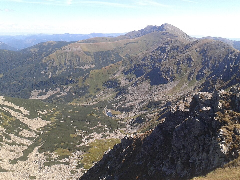
The elegant compromise: up by cable car, along the ridge on foot, then down by cable car or through the valley. A marked trail runs along the main ridge in both directions from Chopok, west over Dereše (2,003.5 m) and on towards Chabenec, east towards the highest summit of the range. The beauty of it is that you can turn back at any point and be at the lift again within the hour.
If you want to walk the whole stretch from Chopok to Ďumbier, understand what you are taking on: it stops being a day out and becomes a serious mountain day with a long descent on the far side. That section belongs to the multi-day traverse, which has its own part further down.
💡 Read the sky, not the schedule. The ridge of the Low Tatras is open and has nowhere to hide. If a wall of cloud is building from the west, turn back before the rain starts, because the cable car is not an escape route in a thunderstorm. Services stop in strong wind and lightning.
Ďumbier and the highest peaks of the Low Tatras
The most common question about this range, answered with its source. The highest mountain in the Low Tatras is Ďumbier. The national park administration writes on napant.sk, word for word: “Najvyššiu nadmorskú výšku dosahuje na Ďumbieri – 2043 m n.m.” The Slovak Wikipedia entry for Ďumbier gives 2,045.9 m from a newer survey. The gap of under three metres is a question of survey method, not a dispute about which hill is highest, and in practice the traditional figure of 2,043 m is the one you will see on signs.
The more interesting answer is second place. Most people guess Chopok, because they know it from Jasná, but Chopok is only third. Second is Štiavnica, a summit almost nobody sets out for, even though it stands directly on the main ridge.
| Summit | Height | Where it is | Why it is worth it |
|---|---|---|---|
| Ďumbier | 2,043 m (napant.sk), 2,045.9 m (Slovak Wikipedia) | main ridge, about 15 km north of Brezno | highest peak of the range, genuinely rocky summit |
| Štiavnica | 2,025.3 m | eastern end of the central ridge section | second highest, almost no crowds |
| Chopok | 2,023.6 m | about 15 km north of Brezno, above Jasná | third highest, 360-degree view, easiest to reach |
| Dereše | 2,003.5 m | above the village of Demänovská Dolina | the last 2,000er on the ridge |
| Chabenec | 1,955 m | above the Dúbravská valley | broad grassy back, silence |
| Kráľova hoľa | 1,946.1 m | above Šumiac, about 19 km south of Svit | highest point of the whole eastern half |
| Veľká Chochuľa | 1,753.2 m | above Liptovská Lúžna | highest peak of the western Ďumbierske Tatry |
| Salatín | 1,630.2 m | above Liptovská Lúžna, about 11 km from Ružomberok | a separate summit off the main ridge |
| Poludnica | 1,548.7 m | northern edge of the range above Liptovský Ján | low, but with the view across to the High Tatras |
Ďumbier: the one rocky summit
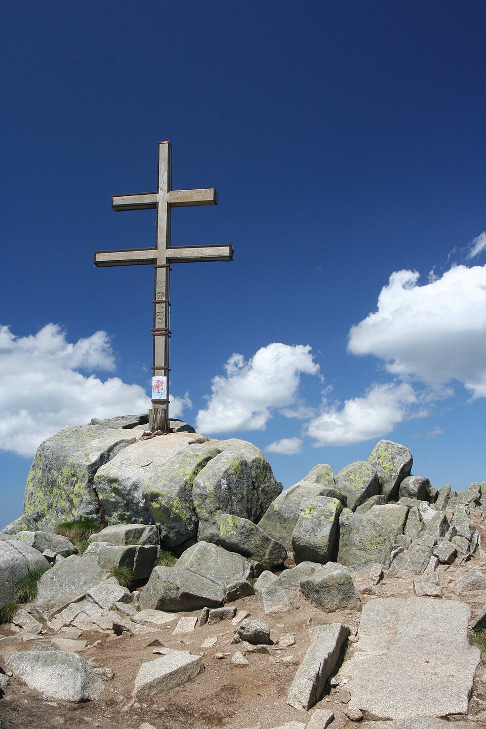
Ďumbier is the only place in the range where the top has a properly rocky, Tatra-like character. The last metres cross tumbled blocks and the summit itself is so small that on a Saturday afternoon there is barely room to stand. On a clear day you see the High Tatras, the Veľká Fatra and deep into the Horehronie.
Below the summit at 1,740 m stands the Chata generála M. R. Štefánika, a year-round mountain hut where booking is compulsory. As a landmark it is useful even if you are not staying: reach the hut and the summit is within striking distance. Several routes lead up, and the shortest of them runs along the ridge from Chopok.
💡 A search tip that will save you a laugh. Ďumbier is also the Slovak word for ginger, so typing it on its own brings back recipes. Search for “Ďumbier peak Low Tatras” instead. The same trap applies to several places here: Chabenec alone leads to a street in Banská Bystrica, Ohnište means “fire pit” and returns garden products, and Poludnica returns a Slavic folklore figure and a running race.
Kráľova hoľa and the empty eastern half
The highest summit of the eastern half at 1,946.1 m, and the most sung-about hill in Slovakia. It looks nothing like the 2,000ers in the west: rounded, grassy, more like a giant viewing platform than a mountain. The Slovak Wikipedia describes a view taking in Spiš, the High and Western Tatras, Liptov and the Horehronie, which is accurate. There is a transmitter on top, which does the photographs no favours and the view no harm at all.
Kráľova hoľa is the proof that the Low Tatras do not end at Jasná. On a weekday you will meet a handful of people and otherwise just wind. The same is true of Chabenec above the Dúbravská valley, and of Veľká Chochuľa and Salatín at the western end, which is the most overlooked corner of the whole range.
Best day hikes in the Low Tatras, Slovakia
The park administration counts more than 840 km of marked trails and fifteen educational paths, so the choice is not the problem. What makes this range unusually forgiving is that nearly every walk starts at a car park in a valley you can drive to, which means you can change the plan over breakfast depending on what the clouds are doing.
An easy walk here does not mean a flat one. It means a route without chains, without exposure and with the option of turning round at any moment, and the rounded grass ridge of the Low Tatras delivers exactly that.
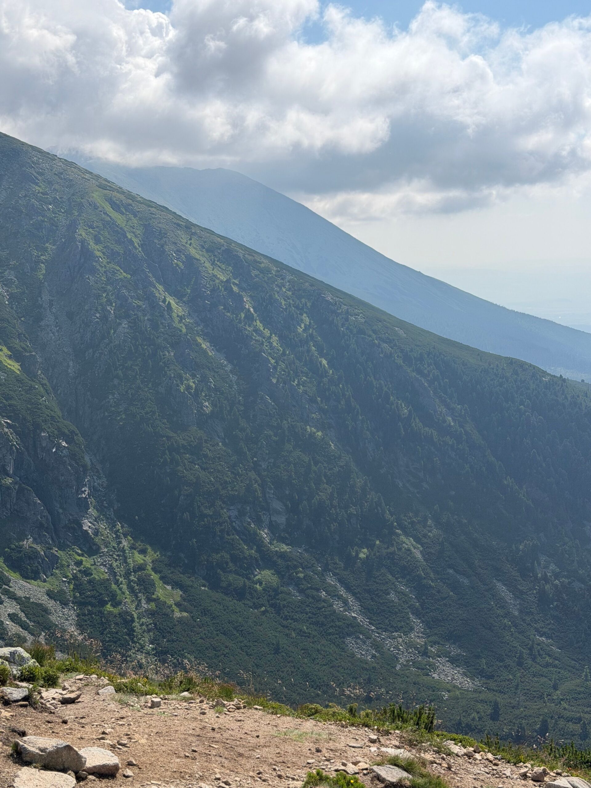
Poludnica above Liptovský Ján, the best effort-to-view ratio
If you only do one walk on your own legs, do this one. Poludnica (1,548.7 m) is a grassy hill with a circular panorama over the Liptov basin, the High Tatras and the main ridge of the Low Tatras, and getting there is ordinary walking on a footpath. Start from Liptovský Ján, or alternatively from Závažná Poruba; either way it is a full day with a long pause at the top.
The slope is open all the way up, which is a gift in the morning and punishing at midday. September is a markedly more pleasant month for it than mid-July.
Ohnište, the limestone plateau above the Jánska dolina
Ohnište is a national nature reserve declared in 1973 over 852.26 hectares, in the municipalities of Liptovský Ján and Liptovský Hrádok. The official protection covers its geomorphological formations, its karst system and its old-growth forest on dolomite and dolomitic limestone.
Behind that wording sits one of the strangest places in the range: a broad limestone plateau with shafts, rock windows and cave mouths, where the quiet is different from the quiet on the ridge, because the water disappears underground and there are no streams to hear. It looks on a map like a modest outing and turns into a full day in the field. You start from the Jánska dolina above Liptovský Ján, climb through forest, and then wander a tableland where time goes missing on its own.
Valley walks and educational trails, if you would rather not climb
The park’s fifteen educational paths are the best raw material for an undemanding day. The Demänovská dolina educational trail runs through the main valley itself, the Vajskovská dolina trail covers the southern side of the range, and the Donovaly to Šachtička path serves the western end. All three start at a car park, can be turned round at any point and never drop you into a saddle.
This is also the answer for anyone walking with small children or pushing a buggy. A sports pushchair with big wheels will manage the surfaced tracks in the Demänovská dolina and most of the valley-floor sections in the Jánska dolina. The moment a route leaves the valley bottom and starts climbing through forest, it ends. Anything with the word saddle or summit in its description is out.
💡 Signposts here give time, not distance. Slovak trail signs are marked in hours and minutes rather than kilometres, and those times assume a walker who does not stop and does not photograph anything. With children, add half as much again; with small children, simply double it.
A day with children: the Demänovská dolina
If you have one day in the Low Tatras and you are travelling with a family, spend it in the Demänová valley. It is a short drive from Liptovský Mikuláš, a road with several car parks runs up it, and everything a family day needs is gathered in one place: Vrbické pleso with a flat circuit round the water, wide forest tracks, food in Jasná, an educational trail, the cable car and the caves as a weather-proof fallback.
The programme that works: the lake and the lower valley in the morning, the cable car after lunch, back down in the afternoon. If the weather turns, drop a few kilometres down the valley to the caves and the day is saved without driving anywhere else. No other valley in the range has that spare track.
One thing to get right: the car parks in the Demänovská dolina fill up during the morning in summer and at weekends. Arriving after eleven means hunting for a space and reversing along a narrow road between oncoming cars. At nine it is calm.
The hardest day: climbing Ďumbier
As a one-day objective, the highest summit is a class above everything else here. You start either from the southern side at Bystrá and Trangoška or from the north out of the Demänovská dolina, and either way it means a full day, a long ascent and a final rocky section where you use your hands.
Three things ruin this day most often: a late start, an afternoon thunderstorm after two o’clock, and underestimating the way down. The descent on foot is as long as the climb, so anyone setting off at ten comes back in the dark, and moving after dark is not permitted under the park’s visitor regulations in the first place.
How much of a day each walk takes
This table is for building a day, not for precise distances. Exact times are on the signposts and depend on where you start and how high you park.
| Walk | Who it suits | How much of the day | Starting point | Season |
|---|---|---|---|---|
| Vrbické pleso and the lower Demänovská dolina | families, small children, pushchair on the valley floor | half a day | car parks in the Demänovská dolina | all year |
| Chopok by cable car, there and back | families, older visitors, a lazy afternoon | half a day, a full one with lunch at the top | Jasná, lower cable car station | summer and winter service |
| Educational trail in a valley | completely undemanding, ideal with children | 2 to 3 hours depending on the trail | Demänovská dolina, Vajskovská dolina, Donovaly | summer and autumn |
| Poludnica (1,548.7 m) | an easy walk with a big view | full day | Liptovský Ján, Závažná Poruba | late spring to autumn |
| Ohnište plateau | fitter families, walkers | full day | Jánska dolina above Liptovský Ján | late spring to autumn |
| The ridge on foot from Chopok | experienced walkers, good weather only | half a day to a full day | top station of the Chopok cable car | summer, back by 17:00 |
| Ďumbier (2,043 m) | experienced only, the hardest day walk here | full day from early morning | Bystrá in the south, Demänovská dolina in the north | summer and early autumn |
| Caves and a water park | a rainy day, any age | full day | Demänovská dolina, Liptov, Bešeňová | depends on the individual cave |
Vrbické pleso, the Brankovský waterfall and the two big valleys
The Low Tatras are not a range of lakes. The glaciers here held on only in a small way, so where the High Tatras count their tarns in dozens, this range has effectively one that people travel for. It repays the attention.
Vrbické pleso, the lake in the Demänovská dolina
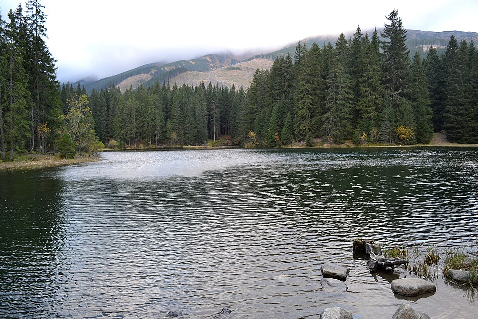
The largest natural lake in the Low Tatras lies in the upper western arm of the Demänová valley at 1,113 m. It formed after the ice retreated from the northern slopes of Chopok and Dereše, which makes it a moraine lake rather than a glacial one in the strict sense. It covers 0.69 hectares, measures 115 m by 62 m and is 8 m deep at its deepest point.
A path runs right round it and the circuit takes a matter of minutes, which makes this the easiest objective in the entire guide. It works best early in the morning, when the surface is completely still and the spruces reflect in it without a ripple. Around midday it is the busiest spot in the valley, because everyone who has not walked anywhere else gets driven up to it.
A search note: type Vrbické pleso Demänovská dolina in full. The word on its own sends you to a lake at Bohumín in the Czech Republic, which is a long way from Liptov.
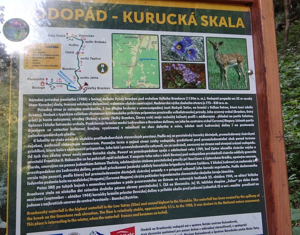
Brankovský vodopád, the highest waterfall in the range
The highest waterfall in the Low Tatras, and one of the few places where this range looks wild. The Slovak Wikipedia gives it a height of 55 m and states plainly: “Výškou 55 m je najvyšším vodopádom v Nízkych Tatrách.” It sits on the western edge of the range where the side valley meets the Revúcka dolina, in the municipal district of Ružomberok, and it has been a national natural monument since 1980.
The water drops over several steps, and in a dry summer it thins to a ribbon, so the strongest impression comes in spring after the melt and after heavy rain. In winter it freezes into a column and ice climbers come for it, which means it is worth a detour outside the season too. A side path leads to it through forest from the nearest car park; allow a few tens of minutes on foot.
Demänovská dolina and Jánska dolina
The Demänovská dolina is the best known valley in the range, roughly 15 km long, with a national nature reserve declared as far back as 1929. It is also the busiest address here: one valley holds both show caves, the lake and the approaches to Chopok. What makes it work is the contrast, limestone gorges and beech forest at the bottom, open ridge at the top, and the fact that everything important is a few minutes’ drive from the same road.
Jánska dolina, the next valley east, is about the same length, carries the Štiavnica stream and is entered from Liptovský Ján. It is noticeably quieter than its neighbour and feels tighter, rockier and considerably less developed. It also has the Stanišovská jaskyňa, a cave run by a private operator outside the Slovak Caves Administration; we could not reliably verify its prices or opening hours because the site loads dynamically, so check directly at stanisovska.sk. A blue-marked trail runs from this valley all the way up to the Štefánik hut on the main ridge.
What to do when it rains
A wet day here does not mean a day in the apartment, because the whole programme underground is weather-proof and there are two large water parks under the mountains.
- Caves in the morning. Several are within reach of the Demänovská dolina and they run regardless of the weather. Remember the two catches: no reservations are taken, so on a wet day in high season you will queue, and most of them close on Mondays.
- Water in the afternoon. The water parks at Liptov and Bešeňová are half an hour’s drive from the caves and will absorb an entire afternoon, meals included.
- Town in the evening. Liptovský Mikuláš has museums, cafés and an indoor climbing wall, which is the plan for when it rains into the evening as well.
- Havránok. Above the dam of the Liptovská Mara reservoir stands an open-air archaeological museum built on two layers of settlement: a Celtic hillfort from the first century BC, where a sacrificial shaft with an altar was found, and a medieval Slavic village with a wooden fort and later a stone church. It has been a national cultural monument since 1967. No road runs all the way up, though: the simplest approach is from the village of Bobrovník on the red trail, about half an hour on foot, which makes it a drizzle plan rather than a downpour plan.
The multi-day ridge traverse: walking the Low Tatras end to end
The whole main ridge can be walked in one go, and this is the range’s answer to the hut-to-hut trips people do in the High Tatras. The line is held by the red-marked trail number 0801, the Cesta hrdinov SNP (the Route of the Slovak National Uprising Heroes), which follows the crest from Kráľova hoľa in the east to Donovaly in the west. Everything else is an approach, a descent or a detour.
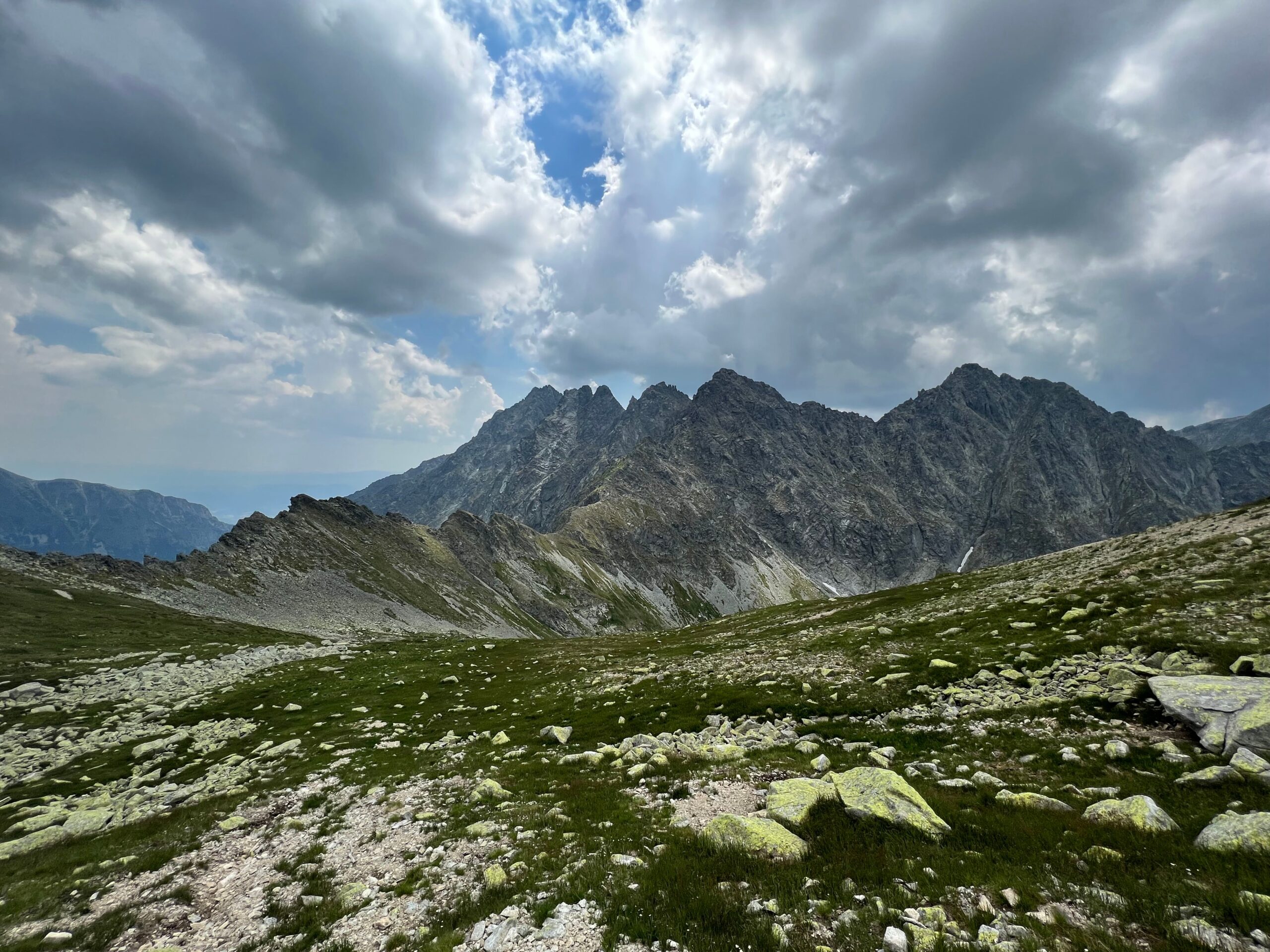
How long it takes and which way to walk it
People usually do it in three, four or five days. The difference is not the route but where you join it and where you cut it short. We deliberately do not give distances or stage times: sources disagree depending on exactly which variant they walked and where they started, and an estimate copied off someone else’s blog is the worst thing you can carry on a multi-day walk. Treat the following as a skeleton built around places to sleep, and measure your own variant on a map.
- Three days, the western half. From the Čertovica pass along the Ďumbierske Tatry to Donovaly. This is the popular version, because it contains the 2,000ers, Ďumbier and Chopok. You miss the whole eastern half, which is the calmer and in some ways nicer part.
- Four days, the usual compromise. Telgárt and Kráľova hoľa, then Čertovica, then Chopok, then Donovaly. Day three is the hardest even when it is not the longest.
- Five days, the whole ridge in comfort. The same line with a spare day, which is what lets you sit out a storm instead of pushing through it. On a ridge with no escape, that is the most valuable item in the plan.
The classic direction is east to west, from Telgárt over Kráľova hoľa towards Donovaly, for three reasons: you break yourself in on gentler ground and reach the rocky Ďumbierske Tatry with the walking already in your legs, you have the sun behind you rather than in your eyes, and you finish in a more populated area with better transport. The reverse works too if your logistics point that way.
Where to sleep on the ridge
On this traverse the beds matter more than the route, because the route is fixed by the red waymarks while the nights are what decide whether the plan holds. On the main ridge there are two mountain huts, three unstaffed shelters and eight officially designated bivouac spots. Everything else is improvisation.
Chata generála M. R. Štefánika is the most important address on the traverse. It stands at 1,740 m just below Ďumbier, opens all year and is the only reliable roof in the hardest part of the ridge. It has six eight-bed rooms, one twin room and a dormitory with eight mattresses where you bring your own sleeping bag. Booking is compulsory and carries a non-refundable reservation fee of €15 per person (about £13), and the booking is only held until 20:00 before it lapses. Check-out is by 9:00 and breakfast is served at 7:00 and 8:00. A bed costs roughly €24 to €40 per person (about £20 to £34) depending on the type and on club membership, with the twin room charged as a unit; most rates include breakfast. Current prices and the booking form are at chatamrs.sk.
Kamenná chata pod Chopkom is the second roof and the third highest hut in Slovakia, at 1,985 m immediately below Chopok, open all year with occasional maintenance breaks. You sleep in a shared dormitory; there is central heating, a fireplace and food. There is no Wi-Fi and the hut says so itself, which matters if you were planning to download a forecast in the morning. Booking runs through a web system that shows current occupancy. We do not quote prices here, because we could not verify them; the price page did not work. Check at kamennachata.sk.
Besides the two huts there are the shelters (útulne) at Andrejcová, Ramža and Ďurková. These are simple unstaffed buildings with no booking, where the unwritten rule is that space gets shared and nobody is turned out. The park’s visitor regulations list them as places where overnight stays are permitted. We do not give their capacity, opening arrangements or facilities, because those could not be verified from an official source, and where you sleep is not a good place for guesswork. Plan as though the shelter might be full and carry an outdoor option.
The eight legal bivouac spots
Camping and bivouacking outside designated places is prohibited in the Low Tatras National Park. The catch is that eight places are designated for a single night’s stay, and they sit exactly where a multi-day walker needs them:
- Predné sedlo (blue trail 2610)
- Sedlo Andrejcová by the shelter (red trail 0801)
- Sedlo Priehyba (red 0801)
- Sedlo Ramža by the shelter (red 0801)
- Sedlo Čertovica, below the mountain rescue building or behind the roadside motel
- Ďurková, only once the shelter is full (blue 2639, green 5609)
- The settlement of Magurka, by the tourist hut on Panská lúka
- Hiadeľské sedlo (red 0801)
Two things follow. Six of the eight sit on or beside the red ridge trail, which is why a self-supported traverse works here without hut bookings at all. And at Ďurková the permission is tied to the shelter being full, so it is not a campsite of convenience. Open fires are allowed only in the designated areas at huts and campsites, so it is a stove and nothing more.
For comparison, in the neighbouring High Tatras there is exactly one permitted camping spot in the whole park, and even that only in the context of a climbing or ski-mountaineering trip. By Slovak standards the Low Tatras are generous.
💡 The thing that catches people out is water. There are no reliable water sources on the ridge. You either buy water at the huts, descend into a valley for it, or carry it, and two litres per person per day is a minimum in hot weather. Plan escape routes as carefully as stages: for every day, find the nearest saddle with a marked descent into a valley. Almost every problem in the Low Tatras is solved by dropping off the ridge in good time.
Is the traverse suitable for children?
Honestly, no. The stages are the length of an adult day, there is no way to shorten a section between saddles or call for a lift out, and the rule about walking only in daylight forgives no delays. Families are far better served by day walks from a base in one of the valleys, which is what most of this guide is about.
How to get to the Low Tatras
Everything on the northern side funnels through Liptovský Mikuláš, and everything on the southern side through Brezno. Once you know that, the logistics stop being complicated.
- Poprad is the nearest airport and sits on the main Slovak railway line. From Poprad it is a straightforward run west along the D1 to Liptovský Mikuláš, and from there about twenty minutes up the Demänová valley.
- Bratislava is the country’s main gateway and lies on the same east-west corridor by road and rail, though it is the longest of these approaches.
- Košice has the larger airport in the east of the country and works well if you are starting from the eastern half of the range around Kráľova hoľa.
- Kraków is the obvious approach from southern Poland, but be clear that it points you at the High Tatras first. You cross the border and carry on south-west past Poprad to reach the Low Tatras.
Public transport works but shapes your day. Trains and long-distance buses reach Liptovský Mikuláš easily; from there a local bus goes up the Demänovská dolina, but services are sparse and the last afternoon bus back sets the length of your walk more than your legs do. Most walks in this guide start from a paid car park in a valley, and in the Demänovská dolina and Jasná those fill up during the morning in high season.
Two practical notes. Slovakia uses the euro (roughly £0.84 to the euro at the time of writing), and cash is worth carrying, because the caves and the mountain huts cannot be relied on to take cards. And Slovak motorways require a vignette, which you buy online as an e-vignette linked to your number plate before you drive onto the motorway network.
When to go, and the truth about seasonal trail closures
The best window for the ridge and the summits is the second half of June and the whole of September. In July and August the crest is hot from mid-morning, with thunderstorms in the afternoon and no shade anywhere. September gives you golden grass on the eastern ridges, clean air and car parks you can still get into after nine.
Underground follows a completely different logic. The Cave of Liberty and Bystrianska jaskyňa run outside the main season as well, which makes them the only targets on this list that work more or less all year. The Ice Cave is purely a summer proposition, open 15 May to 30 September only.
Now the point that most English-language articles get wrong. There is no blanket seasonal trail closure in the Low Tatras. This is not the High Tatras or the Malá Fatra, where large parts of the high mountains shut for months. The main ridge along red trail 0801 has no seasonal closure and can be walked all year. The visitor regulations close only the following:
| Section | Closure period |
|---|---|
| Kotliská to Žiar (yellow trail 8447) | 1 October to 30 June |
| Poľana to sedlo Sinná (yellow 8619) | 1 October to 30 June |
| Demänovské sedlo to sedlo Javorie to Krupovské sedlo (yellow 8620) | 1 October to 30 June |
| Chata M. R. Štefánika to Ďumbier along the winter pole markers | whenever there is no continuous snow cover of at least 15 cm |
That last line is the one that gets misquoted. The trail to Ďumbier is not closed; what closes is the winter variant marked by poles, which may only be used when at least fifteen centimetres of continuous snow is lying. In summer you simply take the normal route.
Winter in the Low Tatras
Winter here is a full season rather than a tolerated exception. The cable car to Chopok plus a short walk at the top is the simplest way to stand above 2,000 m in January, and the valley floors of the Demänovská and Jánska dolina hold tracks that are avalanche-safe, unlike the open slopes above them, which makes them good snowshoe ground.
Two limits to know. The daylight rule bites hard in December: walking is allowed only from one hour after sunrise to one hour before sunset, which leaves you around seven usable hours. And ski touring is permitted only in two designated areas, Chopok and Kráľova hoľa, and only from 15 December to 30 April, with the permission suspended entirely whenever the mountain rescue service declares avalanche danger of level three or above.
Dogs, bears and mountain rescue
Dogs: the rule almost everyone gets wrong
The Low Tatras are good dog country, but the rule is regularly mistranslated on blogs. The visitor regulations of the Low Tatras National Park state that a dog may be taken along on a lead and with a muzzle. It is not “a lead or a muzzle”. Both, at the same time. So the muzzle goes in the rucksack even if your dog has never worn one.
The rest of a dog day is easy to arrange. Dogs are allowed on the cable car, small ones carried in a bag travel free and larger ones cost €10 per animal. There is no water anywhere on the ridge, and the open grass slopes get genuinely hot in summer, which takes a dog down before it takes you down. Early starts count double here. The multi-day traverse is a different matter and not a place to bring a dog.
Bears
The brown bear lives in the Low Tatras and an encounter is not extraordinary, particularly at dawn, at dusk and in the bilberry season. We do not quote bear numbers, cull figures or claim that any exceptional legal regime is currently in force in Slovakia, because none of that could be verified from an official source and it would date faster than this article. Check the Slovak interior and environment ministry pages before you travel.
What holds regardless of the current situation is behaviour on the trail. Make a reasonable amount of noise, because a bear wants to meet you even less than you want to meet it, and wind on an open ridge swallows conversation. Never leave food by the place you sleep, and treat rubbish, toothpaste and anything scented the same way. Do not walk at dusk, which you are not allowed to do anyway. If you see a bear at a distance, go round it in a wide arc, never approach for a photograph and never get between a female and her cubs. If you meet one at close range, do not run: back away slowly, face it, speak calmly and leave it an escape route.
Mountain rescue in Slovakia is chargeable
This surprises visitors arriving with a European health card and standard travel cover. Under Slovak law, the person rescued pays the costs of the mountain rescue service’s intervention in the mountains, and a helicopter is expensive. Take insurance that explicitly covers mountain rescue and hiking, and save two numbers in your phone: 18 300 for the mountain rescue service (Horská záchranná služba) and 112 for the general emergency line.
Where to stay in the Low Tatras
Liptovský Mikuláš and the Demänovská dolina are the best base, because from there you have both show caves, the lake, the cable car and the main ridge within reach. From Mikuláš you are in the valley in twenty minutes, you have shops and something to do in the evening, and rooms are usually cheaper than directly under the ski slopes. Find places to stay around Liptovský Mikuláš →
Staying in the valley itself puts you at the trailheads and at the lower cable car station, which is worth a lot on a summer morning when the car parks fill up before ten. Find places to stay in the Demänovská dolina →
For the southern side of the range and the approaches to Ďumbier from Bystrá and Trangoška, look at Tále and Brezno instead. And for the eastern half around Kráľova hoľa, Šumiac and Telgárt are the practical bases, though the choice of accommodation there is much thinner.
💡 If you want a place to yourself. Go to Kráľova hoľa, Veľká Chochuľa or Chabenec on a weekday. While there is a queue of cars in the Demänovská dolina, you will meet a handful of people all day in the eastern half. Same range, one hour’s drive further on.
Where to go next
If you are collecting Slovak mountains, the obvious follow-ups are the High Tatras across the valley to the north, with their cable cars and their much stricter seasonal closure, and the two Fatra ranges to the west, the Malá Fatra with its ladder-and-chain gorges and the Veľká Fatra with its long grassy ridge. Slovakia’s other show caves, several of them UNESCO listed, are also within a day’s drive of Liptov.
Frequently asked questions
What are the best things to do in the Low Tatras?
Start underground with the Demänovská Cave of Liberty, the most visited cave in Slovakia, then take the Chopok cable car from Jasná for a 360-degree view at just over 2,000 m. Add the moraine lake Vrbické pleso in the Demänovská dolina, the 55 m Brankovský waterfall near Ružomberok, and one walk on your own legs, most easily Poludnica above Liptovský Ján. With more time, the ridge traverse along the red trail takes three to five days.
How do the Low Tatras differ from the High Tatras?
The High Tatras are alpine, with granite peaks, chained sections and a seasonal closure of the high trails. The Low Tatras are a long, rounded grass ridge, easier underfoot, quieter and cheaper, with almost no exposure but also no shelter or shade on top. The decisive difference is underground: the Low Tatras hold the largest cave system in Slovakia and the High Tatras have nothing comparable.
Is there still ice in the Demänovská Ice Cave?
No. The Slovak Caves Administration states that after another run of warm winters the cave lost the last remnants of its ice, and that the ice decoration can now be seen only in older photographs and on souvenirs. The name survives as a place name. The cave is still worth an hour as a large, strange, very cold underground space, but not if you are travelling specifically for ice.
How much do tickets for the Demänovská Cave of Liberty cost?
The traditional circuit of 1,150 m and 60 minutes costs €15 for an adult, €8 for children aged 4 to 15 and disabled visitors, and €14 for students and over-60s. The long circuit of 2,150 m and 100 minutes costs €24, or €12 and €22 respectively. Prices come from the Slovak Caves Administration and were checked in August 2026.
Can you book tickets for the Demänovská caves in advance?
No. The Slovak Caves Administration states explicitly for both Demänová caves that reservations are not made, and no online ticket sale exists. Entry is first come, first served, and in high season visitors are admitted in groups according to capacity. Bring cash, because card payment may not be available, and note that both caves close on Mondays.
What time does the last Chopok cable car go down?
The lifts at Jasná run every day from 8:30 to 17:00 at half-hourly intervals, and the last cable car down from Chopok leaves at 17:00. Prices cannot be quoted in advance because the operator uses dynamic pricing with no static price list, though buying online ahead of time is cheaper than the ticket window. The service also depends on the weather and stops in strong wind.
What is the highest mountain in the Low Tatras?
Ďumbier. The national park administration gives 2,043 m on napant.sk, while the Slovak Wikipedia quotes 2,045.9 m from a newer survey. The second highest is Štiavnica at 2,025.3 m and only third is Chopok at 2,023.6 m, which most people guess first because they know it from the Jasná ski resort.
Are hiking trails in the Low Tatras closed in winter?
There is no blanket seasonal closure here, unlike the High Tatras or the Malá Fatra. The visitor regulations close only three yellow-marked sections, from 1 October to 30 June, plus the winter pole-marked variant between the Štefánik hut and Ďumbier, which may be used only when at least 15 cm of continuous snow is lying. The main ridge along red trail 0801 is not closed.
Where is the best base for visiting the Low Tatras?
Liptovský Mikuláš or the Demänovská dolina itself. From Mikuláš you reach the valley in twenty minutes and you have both show caves, Vrbické pleso, the Chopok cable car and the main ridge within easy range, with shops and evening options in town and cheaper rooms than under the ski slopes. For the southern side and the approaches to Ďumbier, Tále and Brezno work better.
Potřebujete pomoct s cestováním?
-
Ubytování 🏨
Vyberte si to nejlepší ubytování, ať už jste kdekoliv, přes Booking.com. -
Půjčení auta 🚗
Auto si snadno najdete přes Booking.com, kde máte často slevu díky ubytování, nebo Rentalcars.com, kde porovnáte nabídky většiny půjčoven. -
Zážitky 🎟️
Přes GetYourGuide.com si vyberete z nejrůznějších výletů i zážitků po celém světě, navíc se zrušením zdarma do 24 h předem.