Last updated 1.9.2026
The Veľká Fatra ridge hike is the longest grassy traverse in Slovakia and, on most days of the year, the emptiest. Veľká Fatra means “the Greater Fatra”, and the name is honest: the main crest runs for roughly fifty kilometres from the Malý Šturec saddle over Kráľova studňa, Krížna and Ostredok to Ploská, where it forks into a western and a northern arm. For hours on end you walk above the treeline on open meadow with the Low Tatras on one side and the Malá Fatra on the other, and you meet almost nobody. That is the reward. The price is distance: depending on which version you choose, the Veľká Fatra traverse is 41 to 51 km with somewhere between 2,600 and 2,800 metres of ascent.
This guide sets out exactly where the ridge runs, three versions of the walk depending on how many days you have, where you can legally sleep up there, where the water is (there is very little), how to reach the start and get home from the finish without a car, and how the Veľká Fatra differs from its more famous neighbour, the Malá Fatra.
The Veľká Fatra ridge hike at a glance
- Where: Veľká Fatra National Park in central Slovakia, in the triangle between Banská Bystrica, Martin and Ružomberok. The main crest is about 50 km long.
- Highest point: Ostredok, 1,596 m, followed by Krížna (1,574 m) and Rakytov (1,567 m).
- The classic traverse: Staré Hory to Ružomberok, 43 km, around 2,600 m of ascent, comfortable in two days with a night at Chata pod Borišovom.
- The long version: Harmanec to Ružomberok, roughly 51 km and about 2,800 m of ascent, sensibly walked over three days.
- A one-day taster: the circuit from Vyšné Revúce over Ploská, 19 km with 1,148 m of ascent.
- Sleeping: Chata pod Borišovom (1,312 m), the Kráľova studňa mountain hotel (1,277 m) and Smrekovica (1,339 m). Wild camping and bivouacking are banned; you may only sleep out within 50 m of a hut or shelter.
- When to go: September and the first half of October usually bring the most settled weather. June is the wettest month, and thunderstorms are a feature of August and September.
- Good news for spring visitors: unlike the Malá Fatra, the Veľká Fatra has no blanket seasonal closure of its ridge paths.
- Getting there: nearest airports are Ostrava, Katowice, Bratislava, Kraków and Vienna; train to Ružomberok or Žilina, then local buses.
Where the Veľká Fatra ridge hike actually runs
The Veľká Fatra is a compact core range, roughly 40 km by 20 km. Nine tenths of it is beech forest — some of the finest in Europe, parts of it UNESCO-listed — but above about 1,300 metres the trees stop and the range opens into hole (singular hoľa): bare, grassy tops that roll on for hours without a single tree. Those meadows are the entire point of coming here.
The main crest from Malý Šturec to Ploská
The ridge proper begins at the Malý Šturec saddle above the village of Staré Hory and climbs past Kráľova studňa — “the King’s well”, a summit of 1,384 m with a mountain hotel some distance below it — to Krížna (1,574 m). Krížna is where most walkers work out what they have signed up for, because from the top you can see several hours of ridge laid out ahead of you. Next comes Ostredok (1,596 m), the highest point of the range, then Suchý vrch and the Chyžky saddle, and finally Ploská (1,532 m), a soft, meadowy dome that Slovaks call the queen of the Veľká Fatra. In the saddle below it stands Chata pod Borišovom — “the hut below Borišov” — the natural midpoint of the traverse and the only place on the crest where you genuinely sleep in the mountains.
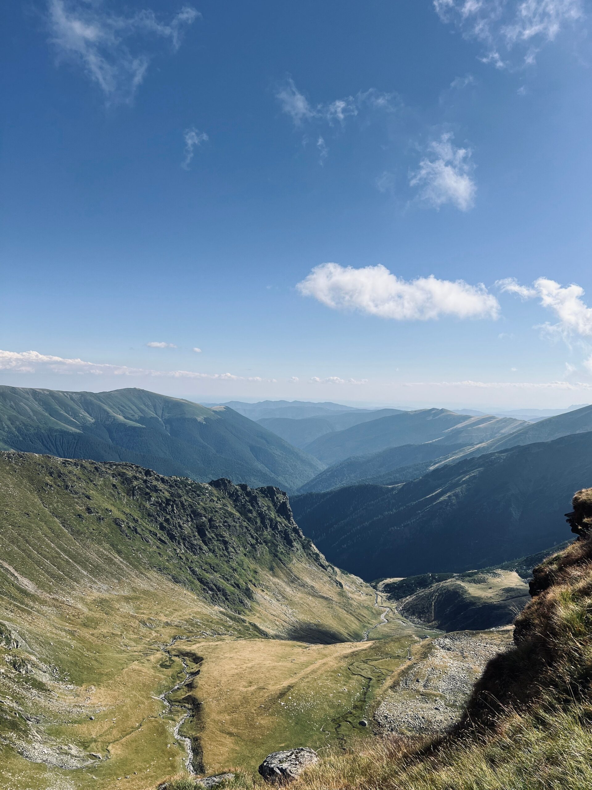 Grassy Carpathian ridges above the valleys. Illustrative photo: Pexels
Where the ridge splits in two
Beyond Ploská the crest divides into two arms, separated by the twenty-five-kilometre trench of the Ľubochnianska dolina valley:
- The Turiec arm runs west over Borišov (1,510 m) and Tlstá (1,373 m) above the Gaderská dolina valley. It is more wooded and gives you fewer views.
- The Liptov arm heads north over Rakytov (1,567 m), Smrekovica (1,339 m) and Šiprúň (1,461 m) down into Ružomberok. It is far more open, and it is the one nearly everybody uses.
When Slovaks talk about the traverse of the Veľká Fatra, they mean the main crest plus the Liptov arm — in other words, a line from the outskirts of Banská Bystrica to Ružomberok. Shorter circuits into the Gaderská and Blatnická valleys are a separate proposition and are covered in our round-up of day walks in the range.
How Slovak waymarking works
If your hillwalking has been done in Britain, the Slovak system will take about an hour to get used to and then feel obvious. It is the shared Czech and Slovak scheme, maintained here by the Klub slovenských turistov (KST), the Slovak hiking club, and it is one of the densest and best-kept networks anywhere in Europe. There is nothing like the British “right to roam”: here you follow the paint.
- Every waymark is a horizontal stripe of colour sandwiched between two white stripes, painted on trees, rocks and posts. You should see one every few minutes. Ten minutes without a mark means you have wandered off.
- Colour tells you the role of the trail, not how hard it is. Red is reserved for main long-distance and ridge routes, so the Veľká Fatra crest is red almost the whole way. Blue and green are the connecting paths up from the valleys — your escape routes. Yellow marks short links.
- Signposts quote times, not distances. “Ploská 1:45” means an hour and three quarters at an average pace. The times are fair rather than optimistic, but add a little if you are carrying a full pack.
- An arrow-shaped mark means a sharp turn. Do not expect cairns, and do not expect a path you can follow by feel across the meadows — in mist you follow the paint and the map.
Staying on marked paths is not merely good manners in a Slovak national park. It is the law.
Three versions of the Veľká Fatra traverse, by how much time you have
There are three sensible ways to tackle this ridge. Choose by the number of days you actually have, not by the distance you think you can walk — the mileage here is closer to a long Pennine day than to an Alpine hut tour, and it comes with almost no water.
| Version | Route | Distance | Ascent | Time |
|---|---|---|---|---|
| One-day taster | circuit from Vyšné Revúce over the saddle below Ploská, Ploská and Suchý vrch | 19 km | +1,148 m | 1 day, allow 7 to 8 hours |
| The classic two-day traverse | Staré Hory to Ružomberok over Krížna, Ostredok and Ploská, night at Chata pod Borišovom | 43 km (19.3 + 26.4 km) | +2,636 m, −2,301 m | 2 days, roughly 7 and 10 hours including breaks |
| The full traverse | Harmanec to Ružomberok, or Turecká to Ružomberok-Biely Potok along the Liptov arm | 51 km, or roughly 48 km | roughly 2,800 m | 3 days |
1. One day: a taste of the ridge
If you have a weekend rather than a week, and you would rather not juggle two different railway stations, go up from the valley and come back down the same way. The tried and tested circuit runs from Vyšné Revúce past the Mogury shepherd’s hut and the saddle below Ploská to the summit of Ploská, then back over the Chyžky saddle and Suchý vrch. It is 19 km with 1,148 metres of ascent — a full mountain day by any measure — and it hands you the prettiest grassy section of the crest without a sleeping bag on your back. A shorter alternative starts in Liptovské Revúce and goes up to Chata pod Borišovom and back: 16 km and about 1,150 metres of climbing.
2. Two days, with a night in the hut
This is the version most people walk. Day one takes you from Staré Hory to Chata pod Borišovom, roughly 19 km and about seven hours with breaks. Day two runs from the hut over Rakytov and Smrekovica and down into Ružomberok: more than 26 km and a solid ten hours. In other words, day two is longer than a full round of Scafell Pike from Wasdale, at the end of a night on a bunk in a hut with no shower. Set off straight after breakfast.
💡 Tip: If day two turns out to be more than your legs want, drop off Smrekovica down to Podsuchá on the Ružomberok–Banská Bystrica road. You will save several hours and a bus will take you into town.
3. Three days: the whole ridge
The complete version starts lower and earlier, usually at Harmanec, and comes to about 51 km with roughly 2,800 metres of ascent. The alternative is to start at Turecká and follow the entire Liptov arm down to Ružomberok-Biely Potok, around 48 km with two nights out. Three days also fits the travel better: the first and last days are largely eaten by getting to the start and away from the finish.
Which direction to walk
Most people go south to north, from Banská Bystrica towards Ružomberok. You get the loveliest meadow sections on day one while you are fresh, and you finish at a station on the main railway line. The reverse makes sense if you have a car, because Ružomberok is the easier end to drive to from Czechia and Poland, and the southern end has denser bus services, which makes getting back to your vehicle simpler. Decide on the basis of where the car is parked, not where the views are.
Where to sleep on the Veľká Fatra ridge
There are three reliable places to sleep on the main crest, and every one of them needs booking in advance. Beds in the valleys and in the surrounding towns are a separate matter, covered in our guide to accommodation in the range.
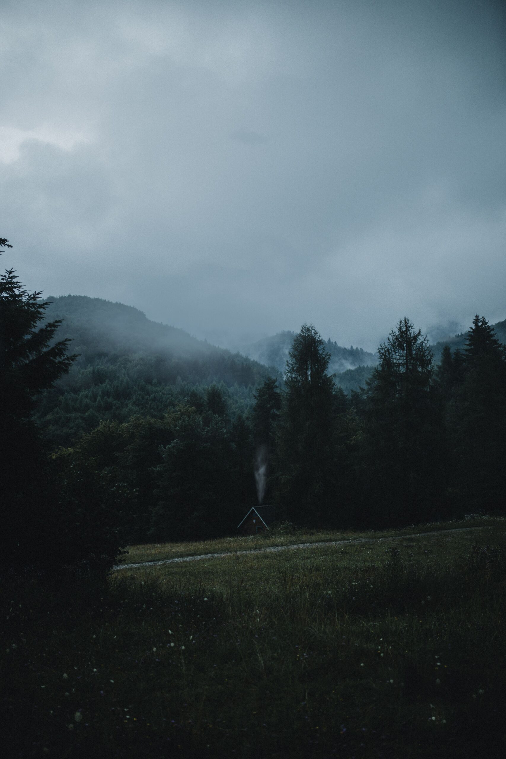
Chata pod Borišovom (1,312 m)
The heart of the traverse and the only true mountain hut on the route. It is open year-round and has 20 beds in three six-bed rooms and one twin, all of them bunks. You book a bed rather than a room, exactly as you would in an Alpine refuge. Prices valid from 1 January 2026: €28 per person per night with bedding (about £24), €23 if you bring your own sleeping bag (about £19), breakfast €8 and dinner €10 to €12. Payment is in cash only.
You reserve online or by email at chatapodborisovom@gmail.com, or by phone on 0919 493 493. There is no permanent mobile signal at the hut, so a reply can take a couple of days. The deposit is 50 per cent and is refunded if you cancel at least seven days ahead. Be clear about what you are booking: there is no hot water and no shower, the toilets are dry composting ones, dogs are not accepted, and you may not pitch a tent outside.
💡 Tip: On summer weekends the hut is full weeks ahead. Book the moment you know your dates, and carry euros in cash. There is no cash machine on the ridge, and no card terminal either.
Kráľova studňa mountain hotel (1,277 m)
The comfortable option, right at the southern start of the ridge below Krížna. Note the two different heights: the summit called Kráľova studňa is 1,384 m, while the hotel sits a little lower at 1,277 m. It has 52 hotel beds plus three basic walkers’ rooms of eight beds each, and the restaurant serves until 8 p.m. daily. It is the obvious choice if you want to be on the ridge the evening before you start. Driving up means 14 km of forest track through the Zalámaná dolina valley, for which you need a paid permit from the Banská Bystrica municipal forestry office, currently €6 (about £5), and a car with decent ground clearance.
Smrekovica (1,339 m)
A mountain chalet on the northern arm of the ridge, on the edge of the Skalná Alpa reserve. Open all year, 62 beds, a restaurant, a sauna, and in winter a drag lift with cross-country tracks. By car you reach it from Podsuchá, about 10 km short of Ružomberok, and then 8 km uphill. For a three-day traverse it is the logical second night.
You will also pass útulne — unstaffed emergency shelters, such as the útulňa at Chyžky — and working salaše, the shepherds’ summer dairies. Treat both as a fallback if the weather turns, not as a planned bed for the night.
How booking a Slovak mountain hut works
It is nothing like reserving a hotel room, and nothing like the centralised systems of the Alps either. Expect the following:
- You book by email or telephone, occasionally through a form on the hut’s own site. Replies can take hours or days, because somebody has to walk into signal to send them.
- A request is not a reservation. It only counts once the hut confirms it. Get the confirmation in writing and screenshot it — you will not have signal on the crest.
- Basic English is usually understood, but keep the message short and structured: dates, number of people, whether you are bringing a sleeping bag, whether you want meals.
- Bring cash in euros. At Chata pod Borišovom it is not a preference, it is the only option.
- Half board is worth taking. You are not going to carry a stove and three days of food across fifty kilometres of waterless meadow.
Water on the ridge
The Veľká Fatra is limestone, and its water disappears underground. You can walk half a day along the grassy crest without crossing so much as a trickle. This is the single thing British walkers most often get wrong here, because Scottish and Welsh hills condition you to expect a burn every twenty minutes.
- The dependable sources are the huts and mountain hotels: Kráľova studňa, Chata pod Borišovom and Smrekovica.
- The spring below the Ploská saddle is usually running, but the spring below Suchý vrch was found dry in August.
- In a dry summer even springs permanently marked on the map stop flowing altogether.
💡 Tip: Start the day with three litres per person and top up at every opportunity. The shepherds’ salaše along the route normally have water and will happily fill your bottles.
Getting to the Veľká Fatra from abroad
The range sits in the middle of Slovakia, which makes it awkward to fly to and easy to reach by train. It can be done entirely without a car, and public transport here is cheap by British standards.
Nearest airports
Žilina has an airport but no scheduled passenger flights, so discount it. In practice you fly into one of five:
- Ostrava (OSR), Czech Republic — about 110 km, the closest of the lot, though with a thin route network.
- Katowice (KTW), Poland — about 185 km, well served by budget airlines from the UK.
- Bratislava (BTS), Slovakia — about 200 km, and the only one that puts you on a direct train towards Ružomberok without changing countries.
- Kraków (KRK), Poland — about 200 km, the best choice if you are pairing the trip with the Tatras.
- Vienna (VIE), Austria — about 250 km, the widest choice of flights and straightforward onward connections via Bratislava.
By train
Ružomberok, the northern end of the traverse, sits on the main Žilina–Košice railway line, which means frequent, cheap and reliable trains. Žilina itself is the regional hub and the easiest place to change; from Bratislava it is about two and a half hours, and there are direct services from Prague and Ostrava. Buy tickets on the ZSSK website or app. Fast trains are worth reserving in high summer; local trains never need it.
Reaching the start and getting home from the finish
It works without a car, but look up the timetables before you go — services thin out at weekends.
- The southern end: buses run from Banská Bystrica to Staré Hory and to Turecká. At weekends and on public holidays from April to October, the seasonal TURBUS service runs from Banská Bystrica up to Kráľova studňa: €5 one way, €7 return.
- The northern end: train to Ružomberok on the Žilina–Košice line, then a city bus or a local service on to Biely Potok.
- Driving: a car is a liability on a fifty-kilometre point-to-point walk, because it will be sitting at the wrong end of it. The tidiest solution is to park in Ružomberok and take the bus round to the start.
For the night before you set off or the night after you come down, the practical bases are Ružomberok at the northern end, or Donovaly on the southern side.
💡 Tip: Slovakia uses the euro, and contactless payment is standard in towns. Mountain huts, village shops and rural buses often are not. Draw out €100 or so before you head for the hills.
Weather and thunderstorms on an open ridge
A grassy crest is a delight right up to the moment the sky closes in. Then it dawns on you that you are the highest object for miles and the nearest tree is an hour’s descent away. Storms here typically build in the afternoon, most often in August and September, and June is reliably the wettest month of the year. The most settled spell is usually September and the first half of October, when the beech woods below have turned as well.
The rule is simple: leave early, and know before you set off where you would drop into a valley if you had to. There are plenty of marked descents off the crest, but in mist they are hard to find, because the hole meadows have no distinguishing features whatsoever — no crags, no walls, no cairns, just grass in every direction. Download an offline map, start the day with a full battery, and check the forecast for the summits rather than for Ružomberok in the valley.
The Veľká Fatra ridge in winter
In winter the range turns into ski-touring and snowshoeing country. The huts on the crest stay open all year, so a winter traverse is possible, but it is a different discipline altogether. The open meadows scour and drift, the paths vanish under snow, and navigation comes down entirely to map and compass or GPS. Add the short daylight and genuine avalanche risk on the steeper flanks below the crest. Go with somebody who has done it in winter before, and plan on covering considerably less ground each day than you would in summer.
Veľká Fatra National Park rules
The national park was declared on 1 April 2002. It covers 403.71 km², with a further 261.32 km² of buffer zone, and it carries the higher levels of protection defined by Slovakia’s nature conservation act. Three things follow from that:
- Camping, bivouacking and pitching a tent outside places designated by the park administration are all prohibited. In practice you may only sleep out within 50 metres of a hut or an útulňa, and only where the hut allows it. A legal night on the ridge means a bunk, not a tent below Ploská.
- No open fires, and you keep to the waymarked paths.
- Dogs on a lead. On top of that, Chata pod Borišovom does not accept dogs at all, which effectively rules the ridge out as a two-day trip with a dog.
What about the spring trail closures?
Worth flagging, because it confuses visitors who have read about the neighbouring range. In the Malá Fatra, several sections — including the finale over Veľký Rozsutec — are closed every year from 1 March to 15 June. No equivalent blanket seasonal closure applies to the Veľká Fatra ridge, so do not plan your trip around one. Individual paths can still be shut at short notice for forestry work, storm damage or wildlife protection, and those notices go up at the trailheads and on the park’s website, usually in Slovak only. Check before you travel and read the signs at the start of the walk.
Bears, wolves and lynx
The Veľká Fatra is home to all three. An encounter is unlikely but perfectly possible, and the range even shows up in search results as bear country. Make noise on wooded sections, particularly at dawn and dusk, keep food inside the hut rather than outside it, and never approach or run from a bear you do see. The Slovak mountain rescue service (Horská záchranná služba) is on 18 300; the European emergency number 112 works throughout Slovakia.
What to pack for the Veľká Fatra ridge hike
Nothing exotic on this list, but nothing on it is optional either.
- Bottles or a bladder for three litres of water, plus a filter or purification tablets.
- Cash in euros. Chata pod Borišovom does not take cards.
- Your own sleeping bag, which saves you €5 a night.
- A waterproof and one warm layer more than you think, because the wind on the open meadows blows even in August.
- A paper map and a power bank. Signal on the crest is poor and at the hut there is none.
- Head torch and blister plasters — the second day is ten hours long.
- Boots above the ankle and poles for the long descent into Ružomberok.
The most common mistakes on the Veľká Fatra traverse
- Underestimating the water. This is the single most common reason people abandon the traverse.
- Not booking the hut. Turn up unannounced in season and you may be turned away, and the next bed is hours of walking distant.
- A late start on day two. Leave the hut at ten and you will be walking into Ružomberok in the dark.
- Planning by the straight-line distance. Even the “flat” stretches of crest quietly add hundreds of metres of ascent.
- Climbing onto the meadows in the afternoon in August. That is exactly where a thunderstorm will catch you, with nowhere at all to shelter.
- Assuming a tent solves the accommodation problem. It does not. Bivouacking is banned.
Veľká Fatra or Malá Fatra?
Both traverses can be done in two days, and they give you completely different things. The Malá Fatra ridge hike is about 35 km with over 3,000 metres of ascent and is much more dramatic: narrow crests, the exposed Steny section, the pyramid of Veľký Rozsutec. It is also busy, and part of the route is closed from 1 March to 15 June.
The Veľká Fatra ridge hike is longer, gentler underfoot and, above all, empty. There is nothing exposed on it and no chains, just hour after hour of walking on grass without meeting a soul. If you want photographs to frame, go to the Malá Fatra. If you want silence and long miles, the Greater Fatra is yours — and it lives up to the name.
Where to go next
If the ridge has given you the taste for this corner of Slovakia, the obvious follow-ups are the shorter day walks and valley circuits of the Veľká Fatra itself, a round-up of where to stay in the range and in the towns around it, and the neighbouring Malá Fatra: its own ridge traverse, the Jánošíkove diery gorges with their ladders and walkways, and where to base yourself in Terchová. Further west, the Súľov Rocks make an excellent recovery day, and if you are combining Slovakia with Poland, the Polish Tatras are two hours up the road. It is also worth reading up on walking in bear country before you come.
Veľká Fatra ridge hike: frequently asked questions
How long is the Veľká Fatra ridge hike?
The main crest measures roughly 50 km. The classic traverse from Staré Hory to Ružomberok is 43 km with about 2,636 m of ascent. The longer version from Harmanec to Ružomberok comes to roughly 51 km and around 2,800 m of ascent, and the highest point on the way is Ostredok at 1,596 m.
How many days do you need for the Veľká Fatra traverse?
Two days are enough if you are used to twenty-kilometre days and sleep at Chata pod Borišovom. Three days are more comfortable and fit the travel better, because the first and last days are largely taken up with getting to the start and away from the finish. If you only have one day, walk part of the crest instead — the 19 km circuit from Vyšné Revúce over Ploská is the pick.
Where can you sleep on the Veľká Fatra ridge?
There are three options on the main crest: Chata pod Borišovom in the saddle below Borišov (1,312 m), the Kráľova studňa mountain hotel at the southern start of the ridge (1,277 m), and Smrekovica on the northern arm (1,339 m). All three are open year-round and all three need booking in advance, by email or telephone. A request only counts as a reservation once the hut confirms it.
How much does a night at Chata pod Borišovom cost?
From 1 January 2026 it is €28 per person per night with bedding (about £24) and €23 with your own sleeping bag (about £19). Breakfast costs €8 and dinner €10 to €12. Payment is cash only, the hut does not take cards, and a booking requires a 50 per cent deposit. There is no hot water and no shower, and dogs are not accepted.
Is there water on the Veľká Fatra ridge?
Very little. The range is limestone and the water drains underground, so the reliable sources are the huts and the shepherds’ salaše. The spring below the Ploská saddle usually runs, while the spring below Suchý vrch dries up in a hot summer. Plan on three litres per person per day and fill up at every opportunity.
Can you wild camp or bivouac in the Veľká Fatra?
No. This is a national park under a higher level of protection, and camping, pitching a tent and bivouacking outside places designated by the park administration are all prohibited. In practice you may only sleep out within 50 metres of a hut or shelter, and only with the hut’s agreement. Open fires are banned and you must keep to the waymarked paths, so the only legal night on the ridge is a bunk in a hut.
Are any Veľká Fatra trails closed in spring, as they are in the Malá Fatra?
There is no blanket seasonal closure of the ridge paths in the Veľká Fatra, so do not confuse it with its neighbour. In the Malá Fatra several sections, including the traverse over Veľký Rozsutec, are shut every year from 1 March to 15 June. Individual paths in the Veľká Fatra can still be closed at short notice for forestry work or wildlife protection, and those notices are posted at the trailheads and on the national park’s website.
Are there bears in the Veľká Fatra, and is the ridge safe?
Brown bears live here, along with wolves and lynx, and encounters are unlikely but possible. Make noise on wooded sections, especially at dawn and dusk, keep food inside the hut, and never run from a bear. The bigger risks on this walk are prosaic: running out of water, afternoon thunderstorms on the open meadows and navigation in mist. Slovak mountain rescue is on 18 300 and the European emergency number 112 works everywhere in the country.
Potřebujete pomoct s cestováním?
-
Ubytování 🏨
Vyberte si to nejlepší ubytování, ať už jste kdekoliv, přes Booking.com. -
Půjčení auta 🚗
Auto si snadno najdete přes Booking.com, kde máte často slevu díky ubytování, nebo Rentalcars.com, kde porovnáte nabídky většiny půjčoven. -
Zážitky 🎟️
Přes GetYourGuide.com si vyberete z nejrůznějších výletů i zážitků po celém světě, navíc se zrušením zdarma do 24 h předem.