Last updated 30.8.2026
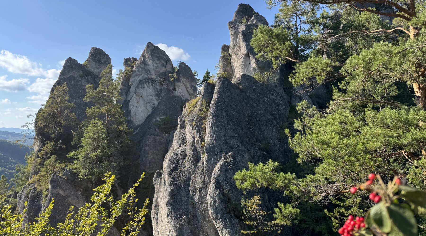
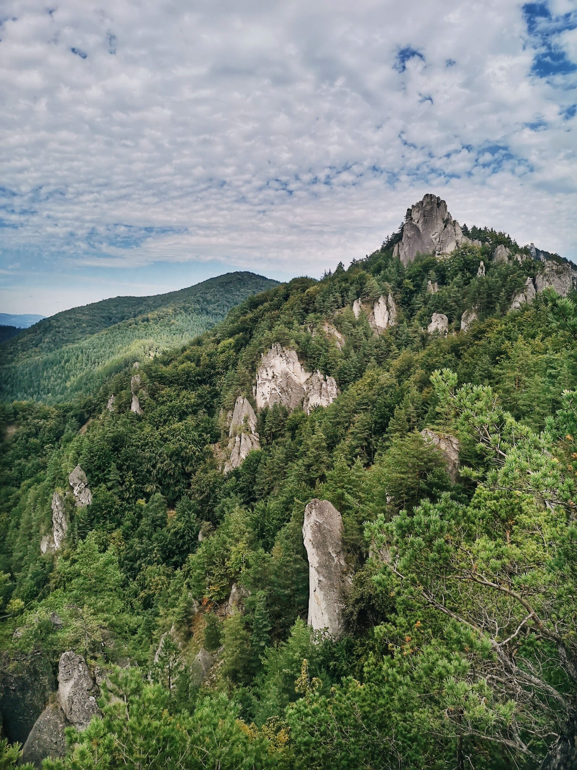
If you only know Slovakia from the High Tatras, the Súľov Rocks (Súľovské skaly) will come as a surprise. This is a rock town in the north-west of the country, where dozens of grey towers, needles, windows and natural gateways push out of a wooded hillside above one small village. The hills themselves are modest by Slovak standards, but the scenery reads like the Dolomites shrunk to a morning’s walk — and unlike the Tatras, you can be standing under the most photographed rock arch in the region half an hour after leaving the car park.
Below you will find the main Súľov-Hradná loop broken down section by section, real distances and ascent figures, an honest account of the ladders and chains, shorter versions for families, current parking charges and what to do with the rest of the day.
The Súľov Rocks at a glance
- Where: the village of Súľov-Hradná, Bytča district, north-west Slovakia. Roughly 10–12 km from Bytča and 25–30 km from Žilina.
- Main loop: the educational trail is 4.2 km with 300 m of ascent (1 hr 40 min); the longer version past the castle is 6 km and 252 m (2 hrs 15 min).
- Big loop with Šarkania diera: around 8–10 km and some 600 m of ascent — allow 4 to 5 hours.
- Highlights: Gotická brána (the Gothic Gate), the ruins of Súľov Castle (652 m), the viewpoints below Brada and Roháč, and the Šarkania diera (Dragon’s Hole) cave.
- Entry: free. Parking: €3 per car per day (about £2.50).
- Difficulty: moderate. Metal ladders, foot pegs and handrails, but no via ferrata gear needed — just slippery when wet.
- Best time: late April to June, and the second half of October. Weekends get busy.
What are the Súľov Rocks, and why make the detour?
The Súľov Rocks are a national nature reserve, declared in 1973, covering 543.23 hectares with a further 281.77 hectares of buffer zone. They carry the fifth and strictest level of protection in the Slovak system, which for a visitor boils down to one rule: never step off the waymarked paths.
The shapes are down to geology. The cliffs are built of Súľov conglomerate, a Palaeogene rock cemented together from limestone pebbles and dolomite fragments. It weathers unevenly, so the hillside has been carved into towers, mushrooms, windows and gates, most of which have picked up local nicknames along the way — Sova and Sovička (the Owl and the Little Owl), Mních (the Monk), Papagáj (the Parrot). The highest summit in the range is Žibrid at 867 m, but the two that matter on the loop are Brada (815 m) and Roháč (802 m).
There is a practical argument too. This is the obvious escape when the Malá Fatra is heaving, and it is one of the loveliest bits of walking in Slovakia outside the Tatras. Súľov sits lower, the trails are shorter, and you can still be back in Žilina for a late lunch.
Getting to the Súľov Rocks
Súľov-Hradná sits in the Súľov Hills, tucked into a side valley off the Váh river. It is not on the way to anywhere, which is exactly why it stays quieter than the big-name Slovak trails.
- By car. From Žilina take the road towards Bytča, then turn off towards Súľov — 25 to 30 minutes in all. From Bratislava it is roughly 200 km on the D1 motorway (about two hours to Žilina, plus the last half-hour). From Kraków or Vienna allow three to four hours.
- By train and bus. Žilina and Bytča both sit on the main Bratislava–Košice railway line, so trains are frequent and cheap; Žilina to Bytča takes around 20 minutes. From Bytča, local buses run into the valley — get off at the stop Súľov, ZŠ (the primary school), which is a two-minute walk from the trailhead. Buses also run direct from Žilina.
- Nearest airports. Žilina’s own airport handles private and charter traffic only. In practice you fly into Ostrava (roughly 100 km), Kraków, Katowice, Bratislava or Vienna, and continue by hire car or train.
💡 Tip: Weekend bus services in the valley are thin on the ground. If you are coming without a car, check the return departure before you set off — several visitors a season end up walking the 10 km back down to Bytča.
The main Súľov-Hradná loop, section by section
The walk everyone comes for is the loop from the car park in Súľov-Hradná, up through the Gothic Gate and Súľov Castle and back down to the village. Waymarking is excellent. The numbers, on the other hand, vary from source to source, because different people measure different variants:
| Variant | Distance | Ascent | Walking time |
|---|---|---|---|
| Educational trail, short loop via the castle | 4.2 km | approx. 300 m | 1 hr 40 min |
| Loop via the castle and Lúka pri kamennom hríbe | 6 km | 252 m | 2 hrs 15 min |
| Big loop with Šarkania diera and Roháč | 8–10 km | approx. 600–640 m | 3 hrs 30 min – 5 hrs |
For a first visit, the six-kilometre loop past the castle is the sweet spot. It takes in everything worth seeing and it is still doable if you only arrive after lunch.
1. Car park to the Gothic Gate (about 30 minutes)
From the signpost in the village, follow the green waymarks uphill through the woods. This is the steepest part of the whole route, but it is mercifully short. After roughly half an hour of climbing the trees open up, the first views arrive, and the Gothic Gate is right behind them.
2. Gotická brána (the Gothic Gate)
The Gothic Gate is the emblem of the Súľov Rocks — a natural rock arch around 13 metres high, and one that earns its name honestly: the way the conglomerate has fractured really does echo a Gothic doorway. It is the single most photographed spot in the area, so on a Saturday you will queue for a shot without people in it.
3. The ruins of Súľov Castle (652 m)
From the arch the green trail continues along a rocky forest path. The final metres up to the castle run through a narrow, mildly exposed passage with metal ladders and foot pegs — and this is precisely where the queues form in season, because two people cannot pass each other. Of the castle, generally dated to the 15th century, only fragments of wall clinging to the rock survive, and reaching the upper viewpoint means squeezing through a natural rock window. The reward is a full circle of views over the Súľov horseshoe.
4. Down from the castle and the viewpoints below Brada
The descent from the castle runs down ladders with handrails to Lúka pod hradom (the meadow below the castle). This is your decision point: either take the short cut straight back to the village — that is the short loop done — or pick up the red waymarks towards the peak of Brada. The red trail strings together several viewpoints over the valley, and plenty of walkers rate these as the best of the whole day.
5. Below Roháč and the Giant’s Gate
The red trail leads to the Pod Roháčom junction, where the towers, needles and cones open up from the other side. From here you can detour to the area’s second great rock arch, Obrovská brána (the Giant’s Gate). The descent from this point follows the yellow trail and is steep — genuinely slippery after rain.
6. Šarkania diera and the way back
From the Lúka pod Roháčom junction, a yellow spur drops to the cave known as Šarkania diera (Dragon’s Hole). This fissure cave is 58 metres long and up to 20 metres high, has been a protected natural monument since 1994, and is freely accessible. Getting to it, however, is the hardest section in the whole area: metal ladders, iron pegs and improvised steps. It is open from 1 May to 1 November; outside those dates it is closed as a bat hibernation site. From there, an easy forest track carries you back down to Súľov.
💡 Tip: Walk the loop anticlockwise — green waymarks to the Gothic Gate and castle first. You get the headline sights before the crowds arrive, and you avoid squeezing past a stream of people at the narrow bits.
Ladders, pegs and chains: how hard is it really?
Let us clear one thing up: none of this is a via ferrata and you need no technical kit whatsoever. The “secured” sections mean metal ladders, foot pegs set into the rock, wooden steps and the occasional handrail or chain. They cluster in three places — the final pull up to the castle, the descent to Lúka pod hradom, and the spur down to Šarkania diera.
If you are comfortable on ordinary mountain paths in the UK, you will be fine here. One caveat, though: wet conglomerate and wet metal pegs are genuinely slick, and most accidents in the area happen on the way down rather than on the way up.
💡 Tip: Not good with heights? The short loop to the castle and back is still perfectly manageable, but skip the spur to Šarkania diera. It is the most exposed stretch in the area, and we would not take children under about eight down there at all.
Shorter options for families with children
Súľov is a forgiving family destination, because you can cut the walk short almost anywhere:
- The Gothic Gate and back (about an hour). The least climbing, and the star attraction right at the start.
- The short loop via the castle (4.2 km, around 300 m of ascent). An easy morning out with school-age children.
- The route via Skotňa and Lúka pri kamennom hríbe up to the castle. Gentler gradients than the green trail, with a rock mushroom to look at on the way.
Leave the pushchair behind, even an all-terrain one. The trails run over roots, loose stone and ladders; a child carrier is the only thing that works here.
The Súľov waterfall: not on the loop
This is the single most common mix-up. Súľovský vodopád is an older name for the Hlbocký waterfall, and it is nowhere near the main loop. It drops around 14 metres in the Hlbocká valley, about a kilometre from the village of Hlboké nad Váhom, with an iron ladder plus rope and chains leading to the upper tier. Scenes from the Czechoslovak fairy-tale classics Perinbaba and Soľ nad zlato were filmed here.
You reach it on a short walk from Hlboké nad Váhom (park by the school; you can drive in from Bytča), or on foot from Súľov-Hradná on a traverse the village puts at 9 km with 403 m of ascent and around three hours. It is at its best after heavy rain — in a dry summer it thins to a trickle.
Parking, fees and practical details
Entry to the Súľov Rocks is free — there are no ticket offices anywhere in the reserve. The only thing you pay for is parking, which the village council collects.
| Item | Price / information |
|---|---|
| Entry to the Súľovské skaly nature reserve | free |
| Parking, car | €3 per day (about £2.50) |
| Parking, motorbike | €1.50 per day |
| Parking, coach | €9 per day (about £7.50) |
| Car park capacity | approx. 40 spaces in the Súľovská gorge (Skálie), 55 in the village centre |
| Payment | ticket machine or the village office; cards accepted |
| Public transport | buses from Bytča and Žilina, stop Súľov, ZŠ; or train to Bytča and bus onward |
Parking tickets are valid until midnight on the day of purchase, so if you sleep in the van you pay again in the morning.
💡 Tip: On sunny weekends both car parks fill up by about nine in the morning. Arrive before 8.30am and bring coins — the solar-powered machines are not always reliable.
When to visit the Súľov Rocks
The season runs from roughly April to November. Late April to June is the loveliest, along with the second half of October, when the beech woods below the cliffs turn. Summer is both the busiest and the hottest stretch, and there is little shade on the south-facing rocks. The area stays open in winter, but the ladders and pegs ice up.
What to wear and pack
- Boots with proper grip, ideally above the ankle. Conglomerate polishes smooth and turns to soap after rain.
- Gloves for the metal ladders and pegs.
- Enough water for the whole walk. There is no spring and no refreshment stand on the route — food and drink only back down in the village.
- A head torch if you are attempting the big loop in autumn. Take folding poles rather than fixed ones; you will be stowing them on the ladders anyway.
Turning it into a full day in the area
The loop itself only takes up a morning. A few kilometres away, the afternoon looks after itself:
The Manín and Kostolec gorges
Manínska tiesňava (the Manín gorge), above Považská Teplá, is the narrowest canyon in Slovakia — under four metres across at its tightest point, where the rock was blasted away in 1933 to let a road through. The interpretive trail between the campsite and the village of Záskalie is 2 km long and takes about 45 minutes. The smaller, quieter Kostolecká tiesňava (Kostolec gorge) sits right next door by Záskalie.
Lietava Castle
A sprawling ruin about 10 km from Žilina, patiently restored by a volunteer association over several decades. The shortest approach starts at the car park by the football pitch in Lietavská Svinná-Babkov: 1.4 km and about 30 minutes. The site is open at all times and entered at your own risk; in summer 2026 the tower and exhibition are open daily from 9am to 10pm.
Bytča
When it rains, Renaissance Bytča saves the day. The Wedding Palace (Sobášny palác) opens Tuesday to Sunday, 9–11.30am and 12.30–4pm; admission is €5 (about £4.20), concessions €3, family ticket €13.
And the Malá Fatra just up the road
Terchová, the gateway to the Malá Fatra mountains, is roughly an hour’s drive away. That is where you will find the Jánošíkove diery gorges and the climb up Veľký Rozsutec, arguably the most striking peak in the country outside the Tatras.
Where to stay if you want longer than a day
Súľov-Hradná itself has a handful of guesthouses and private rooms, but capacity is small and it books out at weekends. A more practical base is Bytča or Žilina — both are 15 to 30 minutes from the trailhead and well placed for the Manín gorge and Lietava Castle too. Find places to stay in and around Súľov → or accommodation in Žilina →. Žilina also has the better choice of restaurants and the train connections back to Bratislava.
Mistakes to avoid
- Turning up around midday at the weekend. Full car parks, queues on the ladders. Súľov at eight in the morning is a completely different place.
- Underestimating footwear. You can get round in trainers, but descending wet metal pegs in them is a gamble.
- Cutting off the marked paths. In a reserve with the strictest level of protection that is an offence, and the ground above the cliffs is steep and crumbly.
- Looking for the Súľov waterfall on the loop. It is the Hlbocký waterfall near Hlboké nad Váhom, and it needs its own trip.
- Taking small children down to Šarkania diera. The hardest section in the area — and shut outside 1 May to 1 November anyway.
Where to go next
If the Súľov Rocks whet your appetite for this corner of Slovakia, the natural next steps are all within an hour: day walks in the Malá Fatra, the wooden walkways and waterfalls of the Jánošíkove diery gorges, the ascent of Veľký Rozsutec, and the multi-day Malá Fatra ridge traverse. It is also worth reading up on how to behave in bear country before you go — the Malá Fatra has a healthy population — and, if you are travelling out of season, on where to head in Slovakia during the autumn half-term.
Súľov Rocks FAQ
How long is the Súľov Rocks hike?
The educational trail past Súľov Castle is 4.2 km with around 300 m of ascent (roughly 1 hour 40 minutes), and the longer version is 6 km with 252 m (about 2 hours 15 minutes). The big loop taking in Šarkania diera and Roháč works out at 8 to 10 km, around 600 m of ascent and 4 to 5 hours.
Is there an entrance fee for the Súľov Rocks?
No, the area is free to enter. You only pay for parking, which is collected by the village of Súľov-Hradná: €3 per day for a car (about £2.50), €1.50 for a motorbike and €9 for a coach, valid until midnight on the day of purchase.
How do I get to the Súľov Rocks without a car?
Take a train to Bytča or Žilina on the main Bratislava–Košice line, then a local bus into the valley; the stop is Súľov, ZŠ, in the middle of the village. Buses also run direct from Žilina. Services are sparse at weekends, so check your return departure before you set out.
Are the Súľov Rocks suitable for children?
Yes, as long as you pick the right route. The short loop to the Gothic Gate and the castle is fine for school-age children, although there are metal ladders and foot pegs on the final climb. Skip the spur to Šarkania diera with little ones, and leave the pushchair at home — only a child carrier works here.
What is the Gotická brána (Gothic Gate)?
It is a natural rock arch about 13 metres high and the best-known formation in the Súľov Rocks. The name comes from the way the conglomerate has fractured, which resembles a Gothic doorway. It lies about 30 minutes’ walk from the car park in Súľov-Hradná along the green waymarked trail.
Do I need via ferrata equipment on the trail?
No. The secured sections are metal ladders, foot pegs, wooden steps and the occasional handrail or chain, and no technical gear is required. Most of them are on the climb to and descent from the castle and on the spur to Šarkania diera. After rain both rock and metal turn very slippery, and the greatest risk is on the way down.
Where is the Súľov waterfall?
Súľovský vodopád is an older name for the Hlbocký waterfall, and it is not on the main loop. It drops around 14 metres about a kilometre from the village of Hlboké nad Váhom, with an iron ladder and rope leading to the upper tier. From Súľov-Hradná there is a traverse to it of 9 km with 403 m of ascent.
When is the best time to visit the Súľov Rocks?
Late April to June and the second half of October are the finest, when the beech woods below the cliffs change colour. Summer is the hottest and the busiest. The area stays open in winter, but the secured sections ice up and Šarkania diera is closed from 1 November to 1 May.
Potřebujete pomoct s cestováním?
-
Ubytování 🏨
Vyberte si to nejlepší ubytování, ať už jste kdekoliv, přes Booking.com. -
Půjčení auta 🚗
Auto si snadno najdete přes Booking.com, kde máte často slevu díky ubytování, nebo Rentalcars.com, kde porovnáte nabídky většiny půjčoven. -
Zážitky 🎟️
Přes GetYourGuide.com si vyberete z nejrůznějších výletů i zážitků po celém světě, navíc se zrušením zdarma do 24 h předem.