Last updated 1.9.2026
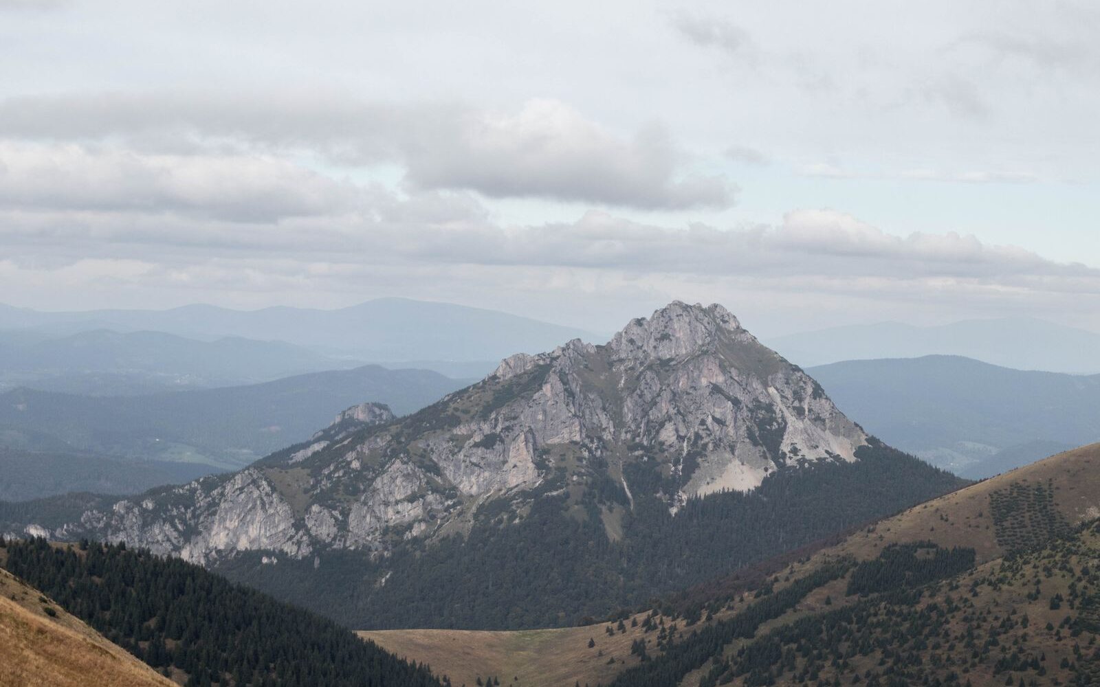
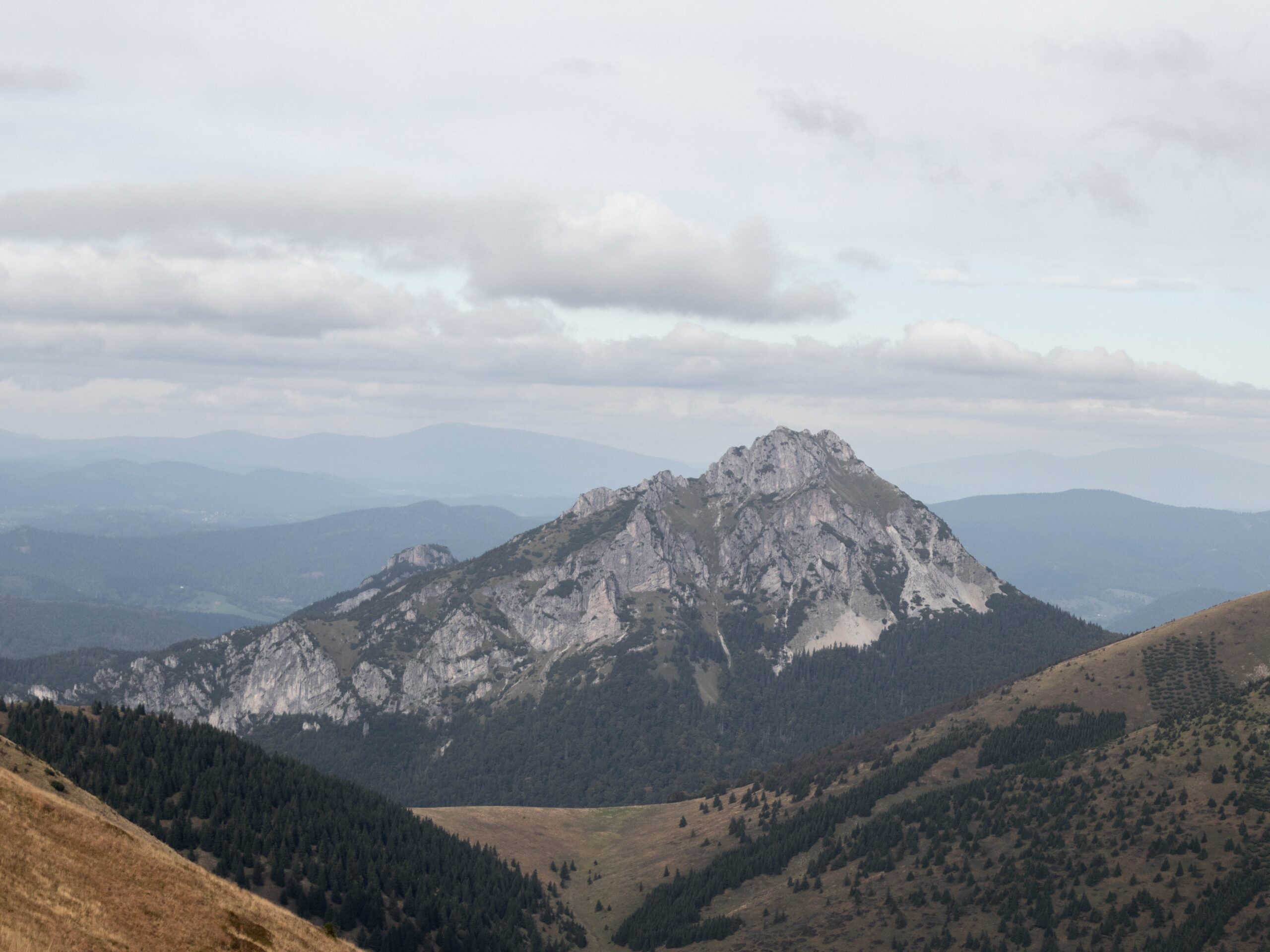
It is the silhouette you will recognise from half the photographs ever taken in the Malá Fatra (the Lesser Fatra): a jagged rock pyramid shouldering its way out of soft grassy ridges, as though somebody had set it down in the wrong mountain range altogether. Veľký Rozsutec (Great Rozsutec) stands at 1,609.7 m, is carved from dolomite, and turns up on the logo of the national park itself. It sits in northern Slovakia, half an hour’s drive from the city of Žilina and within about three hours of Kraków, Katowice or Ostrava. The Veľký Rozsutec hike, though, is emphatically not a Sunday stroll. Whichever side you start from, you are facing roughly 1,000 metres of ascent, loose scree, rock steps and fixed chains. Below you will find every route with real numbers, the one-way sections, the secured passages, and above all the spring trail closure that sends a great many people home disappointed every year.
The Veľký Rozsutec hike at a glance
- Height: 1,609.7 m, in the Krivánska Malá Fatra, northern Slovakia.
- Closed every spring: the red-waymarked trail Medziholie – Veľký Rozsutec – Medzirozsutce is shut from 1 March to 15 June. During those months there is no legal way to the summit from any direction.
- Getting there: nearest airports are Bratislava, Vienna, Kraków, Katowice and Ostrava; Žilina airport has no scheduled flights. Train to Žilina, then a local bus to Terchová.
- Shortest ascent: from Štefanová over the Medziholie saddle, about 5 km and 980 m of ascent, up to 3.5 hours to the top.
- Most popular option: the loop through Jánošíkove diery and the Medzirozsutce saddle, 10 to 13 km, 5.5 to 6.5 hours.
- Difficulty: hard. Loose scree, rock steps, chains below the summit and steel ladders in the gorges.
- Entrance fee: none. You pay only for parking: roughly €3 a day (about £2.50) at Štefanová, and a banded tariff at Hotel Diery running from €5 for three hours to €15 for 24 hours (about £4 to £12.50).
- Not suitable for: children under about ten, dogs, or anyone with no experience of exposed ground.
- Best season: mid-June to October, ideally on dry rock and starting early.
When Veľký Rozsutec is closed: 1 March to 15 June
Start with the thing that ruins more trips here than bad weather does. The Malá Fatra National Park applies an annual spring closure of selected waymarked trails from 1 March to 15 June. The reasoning is straightforward: peace for wildlife while young are being raised, and time for the ground cover to recover after the snow. The awkward part for visitors is that the closure covers precisely the ground everybody comes for.
Three sections are shut:
- Medziholie – Veľký Rozsutec – Medzirozsutce (red waymarks), which is the entire summit section;
- Obšívanka – Malé nocľahy (blue waymarks);
- Vendovka – Malý Kriváň (blue waymarks).
In practice that means one thing: in spring you cannot legally reach the summit of Veľký Rozsutec from any side, because every route funnels onto that same red trail at the end. This catches out foreign visitors in particular — the closure is signposted at the path junctions in Slovak only, and nothing about a warm, dry May morning suggests the mountain might be off limits.
The good news is that the rest of the park stays open, with more than 150 km of waymarked paths. Neither Jánošíkove diery nor Malý Rozsutec is closed, so an April or May trip is not wasted — it just needs a different plan. The extent of the closure can change from year to year, so check the current notice from the park administration (Správa NP Malá Fatra) before you travel.
💡 Tip: If your dates fall inside the closure, walk up to the Medziholie saddle instead. The approach stays open, and the view of the rock pyramid from there is the finest in the whole range. Add the Dolné diery gorge loop and you have a full, memorable day.
Where the Malá Fatra is, and why come at all
The Malá Fatra is a limestone and dolomite range in the north-west of Slovakia, tucked between the city of Žilina and the border with Poland. It is a good deal smaller than the High Tatras and sees a fraction of their traffic, which is precisely the appeal. You get gorges with ladders bolted into the rock, a genuinely alpine-feeling summit ridge and bear country beneath it, all within a compact area you can walk across in two days.
The national park was declared in 1988 and the range splits into two halves. The northern, Krivánska half contains everything in this article — Veľký Rozsutec, the gorges, the Vrátna valley and the highest summit, Veľký Kriváň (1,709 m). The southern Lúčanská half is quieter, gentler and mostly of interest to ridge walkers.
The base for all of it is Terchová, a strung-out mountain village of a few thousand people with a supermarket, a handful of restaurants and a great deal of guesthouse accommodation. It is the birthplace of Juraj Jánošík, the eighteenth-century outlaw who is to Slovakia roughly what Robin Hood is to England, and whose name is attached to the gorges you will be climbing through.
Getting there: airports, trains and whether you need a car
Nothing flies into Žilina. The airport exists but has no scheduled passenger service, so every route in starts somewhere else.
By air. The realistic options, in rough order of usefulness:
- Kraków (KRK) and Katowice (KTW), Poland — roughly 190 to 210 km, about three hours by car. Well served from the UK and the cheapest way in for most British travellers.
- Ostrava (OSR), Czech Republic — the closest airport at around 100 km, but with a thin schedule.
- Vienna (VIE), Austria — about 270 km. The best connected of the lot, and the easiest for long-haul arrivals.
- Bratislava (BTS), Slovakia — around 200 km, and the only one that puts you on a direct train to Žilina without changing countries.
By train. Žilina sits on the main Bratislava–Košice line and is one of the best-connected stations in Slovakia. Fast trains from Bratislava take roughly two and a half hours; from Ostrava it is under two hours; from Vienna, count on about four hours with a change in Bratislava or Břeclav. From Kraków the rail connection is poor and slow, so if you fly into Poland, drive.
By car. Hire cars are available at all the airports above, and the driving is easy — motorway most of the way, then a well-surfaced valley road. Note that Slovakia, the Czech Republic, Austria and Hungary all require a motorway vignette, in most cases bought online before you set off; a hire car may or may not come with one, so ask at the desk. The Slovak vignette is not needed for the final approach through Terchová, but it is for the motorway that gets you there.
Without a car? Yes, it works, with a caveat. Take the train to Žilina, then a regional bus up the valley to Terchová; the journey is around 25 km and takes 40 minutes or so. The stop for the gorges is Terchová, Biely Potok, Hotel Diery, and Štefanová is a short walk uphill from the main road. Buses are frequent enough on summer weekdays but thin out at weekends and in the evening, which is exactly when you will be coming down. Photograph the timetable at the stop when you arrive, and work backwards from the last departure — an eight-hour loop plus a missed bus is a long walk back to Žilina.
💡 Tip: If you are relying on public transport, stay in Terchová or Štefanová itself rather than in Žilina. It removes the bus from both ends of the day, lets you start at first light, and costs less than you would expect outside July and August.
Why Veľký Rozsutec looks nothing like its neighbours
The shape is down to geology. The main ridge of the Krivánska Malá Fatra is built from softer rock, which is why it rolls along in grassy domes. Rozsutec is made of something else entirely: dolomites of the Choč nappe, a slab of hard rock thrust over the softer bedrock from elsewhere. Erosion stripped away the surroundings faster than it could touch the slab, and what was left standing is the peak you see — a sharp summit of rock towers, scree fans and a conspicuous west face some 160 metres high.
The whole mountain lies inside the Rozsutec National Nature Reserve, declared in 1967, covering 842 hectares and carrying the strictest, fifth level of protection under Slovak law. In practice this means exactly one thing for you: stay on the waymarked paths and do not cut corners across the scree. Rangers do check, fines are real, and the scree is loose enough that shortcuts send rocks down onto people below.
The rock cities beneath the summit are among the largest in Slovakia, and cut into them are the Jánošíkove diery (Jánošík’s Holes), a system of narrow gorges fitted with ladders, walkways and chains. The neighbouring Malý Rozsutec (Little Rozsutec, 1,343 m) can easily be added to the day; the two peaks are separated by the Medzirozsutce saddle.
Routes up Veľký Rozsutec
There is no easy way to the top. The routes differ in length and in how much you see along the way, but the final climb to the rock ridge is unavoidable from every direction. All the figures are in the comparison table below.
1. From Štefanová via the Medziholie saddle
The most direct line. A green-waymarked path leads from Štefanová through forest to the Medziholie saddle (1,185 m), reached in about an hour and a half. From there the red trail covers the final 1.5 km or so with around 450 metres of ascent to the summit; allow 2 to 2.5 hours to come back down the same way.
The approach to the saddle is technically undemanding. Above Medziholie the character changes sharply: fine, mobile scree takes over, followed by a short section protected with chains. On dry rock it is steep but straightforward scrambling. Wet, dolomite is as slippery as soap, and this is the single most common reason people turn round.
💡 Tip: If the summit is not essential, walk at least as far as the Medziholie saddle. It offers one of the best views of the entire rock pyramid and is within reach of any reasonably fit family.
2. The Štefanová loop via Jánošíkove diery and Medzirozsutce
The most popular option, because it strings the gorges and the summit into one day. From Štefanová you climb to Vrchpodžiar and through the Horné diery (Upper Gorges) to the Medzirozsutce saddle, then follow the red trail to the summit and descend via Medziholie back to Štefanová. Set aside a full day; the ascent alone, via the Medzirozsutce saddle, takes just under four hours.
3. From Biely Potok through the Dolné diery and Horné diery
The starting point is the car park at Hotel Diery in Biely Potok, a district of Terchová. Blue waymarks lead through the Dolné diery (Lower Gorges) to the Podžiar junction, then the Horné diery continue beneath Tesná Rizňa and Tanečnica to the Medzirozsutce saddle, where the red trail climbs to the summit. The full circuit, returning via Medziholie and Štefanová, comes to around 14.8 km and 7.5 to 8 hours. It is the longest combination on offer, and also the one that contains everything: waterfalls, walkways, ladders and the summit ridge.
4. From Podžiar, if you are already in the gorges
The Podžiar junction is the hub where the Dolné diery, the Nové diery (New Gorges) and the path from Štefanová all meet. If you only make up your mind here, carry on through the Horné diery to the Medzirozsutce saddle and up; that adds roughly 3 to 4 hours. Come back via Medziholie rather than down the ladders.
5. From Zázrivá, on the eastern side
The least crowded flank of the mountain. The routes start in Zázrivá, in the hamlets of Petrová or Biela, and the waymarking combines red and yellow over Príslop nad Bielou to the Medziholie saddle. Useful if you are arriving from the Orava region, or on a day when Štefanová is bursting at the seams.
The routes compared
| Route | Distance | Ascent | Time | Difficulty |
|---|---|---|---|---|
| Štefanová – Medziholie – summit (green + red) | about 5 km up | about 980 m | 3 to 3.5 h up | hard |
| Štefanová via the Medzirozsutce saddle | about 7 km up | about 1,055 m | about 4 h up | hard |
| Biely Potok, Dolné diery and Horné diery | about 7.7 km up | 1,085 to 1,095 m | about 4.5 h up | very hard |
| Zázrivá (Petrová, Biela) via Medziholie | loop of 12 to 15 km | about 800 m | loop of about 5.5 h | hard |
| Loop: Štefanová, gorges, summit, Medziholie | loop of 10 to 13 km | 1,005 to 1,055 m | loop of 5.5 to 6.5 h | very hard |
These are pure walking times taken from the signposts and Slovak hiking portals, without long breaks or photo stops. In the real world, add an hour or two.
One-way sections, and why they exist
Around Rozsutec you will meet something British walkers almost never see: paths with a recommended direction of travel. It is not officiousness, it is logistics. In places the gorges are so narrow that two people wearing rucksacks cannot pass on a walkway, and in season several hundred people come through in a day.
- The section from the Ostrvné junction to the Podžiar junction is recommended as one-way on safety grounds, that is, uphill from Biely Potok. Both the blue trail through the Dolné diery and the yellow through the Nové diery use it.
- The Nové diery are passable only from the bottom upwards.
- The Horné diery are walked one-way uphill and are usually closed in winter.
The practical consequence: plan your loop so that you climb through the gorges and descend via Medziholie. Going the other way means meeting a continuous stream of people on ladders where nobody can step aside.
Chains, ladders and secured sections
Rozsutec is not a via ferrata. You need no harness and no lanyard set. There are still places where you will stow the poles and use your hands.
The most exposed passages between the Medziholie saddle and the summit are protected with steel chains. These are short rock steps where you pull up over a metre or two of steep rock. Above them comes a rocky ridge, airy in places but with an obvious path. You use the same chains on the descent, which is slower than you expect because of the loose scree underfoot.
Take the route through Jánošíkove diery and you add long iron ladders, foot pegs and walkways above the stream, with chains in places. The steelwork has been progressively replaced since 2009 and is maintained, but it is still slippery after rain and iced up in a frost. Those ladders are also precisely why you should not bring a dog: vertical rungs are impassable for an animal, and there is no way round.
💡 Tip: Pack a pair of thin gloves. Chains and steel rungs are unpleasant in the cold and slippery when wet, and gloves make an enormous difference to your grip. Put your poles away on the secured sections — a pole dangling from your wrist is a genuine hazard on a ladder.
Who this hike suits, and who should leave it
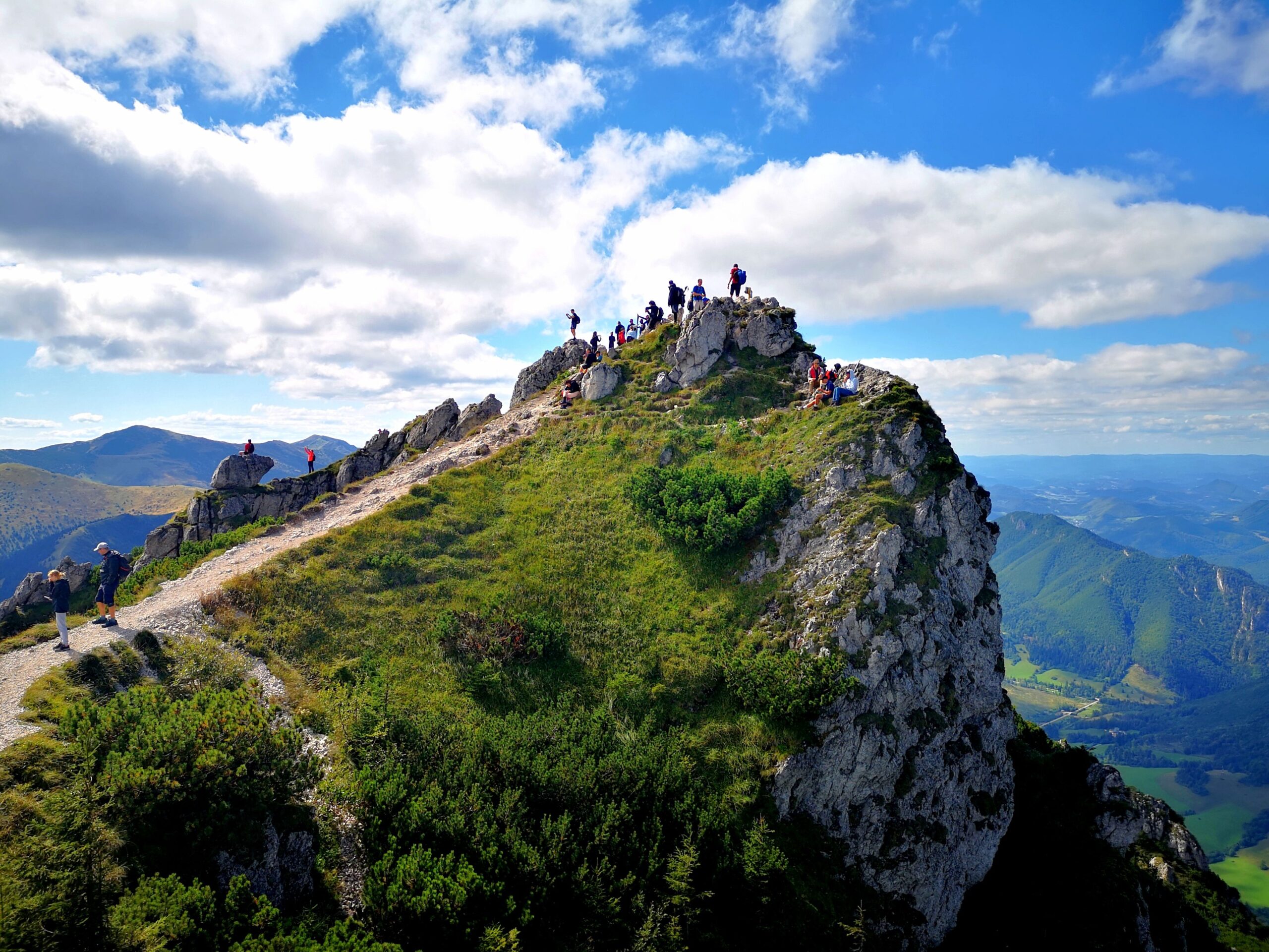
You will be fine if you routinely walk six hours in the mountains, are comfortable on ground where you use your hands, and are untroubled by a few tens of metres of open air beside the path. A background of hill walking in Snowdonia or the Lakes gets you part of the way; the closest British comparison for the summit section is a scramble such as Striding Edge or Crib Goch, only longer and on looser rock. This is nearer to alpine walking than to a day on the fells.
Leave it for another time if:
- You have children with you. The climb is unsuitable for children up to about ten. The problem is not stamina, it is the scree and the chains. Families are far better served by the Dolné diery or the walk to the Medziholie saddle.
- You have a dog. The vertical ladders in the Horné diery are impassable for dogs, full stop.
- It is raining, or has been. Wet dolomite and wet steel are the commonest cause of accidents in this area.
- You have a serious fear of heights. The rock ridge below the summit is short, but it is airy.
If you are unsure, pick something calmer from the range’s many easier walks and keep Rozsutec for the next trip. The mountain is not going anywhere.
The view from the summit
The top is a small grassy platform ringed by rock, so the view runs in every direction. Closest is Malý Rozsutec, and behind it the main ridge with Stoh and Veľký Kriváň (1,709 m). To the north-east the Orava region and the Oravská Magura open up, and in clear conditions you can see across to both the High and the Western Tatras. To the south lie the Low Tatras and the Chočské vrchy. This view is exactly why the summit is crowded at weekends, and why the small platform can feel a good deal smaller than it looks in photographs.
When to go, and when it is busiest
The window runs from mid-June to the end of October. Earlier is impossible because of the closure; later, ice forms on the rock. The most settled weather and the clearest air tend to come in September and the first half of October, when the crowds have thinned as well. The heaviest traffic is on weekends in July and August, when the car parks fill before nine in the morning and queues form on the ladders in the Horné diery.
Weather in the Malá Fatra changes fast, and the range makes its own. Summer afternoons bring convective storms with real regularity, and a rock ridge at 1,600 m is the last place you want to be standing when one arrives.
💡 Tip: Set off by seven in the morning at the latest. You get a parking space, empty ladders, and a decent chance of being off the summit before the afternoon storms build. In summer they tend to form over the Malá Fatra around two o’clock, with impressive punctuality.
Parking and where to start
There is no entrance fee, either for Jánošíkove diery or for the reserve. You pay only to leave the car:
- Štefanová: a paid village car park, roughly €3 per day (about £2.50) per car, with space for around 80 vehicles. Private plots nearby are often a euro cheaper.
- Biely Potok, at Hotel Diery: charged in bands. The first 90 minutes are free, then 3 hours costs €5 (about £4), 6 hours €8 (about £6.50), 12 hours €10 (about £8.50) and 24 hours €15 (about £12.50). This is the starting point for the Dolné diery. The bus stop is called Terchová, Biely Potok, Hotel Diery.
Note what the banding means for a summit day: any loop from here runs well past six hours, so budget for the 12-hour band rather than the cheap one. If both car parks are full, park at Tiesňavy or higher up in the Vrátna valley and walk in, allowing an extra twenty to forty minutes. Prices change from season to season, and payment is usually by cash or card at a machine — carry some coins as a fallback.
The most comfortable approach is to arrive the day before and sleep in Terchová or Štefanová. Beds range from simple mountain guesthouses to a few sizeable hotels, and you can compare what is available through the accommodation search for Terchová →.
Veľký Rozsutec in winter
The summit is legally accessible from 16 June to the end of February, so a winter ascent is possible roughly from December through to the end of February. Do not attempt it without crampons and an ice axe. The scree above Medziholie ices over and the chains disappear under snow. The route through the Horné diery is out of the question — the ladders become sheathed in ice — so the standard winter option runs from Štefanová via Medziholie and back the same way. Add at least an hour and a half to the summer times, and remember how little daylight you have: in December it is dark by four.
What to pack
- Sturdy boots above the ankle, with plenty of tread left on the sole.
- Thin gloves for the chains and ladders.
- At least 1.5 to 2 litres of water per person; there is no drinking water on the route above the gorges.
- A windproof and an extra layer — the summit is noticeably colder than the valley.
- A charged phone with an offline map; signal is patchy in the gorges.
- Poles for the descent, stowed away on the secured sections.
- A first-aid kit, plus the number for Slovak mountain rescue, 18 300. The European emergency number 112 works throughout Slovakia as well.
- Cash in euros. Slovakia uses the euro, and the car park machines and smaller mountain huts are not always card-friendly.
Mistakes to avoid
- Coming in spring. From 1 March to 15 June the summit section is shut. By a wide margin the most common mistake, and the one that catches out overseas visitors most often.
- Underestimating the time. With lunch, photographs and a queue at the ladders, the loop easily runs to eight hours.
- Walking the loop against the recommended direction. Climb through the gorges, descend via Medziholie.
- Setting out after rain. Wet dolomite and wet steel are the biggest single risk on the route.
- Arriving at ten in the morning. The car park is full and the storm will find you on the ridge.
The Malá Fatra is also bear country — brown bears live throughout the range — so do not walk with headphones in both ears. Make a bit of noise on wooded sections, keep food sealed in your rucksack, and give any animal you see a very wide berth.
Where to go next
If you are building a longer trip around this one, the obvious companions are the Jánošíkove diery gorge loops, which can be walked on their own in half a day and are the best wet-weather option in the area; Malý Rozsutec, a considerably gentler summit reached from the same saddle; and the full Malá Fatra ridge traverse, a two-day high-level walk over Veľký Kriváň. For a day off your feet, the Súľov Rocks near Žilina offer a compact rock city with a castle ruin, and the accommodation clustered around Terchová makes a comfortable base for all of it.
Veľký Rozsutec FAQ
How high is Veľký Rozsutec?
Veľký Rozsutec stands at 1,609.7 m above sea level, or 1,609.78 m precisely after a GNSS re-survey in 2017. It is often rounded to 1,610 m. It is not the highest peak in the Malá Fatra, however — that is Veľký Kriváň at 1,709 m.
When is Veľký Rozsutec closed?
The red-waymarked trail Medziholie – Veľký Rozsutec – Medzirozsutce is closed every year from 1 March to 15 June, to give wildlife peace while young are being raised. The sections Obšívanka – Malé nocľahy and Vendovka – Malý Kriváň are shut over the same period. Jánošíkove diery and Malý Rozsutec stay open.
How hard is the Veľký Rozsutec hike?
It is a hard, full-day walk. Whichever way you start, you face roughly 1,000 metres of ascent, loose scree, rock steps and secured sections with chains. Slovak hiking portals rate it as demanding to very demanding and recommend good fitness plus previous experience of exposed ground. No via ferrata equipment is needed.
How long does it take to climb Veľký Rozsutec?
By the shortest route from Štefanová over the Medziholie saddle, about 3 to 3.5 hours up and 2 to 2.5 hours down. The loop through Jánošíkove diery and the Medzirozsutce saddle takes 5.5 to 6.5 hours, and the longer version from Biely Potok can run to 7.5 or 8 hours.
Are there chains on Veľký Rozsutec?
Yes. The exposed passages between the Medziholie saddle and the summit are protected with steel chains that help you over short rock steps. If you go through Jánošíkove diery you also meet long iron ladders, foot pegs and walkways above the stream. Thin gloves make all of it considerably easier.
Can you reach Veľký Rozsutec without a car?
Yes. Take a train to Žilina on the main Bratislava–Košice line, then a regional bus about 25 km up the valley to Terchová; the stop for the gorges is Terchová, Biely Potok, Hotel Diery. Buses thin out at weekends and in the evening, so check the last departure before you set off, or stay overnight in Terchová.
Is there an entrance fee for Veľký Rozsutec and Jánošíkove diery?
No fee is charged for either. You pay only for parking: roughly €3 per day at Štefanová, and a banded tariff at Hotel Diery in Biely Potok where the first 90 minutes are free, 3 hours costs €5, 6 hours €8, 12 hours €10 and 24 hours €15.
Why are the trails around Rozsutec one-way?
Because of how narrow the gorges are and how many people use them. The section from the Ostrvné junction to the Podžiar junction is recommended as one-way, the Nové diery are passable only uphill, and the Horné diery are climbed rather than descended. Plan your loop so that you go up through the gorges and come down via Medziholie.
Read next
Potřebujete pomoct s cestováním?
-
Ubytování 🏨
Vyberte si to nejlepší ubytování, ať už jste kdekoliv, přes Booking.com. -
Půjčení auta 🚗
Auto si snadno najdete přes Booking.com, kde máte často slevu díky ubytování, nebo Rentalcars.com, kde porovnáte nabídky většiny půjčoven. -
Zážitky 🎟️
Přes GetYourGuide.com si vyberete z nejrůznějších výletů i zážitků po celém světě, navíc se zrušením zdarma do 24 h předem.