Last updated 23.10.2026
Slovenia is a small country with an outsized mountain range. You can see snow-covered summits from Ljubljana, and two hours later you are standing under walls that look like they were cut out of the Dolomites. When people talk about the highest mountains in Slovenia, most of them can name exactly one: Triglav, the three-headed peak from the flag and the coat of arms. Behind it, though, stands a whole line-up of 2,000-metre summits worth knowing — whether you want to climb them or just look at them from a lakeshore.
What makes Slovenia unusually easy to reach is the geography: Ljubljana Airport is 35 km from Lake Bled, Venice is a three-hour drive and Munich just under four. In this guide you get an accurate, verified list of Slovenia’s highest peaks with elevations, ranges and difficulty. We cover the Julian Alps, the Kamnik–Savinja Alps and the Karavanke, add Snežnik as the highest summit outside the Alps, and — most importantly — tell you which peaks an ordinary hiker can reach and which ones need a via ferrata set, a helmet and a healthy dose of respect.
Highest mountains in Slovenia in short
- Highest mountain: Triglav (2,864 m), the highest peak of the Julian Alps and of Slovenia as a whole.
- Three main ranges: the Julian Alps (highest and best known), the Kamnik–Savinja Alps and the Karavanke along the Austrian border.
- Outside the Alps: the highest non-Alpine summit is Snežnik (1,796 m) in the south, the top of Slovenia’s Dinaric karst.
- No ropes needed: Vogel (cable car to 1,535 m), the Kanin plateau (cable car from Bovec to 2,202 m), Stol in the Karavanke and Snežnik.
- Triglav: usually 2 days with a night in a mountain hut, secured via ferrata sections, 6–9 hours of ascent depending on the route.
- Best season: mid-July to mid-September, when the high huts are open and the snow has cleared from the ridges.
- Base: Bled, Bohinj or Kranjska Gora for the Julian Alps; Bovec for Kanin, Jezersko or Kamnik for the Kamnik–Savinja Alps.
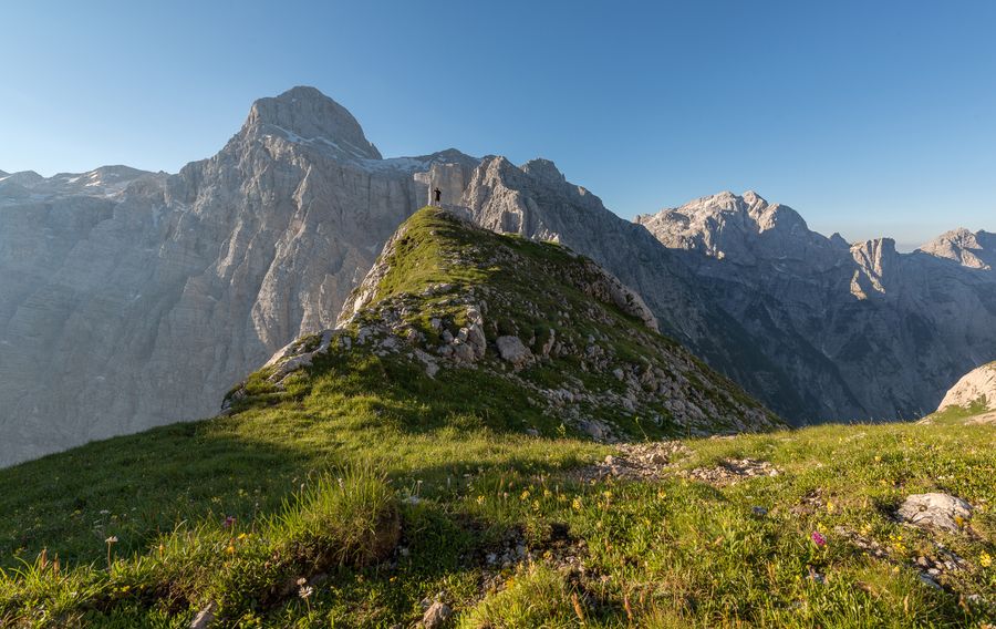
Slovenia’s Alps and Triglav National Park
Slovenia’s mountains are the eastern tip of the Alps and split into three main ranges. The Julian Alps in the north-west are the highest and busiest: this is where Triglav sits, along with the vast majority of Slovenian two-thousanders. Further east come the Kamnik–Savinja Alps with their raw limestone summits around Grintovec, and along the Austrian border run the Karavanke, topped by Stol. A completely different world is Snežnik in the south, Slovenia’s highest peak outside the Alps.
At the heart of it all lies Triglav National Park, Slovenia’s only national park and one of the oldest protected areas in Europe — conservation here dates back to 1924. It covers almost the entire Slovenian side of the Julian Alps: over 800 km² of glacial valleys, emerald rivers and mountain lakes. Most of the summits on our list are inside it, as are Lake Bohinj and the Vintgar Gorge.
One thing worth knowing in advance: this is limestone country, which means it is dry. There is effectively no water on the ridges, so you either carry it up or buy it at a hut. In exchange, the network of mountain huts (koča, dom) is dense and well run, with hot food, a summit stamp and beds that must be booked ahead in season.
💡 Tip: For the Julian Alps, base yourself in Bled, Bohinj or Kranjska Gora — all trailheads are within easy reach. Find a place to stay in Bled →
The 16 highest mountains in Slovenia
The list below is based on official elevations (the Slovenian surveying authority and the hribi.net portal) and is ordered by height. Most of the highest summits are in the Julian Alps, a few in the Kamnik–Savinja Alps; Stol represents the highest mountain of the Karavanke, and at the very end we add Snežnik as Slovenia’s highest peak outside the Alps. For each mountain you get elevation, range and rough difficulty.
| # | Mountain | Elevation | Range |
|---|---|---|---|
| 1 | Triglav | 2,864 m | Julian Alps |
| 2 | Škrlatica | 2,740 m | Julian Alps |
| 3 | Mangart | 2,679 m | Julian Alps |
| 4 | Jalovec | 2,645 m | Julian Alps |
| 5 | Razor | 2,601 m | Julian Alps |
| 6 | Kanin (Visoki Kanin) | 2,587 m | Julian Alps |
| 7 | Kanjavec | 2,569 m | Julian Alps |
| 8 | Grintovec | 2,558 m | Kamnik–Savinja Alps |
| 9 | Prisojnik (Prisank) | 2,547 m | Julian Alps |
| 10 | Kočna | 2,540 m | Kamnik–Savinja Alps |
| 11 | Skuta | 2,532 m | Kamnik–Savinja Alps |
| 12 | Špik | 2,472 m | Julian Alps |
| 13 | Krn | 2,244 m | Julian Alps |
| 14 | Stol | 2,236 m | Karavanke |
| 15 | Storžič | 2,132 m | Kamnik–Savinja Alps |
| 16 | Snežnik (Veliki Snežnik) | 1,796 m | Snežnik (outside the Alps) |
1. Triglav (2,864 m) — Julian Alps
Slovenia’s highest mountain and national symbol number one. The three-headed limestone summit appears on the flag and in the coat of arms, and Slovenes will tell you that you only become a true Slovene once you have climbed Triglav. A note on the number: a 1985 survey gave 2,864.09 m, while a more precise geodetic measurement in 2016 put the summit at 2,863.65 m — which is why you will see 2,864 in some sources and 2,863 in others. It is not an error, just thirty-odd centimetres of better technology. With a prominence of 2,052 m it is one of the most independent peaks in the entire Alps. Difficulty: high — mountain fitness, a via ferrata set and a head for exposure required.
2. Škrlatica (2,740 m) — Julian Alps
Slovenia’s second highest mountain and the dominant peak of the Martuljek group above Kranjska Gora. A rocky summit reached only by secured alpine routes. Trailhead: usually the Vrata valley and Aljažev dom, climbing through high mountain huts. Difficulty: high — a serious alpine ascent, but far less crowded than Triglav.
3. Mangart (2,679 m) — Julian Alps
Third highest and one of the most photogenic mountains in the country, right on the Italian border. Its fame comes mainly from the Mangart Saddle road, the highest road in Slovenia — twelve kilometres of hairpins end at 2,055 m just below the 2,072 m Mangart Saddle, and the view is yours without any climbing. Note: since a rockslide the road is drivable only as far as kilometre nine, above that it is on foot (details below). A secured route continues to the summit itself. Difficulty: summit high, saddle viewpoint easy.
4. Jalovec (2,645 m) — Julian Alps
An elegant pyramid many Slovenes consider the most beautiful mountain in the country — the silhouette of Jalovec was even used as the logo of the Slovenian alpine association. Trailhead: most often the Tamar valley above Planica (Dom v Tamarju). Difficulty: high — exposed and technically demanding, for experienced mountaineers.
5. Razor (2,601 m) — Julian Alps
A massive rock peak that frames the Vrata valley together with Triglav. Trailhead: usually Pogačnikov dom na Kriških podih (from the Vršič pass or the Krnica valley), from where the summit is about two hours away. Popular with experienced hikers looking for an alpine day without the Triglav queues. Difficulty: high — secured sections, best for those comfortable with exposure.
6. Kanin / Visoki Kanin (2,587 m) — Julian Alps
Slovenia’s westernmost two-thousander, on the Italian border above the Soča valley and the town of Bovec. This sprawling karst massif rises far above its surroundings and is best known for the cable car from Bovec, which serves the highest ski area in the country. The top station (station D) stands at 2,202 m, and from there a marked alpine path leads to the summit: 3.65 km, 385 m of ascent and roughly 2 hours 30 minutes. Difficulty: summit high (zelo zahtevna pot), the plateau from the cable car easy.
7. Kanjavec (2,569 m) — Julian Alps
A mountain above the plateau of the Triglav Lakes, often combined into a loop with neighbouring Triglav. Trailhead: typically from Lake Bohinj via the Komarča wall and the Valley of the Seven Lakes, or from Pokljuka. The summit offers one of the finest panoramas over the whole Julian Alps. Difficulty: moderately high — a long day, demanding mainly through distance and elevation gain.
8. Grintovec (2,558 m) — Kamnik–Savinja Alps
The highest mountain of the Kamnik–Savinja Alps and their undisputed king, with harsh limestone faces and classic status among Slovenian hillwalkers. Trailhead: technically the easiest ascent starts in the Kamniška Bistrica valley (Dom v Kamniški Bistrici); approaches from Jezersko and Kokra are harder. Fourteen routes lead to the top and the shortest take 4 to 6 hours. Difficulty: high — secured sections and a long climb.
9. Prisojnik / Prisank (2,547 m) — Julian Alps
A striking peak above the Vršič pass, famous for the huge natural rock window known as Prisojnikovo okno, one of the largest in the Alps. A secured via ferrata (Kopiščarjeva pot) runs straight through it and is a draw in its own right. Trailhead: usually the Vršič pass above Kranjska Gora. Difficulty: high — secured and exposed sections.
10. Kočna (2,540 m) — Kamnik–Savinja Alps
Grintovec’s neighbour, often listed as Jezerska Kočna. A massive rock summit above the Jezersko valley. Trailhead: most often Češka koča above Jezersko; the Grintovec–Kočna ridge traverse in one long day, descending the north face, is a local favourite. Difficulty: high — exposed, secured sections.
11. Skuta (2,532 m) — Kamnik–Savinja Alps
The third of the great Kamnik–Savinja summits. Below its top lies one of the lowest-lying (and last remaining) glaciers in the Eastern Alps. Trailhead: usually from Kamniška Bistrica over Kamniško sedlo and the Kamniška koča hut, or from Češka koča above Jezersko. Difficulty: high — genuine alpine terrain.
12. Špik (2,472 m) — Julian Alps
An iconic rock pyramid above Kranjska Gora and the Vrata valley, one of the most photographed mountains in the Slovenian Alps. The sharp summit is visible straight from the road and attracts climbers and ambitious hikers alike. Trailhead: usually the Koča v Krnici hut or the Vrata valley. Difficulty: high — secured, exposed summit climb.
13. Krn (2,244 m) — Julian Alps
The highest mountain of the south-western Julian Alps, rising above the Soča valley. Unlike most peaks around it, Krn is reached mainly by a marked hiking trail with no via ferrata, so it is within range of fit walkers. The area is deeply tied to the First World War and the Isonzo Front — Italians called the mountain Monte Nero, and its slopes still hold trenches and an open-air museum. Difficulty: moderate — long but straightforward.
14. Stol (2,236 m) — Karavanke
The highest mountain of the Karavanke, the long ridge along the Austrian border, and one of the most popular summits with Slovenes themselves. The view across the valley to the entire Julian Alps is superb. It is among the most accessible high peaks in the country: from the Valvasorjev dom hut the Žirovniška pot reaches the top in 3 hours and is graded lahka pot, an easy marked trail. Just below the summit stands Prešernova koča (2,174 m), one of the highest huts in Slovenia. Difficulty: moderate — no climbing gear needed for a fit hiker.
15. Storžič (2,132 m) — Kamnik–Savinja Alps
A beautifully shaped cone above Kranj, hugely popular with locals year-round. It stands at the western edge of the Kamnik–Savinja Alps, directly opposite the Karavanke, and offers a full circle panorama of the Julian Alps and Triglav. Trailhead: usually the Dom pod Storžičem hut (Bašelj saddle) or the hamlet of Sveti Jošt. Difficulty: moderate — steep but marked, for fit hikers.
16. Snežnik / Veliki Snežnik (1,796 m) — outside the Alps
An outlier on this list, but it belongs here: Snežnik is Slovenia’s highest summit outside the Alps and the high point of the Dinaric karst in the south of the country. The vast forested plateau is home to brown bears and lynx, and a comfortable marked trail leads to the bare limestone top: from Sviščaki (1,242 m) it is 5.4 km, 554 m of ascent and 2 hours 10 minutes. There is a hut on the summit serving hot food in season. A great shoulder-season and family option. Difficulty: low to moderate — no climbing gear.
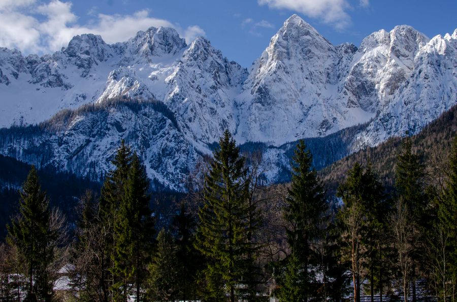
Triglav — climbing the roof of Slovenia
For many visitors, climbing Triglav is the whole reason for the trip. It is no Sunday stroll, though: the summit is reached via secured ferrata sections with steel cables and pegs, and total ascent is measured in thousands of metres. We recommend splitting it across two days with a night in a mountain hut.
The most common approaches start in the Vrata valley (Tominškova pot beneath the legendary north face, about 6 hours 10 minutes to the top), on Pokljuka (about 6 hours) and in the Krma valley via Kredarica (about 6 hours 15 minutes). The longest classic sets off from Lake Bohinj through the Valley of the Seven Lakes and takes almost 9 hours. All of them are graded zelo zahtevna označena pot in the Slovenian system — a very demanding secured marked trail.
High on the ridge you sleep at huts such as Triglavski dom na Kredarici (2,515 m, the highest hut in Slovenia) or Dom Planika. Book your bunk in advance during the season — capacity is limited and weekends fill up.
💡 Tip: If you have no experience with via ferrata and exposure, hire a local mountain guide — besides the safety, it takes a lot of decision-making off your shoulders. Guided ascents and experiences are listed on GetYourGuide →
What you need: a via ferrata set (harness, energy absorber, two lanyards with carabiners), a helmet, sturdy boots, layered clothing and a hut reservation. Alpine weather changes fast — start early and watch the thunderstorm forecast.
Peaks you can reach as an ordinary hiker (Vogel, Kanin, Stol, Mangart Saddle)
Not everyone wants to hang off a steel cable above a drop, and Slovenia’s mountains are wonderful without that too. Here is where you get without any climbing gear:
- Vogel (1,922 m) above Lake Bohinj: the cable car takes you to 1,535 m, and the summit itself is another hour and a half across the meadows. Even from the top station you get one of the finest views of Triglav in the country, and the meadow paths are easy with children.
- Kanin (2,587 m) above Bovec is served by a cable car all the way to 2,202 m, where a high karst plateau opens up with views as far as the Adriatic on a clear day. The plateau needs no climbing; the summit does.
- Stol (2,236 m), the highest peak of the Karavanke, on an easy marked trail — three hours from Valvasorjev dom. A fit hiker manages it without a rope and is rewarded with the whole Julian Alps skyline.
- Snežnik (1,796 m) in the south is a relaxed marked walk across a forested plateau, under two and a half hours. An excellent shoulder-season and family choice.
- Mangart Saddle (2,072 m): Slovenia’s highest road takes you by car to 1,880 m, and the last 40 minutes or so to the saddle are on foot. High alpine scenery without a single step onto a wall.
Add the classics that involve no summit at all: Lake Bohinj, the Vintgar Gorge, the Ojstrica viewpoint above Bled or the shepherds’ plateau of Velika planina in the Kamnik–Savinja Alps.
💡 The Mangart road in 2026: after a rockslide it is drivable only as far as kilometre nine, where the car park sits at 1,880 m (90 spaces; a display at the Mlinč viaduct and the promet.si site show availability in real time). From there it is roughly 40 minutes on foot to the saddle on a marked mountain trail — the closed stretch of road itself is off limits to walkers and cyclists too. The toll is €10 per vehicle, free for cyclists and walkers; vehicles over 2.2 m high are not allowed, and the hut at the saddle is shut for renovation. Go early in the morning — clouds build in the afternoon and the car park fills. One more thing for Vogel: the cable car is out of service from 21 September 2026 until roughly the end of November for major maintenance.
Slovenian trail marking and difficulty grades
Slovenian waymarking works differently from most of Europe and surprises nearly everyone on a first visit.
- There is only one marker: a red dot inside a white circle, the so-called Knafelc mark. There is no colour coding, so the marker itself tells you nothing about whether you are on a main route or a side path.
- Signposts give time, not distance. In broken alpine terrain kilometres say nothing useful about how hard a section will be.
- Lahka pot, an easy path, runs through lower ranges and valleys. Any reasonably fit walker manages it without gear — Stol and Snežnik are both graded this way.
- Zahtevna pot, a demanding path, already has exposed spots and occasionally simple cables.
- Zelo zahtevna pot, a very demanding path, requires a via ferrata set and experience. Most Triglav routes fall into this category, as does the summit path from the Kanin cable car.
The practical takeaway: plan from the times on the signpost and add a buffer. Slovenian estimates assume the pace of an experienced hill walker without long breaks.
Where to base yourself and how to get there
- Trenta is a village in the very heart of Triglav National Park and the best starting point for demanding high routes, Triglav included. The road reaches it over the Vršič pass, and the source of the Soča is close by.
- Logarska dolina in the Kamnik–Savinja Alps is the quieter alternative — a glacial valley walled in on three sides with the Rinka waterfall at the end. Evening light on those walls is among the best sights in Slovenia. There is an entry fee for driving into the valley.
Getting there is easy. Ljubljana Airport is 35 km from Bled (half an hour), Venice is 280 km (three hours), Munich 360 km and Vienna 375 km. Trieste to Bovec is only 133 km. If you drive, Slovenia uses an e-vignette and Austria a separate one, with an extra toll for the Karavanke tunnel. The Vršič pass (1,611 m) is the highest pass road crossing a Slovenian range and is normally open from May to October — the Mangart road reaches higher, but it is a dead-end spur.
Where to next
- Highest mountains in Slovakia (2026)
- Highest mountains in Croatia (2026)
- Highest mountains in Poland (2026)
Frequently asked questions: highest mountains in Slovenia
What is the highest mountain in Slovenia? The highest mountain in Slovenia is Triglav at 2,864 m (2,863.65 m according to the more precise 2016 survey). It lies in the Julian Alps inside Triglav National Park and is a national symbol, appearing on both the flag and the coat of arms.
What is the second highest mountain in Slovenia? Škrlatica at 2,740 m, in the Martuljek group above Kranjska Gora. Third is Mangart (2,679 m), fourth Jalovec (2,645 m) and fifth Razor (2,601 m).
How many 2,000-metre peaks does Slovenia have? Slovenia has dozens of summits above 2,000 m, the vast majority of them in the Julian Alps. After Triglav the highest are Škrlatica (2,740 m), Mangart (2,679 m), Jalovec (2,645 m), Razor (2,601 m) and Kanin (2,587 m).
Which mountain ranges are in Slovenia? Three main high ranges: the Julian Alps (highest, with Triglav), the Kamnik–Savinja Alps (with Grintovec) and the Karavanke along the Austrian border (topped by Stol). The highest summit outside the Alps is Snežnik (1,796 m) in the south.
Is climbing Triglav difficult? Yes. It is a demanding alpine ascent with secured via ferrata sections, graded zelo zahtevna pot in the Slovenian system. Depending on the route it takes 6 to 9 hours to the top, so split it over two days with a hut night, bring a via ferrata set and a helmet, and hire a guide if you lack experience.
Which Slovenian mountains can I climb without technical gear? Without a rope or via ferrata set you can do Stol in the Karavanke (3 hours from Valvasorjev dom), Snežnik in the south (2 hours 10 minutes from Sviščaki), the meadows around the Vogel cable car top station, the Kanin plateau and the viewpoint at Mangart Saddle.
What is the highest road in Slovenia and does it cost anything? The Mangart Saddle road, reaching 2,072 m. The toll is €10 per vehicle and free for cyclists and walkers. In 2026, after a rockslide, it is drivable only to kilometre nine, from where the saddle is about 40 minutes on foot. The highest pass road that actually crosses a range is Vršič at 1,611 m.
When is the best time to hike in the Slovenian mountains? For the higher summits, mid-July to mid-September, when the mountain huts are open and the snow has cleared from the ridges. Outside that window you need winter equipment and experience at altitude.
Where should I stay for hiking in the Julian Alps? Bled, Bohinj and Kranjska Gora are the best bases, closest to the trailheads for Triglav, Mangart and Škrlatica. For the Kamnik–Savinja Alps use Jezersko or Kamnik, and for the western Julian Alps and Kanin, the town of Bovec. Ljubljana Airport is only 35 km from Bled.
Potřebujete pomoct s cestováním?
-
Ubytování 🏨
Vyberte si to nejlepší ubytování, ať už jste kdekoliv, přes Booking.com. -
Půjčení auta 🚗
Auto si snadno najdete přes Booking.com, kde máte často slevu díky ubytování, nebo Rentalcars.com, kde porovnáte nabídky většiny půjčoven. -
Zážitky 🎟️
Přes GetYourGuide.com si vyberete z nejrůznějších výletů i zážitků po celém světě, navíc se zrušením zdarma do 24 h předem.