Last updated 2.9.2026
The first time you stand in Tatranská Lomnica and tip your head back, it lands properly: the highest mountains in Slovakia are not hills, they are a genuine alpine range. Granite peaks rise above 2,600 metres, glacial tarns sit in the hollows between them, and in July there can still be snow up top. The High Tatras win people over on the first visit. They are the smallest high mountains in the world, and one of the cheapest alpine ranges in Europe to reach.
The highest mountains in Slovakia at a glance
- Highest mountain: Gerlachovský štít, 2,655 m, the highest peak in Slovakia and in the entire Carpathians.
- Guide required: Gerlach, Lomnický štít, Ľadový, Pyšný, Vysoká and most summits above 2,500 m.
- Walkable on a marked trail: Rysy (2,503 m), Kriváň (2,495 m), Slavkovský štít, Bystrá (2,248 m), Ďumbier, Chopok, Kráľova hoľa (1,946 m).
- Main ranges: High Tatras (the highest peaks), Western Tatras (Bystrá) and Low Tatras (Ďumbier, Chopok).
- Best season: mid-July to mid-September, when the ridges are clear of snow.
- Where to base yourself: the High Tatras resorts, Štrbské Pleso, Starý Smokovec, Tatranská Lomnica.
The 17 highest mountains in Slovakia
The facts first. The overwhelming majority of Slovakia’s highest summits sit in the High Tatras, where dozens of peaks above 2,500 metres are crammed into a small area. Next come the Western Tatras with Bystrá (the highest mountain in Slovakia outside the High Tatras) and the Low Tatras with Ďumbier and Chopok. A word on the numbers: elevations vary by a metre or two between sources depending on the survey year, and we use the values on current maps. Above all, height does not mean access. You cannot reach most of the highest ones on your own.
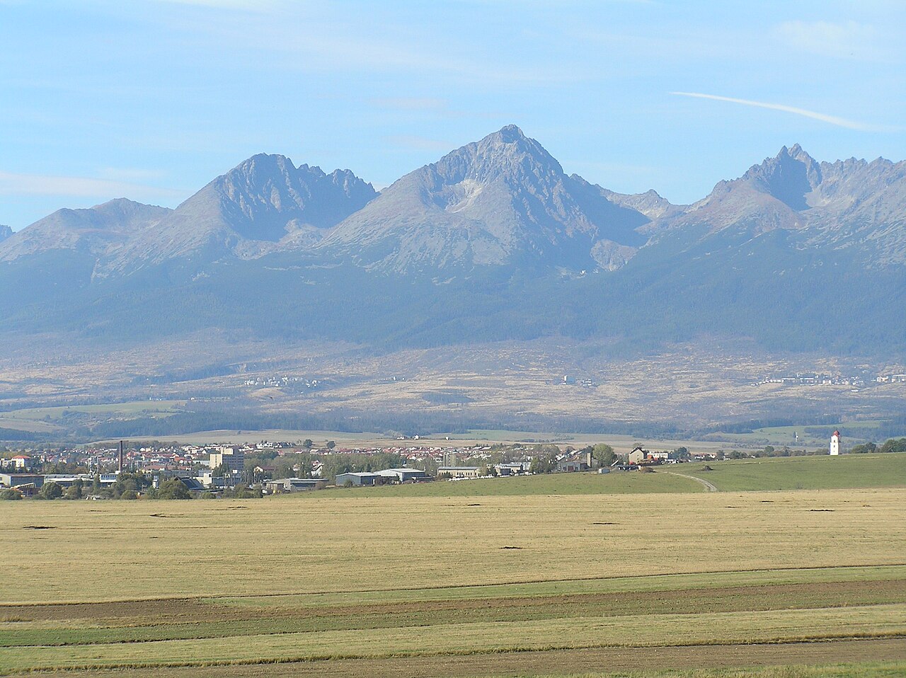
1. Gerlachovský štít, 2,655 m (High Tatras)
The highest mountain in Slovakia and the highest peak in the whole Carpathian range. A curiosity: Lomnický štít was long believed to be the highest, until Ľudovít Greiner measured in 1837 that Gerlach was taller. The summit is accessible only with a mountain guide — this is exposed granite scrambling, not a waymarked path.
2. Gerlachovská veža, 2,642 m (High Tatras)
A subsidiary summit of the Gerlach massif, separated from the main peak by only a few dozen metres of ridge. It is the highest independently named tower in the Tatras, which is why you essentially only reach it as part of the Gerlach ascent, with a guide.
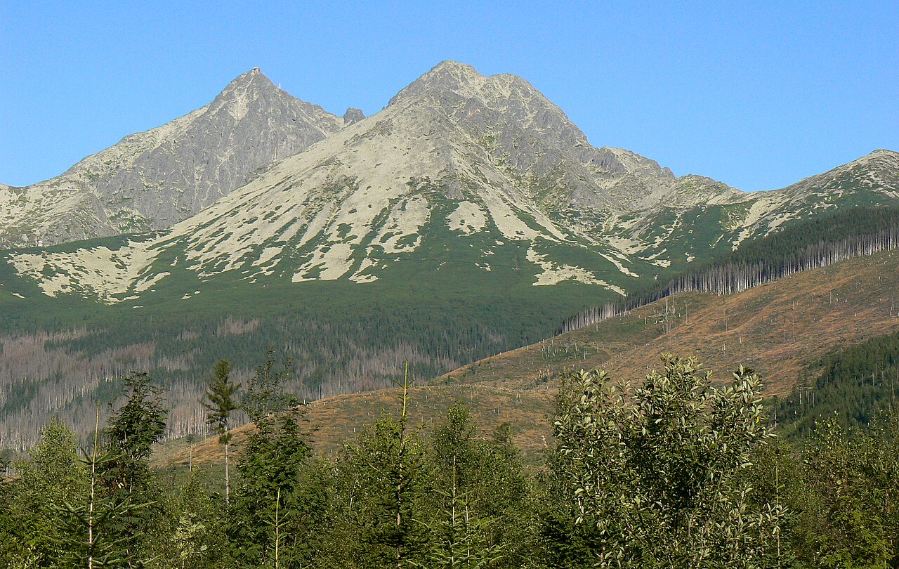
3. Lomnický štít, 2,634 m (High Tatras)
Probably the most famous Tatra peak and the only one in the top tier you can reach without climbing, by cable car from Tatranská Lomnica. There is a viewing terrace and an observatory at the top. Walking to the summit, however, still means hiring a guide.
4. Ľadový štít, 2,627 m (High Tatras)
The third highest peak in the Tatras and the highest point on the main ridge, which gives it one of the widest 360-degree views in the range, taking in the entire Tatra panorama. The ascent from Hrebienok is long and the views are superb, but only with a mountain guide.
5. Pyšný štít, 2,623 m (High Tatras)
The bulkiest rise on the ridge between Baranie rohy and Lomnický štít, wedged between the Malá Studená valley and the Medná basin. Edmund Téry, the founder of Hungarian mountaineering, managed the first ascent only on his second attempt, with the guide Martin Spitzkopf; today it ranks among the technically hardest and is climbed with a guide only.
6. Zadný Gerlach, 2,606 m (High Tatras)
The third summit of the Gerlach massif, sadly known for a 1944 plane crash. No marked trail, guide only.
7. Kežmarský štít, 2,556 m (High Tatras)
It juts out of the north-eastern arm of Lomnický štít and dominates the view from Kežmarok. Its roughly 550-metre south face is one of the most sought-after and most difficult climbing walls in the Tatras. The summit is off limits without a guide.
8. Vysoká, 2,547 m (High Tatras)
A symmetrical twin summit nicknamed “the queen of the High Tatras” for its elegance, and one of the most photographed peaks anywhere in the range. From the top you get a panorama of Rysy, Gerlach and Kôprovský štít. Technically demanding, strictly with a mountain guide.
9. Končistá, 2,538 m (High Tatras)
A massive multi-summit peak on the spur running out of Popradský Ľadový štít, its slopes dropping into the Batizovská and Štôlska valleys. The highest point is a loose boulder known as Jármay’s table. It is one of the easier peaks to climb, yet still guide only.
10. Baranie rohy, 2,526 m (High Tatras)
A twin summit shaped like a ram’s horns, set in the ridge between Ľadový štít and Jahňací štít. It counts among the most easily reached unmarked peaks above 2,500 m, with a first ascent documented as early as 1876, and yet the summit is still guide only.
11. Rysy, 2,503 m (High Tatras)
And finally a summit you can reach on your own along a marked trail — the highest hikeable point in Slovakia. It sits exactly on the Polish border, so you get two countries underfoot; its northern summit (2,499 m) is also the highest point in Poland. A hard but unforgettable full-day hike (see below).
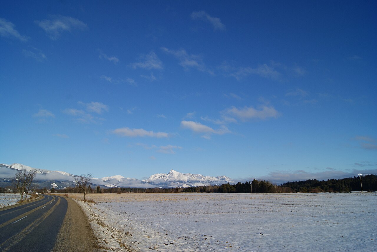
12. Kriváň, 2,495 m (High Tatras)
Slovakia’s national symbol, with its distinctively hooked summit that appears on coins and on the coat of arms. Reachable on a marked trail and the second classic for independent hikers.
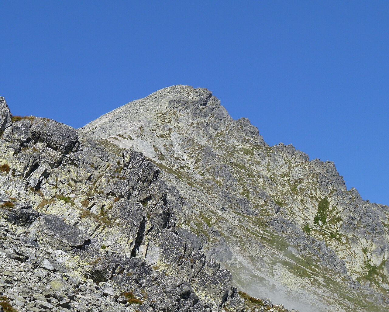
13. Slavkovský štít, 2,452 m (High Tatras)
A rarity among the big peaks: a marked trail runs all the way up from Starý Smokovec. A long but technically easy ascent with a superb view along the entire main ridge.
14. Bystrá, 2,248 m (Western Tatras)
The highest mountain in the Western Tatras and in all of Slovakia outside the High Tatras. It rises at the head of the Bystrá valley above Pribylina and is reachable on a marked trail, though it makes for a long full-day climb. In clear weather you can see the High Tatras, the Low Tatras, both Fatra ranges and the Orava Beskids from the top.
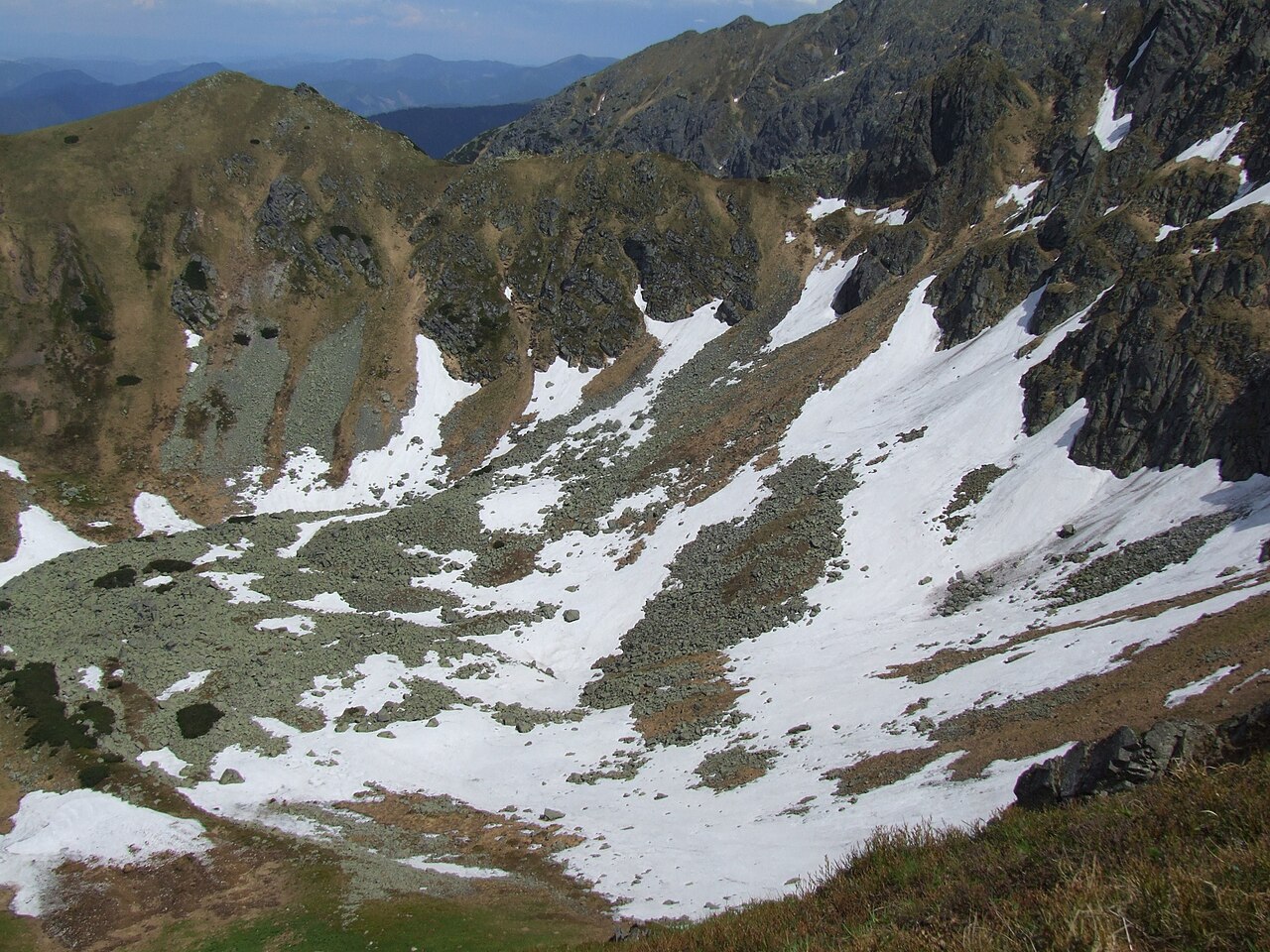
15. Ďumbier, 2,046 m (Low Tatras)
The highest mountain in the Low Tatras. Reachable on a marked ridge trail, a rocky summit with a full panorama. An excellent choice when you want the high-mountain feeling without the Tatra crowds.
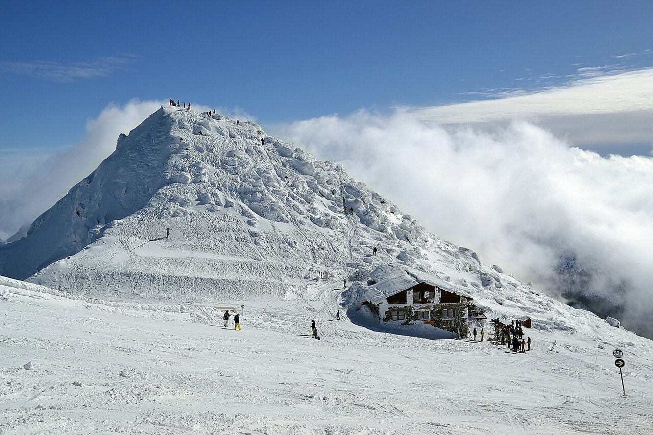
16. Chopok, 2,024 m (Low Tatras)
The second best known summit in the Low Tatras and easy to reach, because a cable car takes you up from Jasná. From here a comfortable ridge walk leads across towards Ďumbier.
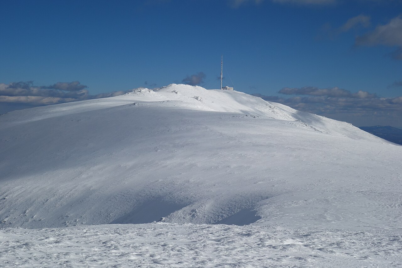
17. Kráľova hoľa, 1,946 m (Low Tatras)
A legendary rounded summit at the eastern end of the Low Tatras, wrapped in Slovak folklore and folk songs. Reachable on a marked trail, with a television transmitter on top. It is a serious climb from the valley, but the trail will get you there.
💡 Tip: If Gerlach or Lomnický štít is on your list, be aware that you may only enter the summit zone above the marked trail in the company of a certified mountain guide (roughly €200 to €350 per day for a small group). This is not red tape: the terrain is genuinely serious, and the guide brings the rope and the belays.
The highest peaks of Slovakia’s other ranges
Slovakia is not only the Tatras. Beyond the alpine summits, every range has its own high point, and many of them make a beautiful full-day hike on a marked trail, with no climbing and no guide. Here are three peaks that rank among the most popular “crowns” outside the High and Low Tatras.
Babia hora, 1,725 m (Orava Beskids)
The highest mountain in the Orava Beskids and one of the highest points along the entire Beskid arc. It sits right on the Polish border, where Poles call it “the queen of the Beskids”. The summit is reachable on a marked trail from Oravská Polhora; the upper slopes are bare and windy, and the reward is a view across the whole Tatra range.
Veľký Kriváň, 1,709 m (Malá Fatra)
The highest summit in Malá Fatra. Do not confuse it with the Tatra Kriváň — this one stands above the well-known Vrátna valley. It is reachable on a marked ridge trail, and you can shorten the approach with the cable car from Vrátna up to Snilovské sedlo. The reward is grassy ridges and views across to both the Tatras and Fatra.
Ostredok, 1,592 m (Veľká Fatra)
The highest point of Veľká Fatra, on the main ridge between the Low Tatras and Malá Fatra. It is reachable on a marked ridge trail, in a landscape of rolling meadows and vast beech forests. A quiet alternative for anyone who wants to escape the Tatra crowds.
💡 Tip: Collecting the highest peak of each range is a popular challenge in Slovakia, and there is even a hiking badge for it, “Najvyššie vrcholy slovenských pohorí”. If it appeals to you, start with the accessible classics like Babia hora, Veľký Kriváň or Bystrá.
Which summits a hiker can reach (Rysy, Kriváň, Kráľova hoľa)
This is the most important part, and the one most lists skip. Of the top Tatra tier you can only reach a handful of summits on your own; the rest belong to climbers and mountain guides. Here are the ones where decent fitness, solid boots and respect for the weather are enough:
- Rysy (2,503 m), the highest hikeable point in Slovakia. The classic route starts at Štrbské Pleso and runs via Popradské pleso and the Chata pod Rysmi hut; there are chains near the top, and you should allow 8 to 10 hours and around 1,300 m of ascent. A route also climbs from the Polish side above Morskie Oko. Demanding, but on a marked trail throughout.
- Kriváň (2,495 m), the national symbol. Climbed from Štrbské Pleso or from Tri studničky, long and stony but requiring no technique at all. Roughly 8 to 9 hours there and back.
- Slavkovský štít (2,452 m), the highest “ordinarily accessible” peak, with a marked trail the whole way. Long, but with no cabled sections.
- Bystrá (2,248 m) in the Western Tatras, the highest hikeable mountain outside the High Tatras. A long climb up the Bystrá valley, on a marked trail and with no scrambling.
- Ďumbier (2,046 m) and Chopok (2,024 m) in the Low Tatras, considerably gentler than the High Tatras, and Chopok has a cable car on top of that. An ideal warm-up before the big range.
- Kráľova hoľa (1,946 m), a long but technically easy climb on a marked trail, with wonderful long-distance views and a proper ridge atmosphere.
💡 Tip: The High Tatras have a seasonal closure of high-mountain trails from 1 November to 15 June. Outside that window many marked routes (including the path to Rysy) are officially closed, so do not plan them for spring.
Summits with a cable car: the fastest way up
When you cannot or do not want to climb all day, the High and Low Tatras both have cable cars. They save two to three hours of ascent and open up ridge views to people who would otherwise never see them.
- Predné Solisko (2,093 m). The easiest 2,000-metre summit in the High Tatras. Take the chairlift from Štrbské Pleso to the Chata pod Soliskom hut, then about an hour along the ridge. Views over the Mengusovská valley and across to Rysy.
- Lomnický štít (2,634 m). A cable car from Tatranská Lomnica right up to the summit. Entry is time-limited and booked in advance, and you may only stay at the top for an allotted slot.
- Skalnaté pleso (1,751 m). The intermediate station on the same line, with several ridge routes starting here and an observatory on site.
- Chopok (2,024 m). Cable cars from Jasná on both the northern and southern side. The most accessible 2,000-metre summit in the Low Tatras, with the Kamenná chata hut on top.
Watch out for this: cable cars have regular maintenance shutdowns, usually in spring and autumn, and they do not run in strong wind. Operators publish the shutdown dates in advance, so it is worth checking the day before you travel.
When and how to hike in the High Tatras
The High Tatras are beautiful, but they can turn on you: the weather changes within an hour and storms arrive reliably in the afternoon. A few things worth keeping in mind:
- Best season: mid-July to mid-September, when the ridges are clear of snow and the trails are open. June often still has snow patches in the gullies.
- Set off in the dark: you want to be on the summit by midday. Storms typically come in the afternoon, and lightning on an exposed ridge is lethal.
- Follow the forecast and the avalanche or storm risk level published by Horská záchranná služba, the Slovak mountain rescue service. If storms are forecast, postpone the summit day.
- Kit: sturdy boots with ankle support, layers, a rain shell, plenty of water and food, and a head torch. Even in summer it can be 10 °C and windy up there.
- Mountain huts: book ahead (Chata pod Rysmi, Zbojnícka chata, Téryho chata). They fill up in season, and wild camping is banned inside the TANAP national park.
For a base we recommend one of the resorts below the ridge: Štrbské Pleso, Starý Smokovec or Tatranská Lomnica. From there the trailheads and the cable cars are within reach, and you get the comforts of civilisation in the evening. Find accommodation in the High Tatras here →
💡 Tip: Would rather not sort out routes and belays yourself? Guided ascents and mountain guide services in the High Tatras can be booked in advance through GetYourGuide →, which is particularly useful for Rysy and the higher peaks.
Where to next
Frequently asked questions
What is the highest mountain in Slovakia? The highest mountain in Slovakia is Gerlachovský štít in the High Tatras, at 2,655 m above sea level. It is also the highest peak in the entire Carpathian range. You can only reach the summit in the company of a mountain guide.
How many mountains above 2,500 metres does Slovakia have? The High Tatras hold dozens of summits above 2,500 m. The highest include Gerlachovský štít (2,655 m), Lomnický štít (2,634 m), Ľadový štít (2,627 m), Pyšný štít (2,623 m), Kežmarský štít (2,556 m), Vysoká (2,547 m) and Rysy (2,503 m).
Which of Slovakia’s highest mountains can I climb without a guide? On marked hiking trails you can reach Rysy (2,503 m), Kriváň (2,495 m) and Slavkovský štít (2,452 m) in the High Tatras, Bystrá (2,248 m) in the Western Tatras, and Ďumbier (2,046 m), Chopok (2,024 m) and Kráľova hoľa (1,946 m) in the Low Tatras.
What is the highest mountain in Slovakia outside the High Tatras? Bystrá (2,248 m) in the Western Tatras. It is the highest 2,000-metre summit outside the High Tatras and, unlike most Tatra peaks, it is reachable on a marked trail, although it is a long full-day climb.
Can tourists climb Gerlachovský štít? Not on their own. The summit of Gerlach lies off the marked trail network and entry to the summit zone is permitted only with a certified mountain guide. Climbing it without a guide is both illegal and dangerous.
Which is the highest hikeable mountain in Slovakia? Rysy, at 2,503 m. Marked trails lead up from Popradské pleso (via the Chata pod Rysmi hut) and from the Polish side. Chains help on the final section. It is a demanding full-day hike with more than 1,300 m of ascent.
What are the highest peaks of Slovakia’s other mountain ranges? Outside the High and Low Tatras, popular ones are Bystrá (2,248 m, Western Tatras), Babia hora (1,725 m, Orava Beskids) on the Polish border, Veľký Kriváň (1,709 m, Malá Fatra) and Ostredok (1,592 m, Veľká Fatra). All of them are reachable on marked trails.
What is the difference between the High Tatras and the Low Tatras? The High Tatras are a rocky alpine range holding Slovakia’s highest peaks above 2,600 m, with glacial tarns and a genuinely alpine character. The Low Tatras are lower and more rounded, their highest point Ďumbier reaching 2,046 m, and their ridge trails are far more accessible to hikers.
When is the best time to hike in the High Tatras? From mid-July to mid-September, when the high-mountain trails are clear of snow and open. High-mountain trails are officially closed from 1 November to 15 June because of snow and avalanche risk.
How much does a mountain guide for Gerlachovský štít cost? As a rough guide, expect around €200 to €350 per day for a small group, depending on the number of people and the peak. The guide provides the rope, the belays and safe leading; on the exposed Tatra peaks that is a necessity rather than a luxury.
Is the climb to Rysy dangerous? In good weather and with decent fitness it is a demanding but manageable hike on a marked trail with chains in the upper section. It becomes dangerous in rain, snow or thunderstorms, so set off early in the morning and watch the forecast.
Can you get to Lomnický štít by cable car? Yes. A cable car runs to Lomnický štít (2,634 m) from Tatranská Lomnica, making it the only one of the highest Tatra peaks whose summit you can reach without climbing. Seats in the cabin must be booked in advance.
Potřebujete pomoct s cestováním?
-
Ubytování 🏨
Vyberte si to nejlepší ubytování, ať už jste kdekoliv, přes Booking.com. -
Půjčení auta 🚗
Auto si snadno najdete přes Booking.com, kde máte často slevu díky ubytování, nebo Rentalcars.com, kde porovnáte nabídky většiny půjčoven. -
Zážitky 🎟️
Přes GetYourGuide.com si vyberete z nejrůznějších výletů i zážitků po celém světě, navíc se zrušením zdarma do 24 h předem.