Last updated 23.10.2026
Say “the roof of the Americas” and most people picture the Rockies or Alaska. The real giants stand a few thousand kilometres further south, in the Andes. The highest mountains in South America reach close to seven thousand metres, and among them rises Aconcagua — the highest summit on the planet outside Asia, and the only one of the Seven Summits you can walk up without ever touching a rope, although “walk up” turns out to be doing a lot of work in that sentence.
This guide gives you a verified list of South America’s highest peaks — elevations, countries and what is actually worth knowing about each one. A warning up front: the numbers disagree between sources, sometimes by a hundred metres. That is not sloppiness. It is the gap between old triangulation and modern satellite surveying. Wherever the spread is wide, you get both figures and the reason for the difference.
The highest mountains in South America at a glance
- Highest mountain: Aconcagua (Argentina), 6,961 m (22,838 ft) — the highest summit on Earth outside Asia.
- Highest volcano in the world: Ojos del Salado (Chile/Argentina), 6,893 m — and the highest point in Chile.
- All twelve giants are in the Andes — the longest mountain range on Earth at over 7,000 km.
- The records sit in the south: the highest peaks are in Argentina and Chile, followed by Peru, Bolivia and Ecuador.
- Four of the twelve straddle the Chile–Argentina border, so both countries claim them in their own rankings.
- Reachable without climbing: Aconcagua is the highest non-technical ascent in the world — though only 30–40% of those who try it reach the top.
- Famous is not the same as highest: Fitz Roy, Cerro Torre and Cotopaxi all miss the top twelve and are icons anyway.
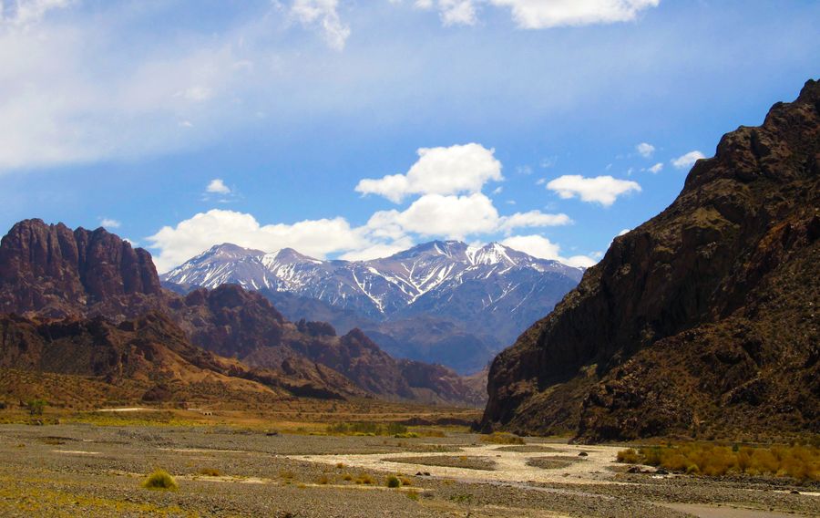
The Andes: the longest mountain range on Earth
Before the ranking, one thing is worth establishing: every one of South America’s highest mountains sits in a single range, the Andes. And the Andes are not an ordinary range. At over 7,000 kilometres, this is the longest continuous mountain chain on the planet, running down the entire western edge of the continent — from Venezuela and Colombia in the north, through Ecuador, Peru and Bolivia, to Chile and Argentina in the south.
They were built where an oceanic plate slides beneath the South American continent, which is why there are so many volcanoes here. The Andes hold around one hundred peaks above 6,000 metres and nearly 900 above 5,000 — a concentration of high mountains you will not find anywhere outside the Himalaya and the Karakoram. The very highest of them stand in the Central and Dry Andes along the Argentina–Chile frontier, where the air is extraordinarily dry and the weather comparatively settled. That, incidentally, is why some of these 6,000-metre peaks are technically friendlier than lower but heavily glaciated mountains in the tropics.
The border explains something that trips up most lists. The Chile–Argentina frontier runs along the main watershed, so a lot of summits are shared between two countries. Chile’s highest mountain, Ojos del Salado, stands exactly on the line, which is why Argentina counts it too. Argentina, however, has a higher champion of its own: Aconcagua lies entirely on Argentine soil, about 15 kilometres from the Chilean border. Four of our twelve are border peaks (Ojos del Salado, Tres Cruces, Llullaillaco and Incahuasi), so the same summits turn up in both national rankings.
💡 Tip: If you are planning a trip to the high Andes, take altitude seriously from day one. Even an “ordinary” city like La Paz in Bolivia sits above 3,600 m — do not underestimate acclimatisation even as a traveller with no summit ambitions at all.
The 12 highest mountains in South America
Here is the full ranking of South America’s twelve highest peaks, with what is worth knowing about each. Elevations follow the standard geographical surveys of the Andes; where measurements diverge significantly, you get both numbers. The rule of thumb: older values come from triangulation and barometric readings, newer ones from satellite GPS — and the difference can run to tens of metres.
1. Aconcagua — 6,961 m (Argentina)
The king of the continent. Aconcagua is the highest mountain not only in South America but in the entire Western and Southern Hemispheres — and the highest summit on Earth outside Asia. It is one of the Seven Summits, the high points of the seven continents. It stands in the Argentine province of Mendoza, about 15 km from the Chilean border, so it is wholly Argentine.
How high, exactly: you will meet three numbers. Argentina’s Military Geographic Institute gives 6,960.8 m, confirmed by a 2012 report; a joint Argentine–Chilean GPS survey in 2001 produced 6,962 m; and everyday usage rounds it to 6,961 m (22,838 ft). The spread comes down to how the summit snow cap was handled and which geoid model the surveyors used.
Accessibility: the Normal (northern) Route is a trek, generally described as the highest non-technical ascent in the world, but this is still a serious near-7,000-metre mountain. Budget two to three weeks including acclimatisation.
First ascent: 14 January 1897 by the Swiss guide Matthias Zurbriggen, during the expedition led by the Briton Edward FitzGerald.
2. Ojos del Salado — 6,879 to 6,893 m (Chile/Argentina)
The second-highest mountain on the continent, the highest volcano in the world and the highest point in Chile. It sits directly on the Chile–Argentina border in the Atacama Desert, one of the driest places on Earth. Its summit crater holds the highest lake in the world, at roughly 6,480–6,500 m. The volcano has no confirmed historical eruption, but fumaroles and steam emissions have been observed repeatedly, so it is classed as dormant rather than extinct.
How high, exactly: the classic figure is 6,893 m, while newer GPS work gives 6,879 m, or in some sources 6,887 m. Fourteen metres of disagreement is a textbook illustration of what happens when barometric heights are replaced by satellite ones.
Accessibility: mostly a trek with a mildly technical finish. From the Chilean side a 4×4 gets you to around 5,200 m and the climb itself is undemanding, but the summit rock tower usually calls for a short roped section — and above all for good acclimatisation.
First ascent: 26 February 1937 by the Polish climbers Justyn Wojsznis and Jan Alfred Szczepański. Most of that expedition’s maps and reports were lost during the Second World War.
3. Monte Pissis — 6,793 m (Argentina)
An extinct volcano on the boundary of the Argentine provinces of La Rioja and Catamarca, named after the French geologist Pedro José Pissis. It stands in an extremely arid part of the Andes, so despite the altitude you will see almost no snow and no glaciers worth the name — it is one of the driest high mountains anywhere.
How high, exactly: this is the most dramatic disagreement on the whole list. An Argentine expedition in 1994, using then-new GPS equipment, measured 6,882 m and announced that Pissis was higher than Ojos del Salado. More careful differential GPS surveys in 2005 and 2007 both overturned that and settled the mountain at 6,792–6,793 m. That is a discrepancy of almost ninety metres — a useful reminder that the phrase “measured by GPS” guarantees nothing on its own.
Accessibility: a technically easy expedition peak — in practice a long endurance slog uphill — but it demands lengthy acclimatisation and complete self-sufficiency in empty terrain.
First ascent: a Polish expedition in 1937 (Stefan Osiecki and Jan Alfred Szczepański). The mountain is so remote that the next documented ascent came almost half a century later.
4. Huascarán — 6,768 m (Peru)
The highest mountain in Peru and the highest summit anywhere in the tropics. It rises in the Cordillera Blanca and is a properly glaciated high peak — the exact opposite of dry Pissis. Because it stands both near the equator and very high, its summit is one of the points on Earth furthest from the planet’s centre, second only to Ecuador’s Chimborazo, and it is the place on Earth with the weakest gravity. It also carries a grim history: during the 1970 Ancash earthquake, roughly 80 million cubic metres of ice, mud and rock broke away from its north face, burying the towns of Yungay and Ranrahirca and killing more than 20,000 people.
Accessibility: a hard technical climb. Glaciers, crevasses and avalanche risk mean crampons, ice axe, rope and real mountaineering experience — categorically not a trekking peak.
First ascent: the main south summit was climbed on 20 July 1932 by a German–Austrian expedition (Erwin Schneider, Hermann Hoerlin, Franz Bernard, Philipp Borchers and Erwin Hein).
5. Cerro Bonete — 6,759 m (Argentina)
Another Argentine 6,000er, in La Rioja province. Strictly speaking this is Bonete Chico, routinely confused with the lower Bonete Grande, which does not even reach 6,000 m — so when you are researching, check which summit your source actually means.
Accessibility: among the technically easiest high mountains on the continent — the ascent is a long endurance walk rather than a climb, and the real challenges are acclimatisation and remoteness.
6. Tres Cruces — 6,758 m (Chile/Argentina)
A multi-summited massif on the Chile–Argentina border, not far from Ojos del Salado. Its highest top, Tres Cruces Sur, misses out on beating Cerro Bonete by a single metre. The region is famous for the raw, almost Martian landscape of the high-altitude desert — and it is one of those frontier massifs that both Chile and Argentina count in their own lists.
Accessibility: an expedition 6,000er, technically undemanding; the limiting factors are extreme remoteness and weather.
First ascent: the main summit was climbed in 1937, again by the Polish Andean expedition.
7. Llullaillaco — 6,739 m (Chile/Argentina)
A border volcano in the Atacama that earned its place in the history of archaeology. In March 1999, three extraordinarily well-preserved mummies of Inca children were found here, sacrificed in the capacocha rite — a seven-year-old boy, a six-year-old girl and a fifteen-year-old known today as La Doncella, the Maiden. Aridity and permanent cold preserved them in a condition with no equal anywhere in the world. The summit platform at 6,715 m is the highest archaeological site on Earth. Some sources give the volcano itself as 6,723 m rather than 6,739 m — once again the older-versus-newer measurement gap.
Accessibility: an expedition ascent of essentially trekking character, with no serious climbing, but a long desert approach and demanding acclimatisation.
First ascent: judging by the shrines found on top, the Inca stood here around 1500; the first modern ascent was made in 1950 by the Chilean climbers Bión González and Juan Harseim.
8. Mercedario — 6,720 m (Argentina)
A massive peak in the Argentine province of San Juan, north of Aconcagua. It sits away from the main trekking routes, which makes it far quieter than its famous neighbour — an appealing target for experienced climbers who want a 6,000er without the crowds.
Accessibility: a long expedition climb, technically straightforward for the most part, but requiring self-sufficiency and several days of acclimatisation.
First ascent: a Polish expedition in 1934 — the same team that pioneered the eastern glacier route on Aconcagua, known ever since as the Polish Glacier (Glaciar de los Polacos).
9. Cazadero (Walther Penck) — 6,670 m (Argentina)
A sprawling complex of volcanoes, lava domes and flows — also known as Cerro Tipas — in the Argentine province of Catamarca, next door to Monte Pissis. It is named after the German geologist Walther Penck, who reached the area in 1913; the first ascent had to wait for a Chilean–Japanese expedition in 1970. A detail for peak-baggers: the massif has so many rock cones of near-identical height that finding the true summit is a matter of trial and error, guided by a summit register stashed among the boulders.
Accessibility: technically easy, physically and logistically exhausting.
10. Incahuasi — 6,638 m (Chile/Argentina)
A border volcano in the Ojos del Salado area whose name means “house of the Inca” in Quechua. The name is no accident: Inca structures and shrines survive near the summit, among the highest archaeological finds in the world. The Inca came up here at the height of their empire, roughly between 1470 and 1530 — not later, since the empire fell in 1533. The landscape around is classic Atacama: dry and all but bare.
Accessibility: a technically undemanding ascent (the north ridge is a long scree plod); the difficulty comes from altitude, wind and route-finding across featureless ground.
11. Sajama — 6,542 m (Bolivia)
The highest mountain in Bolivia and the centrepiece of the national park that shares its name. It is a striking volcanic cone standing alone above the altiplano. On its slopes grows the queñua (Polylepis tarapacana) — gnarled, low trees that at 5,200 metres form the highest treeline on Earth. Older sources give the mountain as 6,572 m; the figure has since settled at 6,542 m.
Accessibility: a technical glacier climb; steep névé and ice call for crampons, ice axe and mountaineering experience, though nothing extreme.
First ascent: August 1939, by Joseph Prem and Wilfrid Kühm.
12. Chimborazo — 6,263 m (Ecuador)
The highest mountain in Ecuador and the holder of one unusual record: because the Earth bulges at the equator, Chimborazo’s summit is the point on Earth’s surface furthest from the centre of the planet — roughly 2.1 kilometres further out than the summit of Everest. It is not the highest mountain measured from sea level, but it is the closest you can get to space if you measure from the Earth’s core.
How high, exactly: older summaries give 6,267 m, and some go as high as 6,310 m. A joint GPS survey by Ecuador’s Military Geographic Institute and France’s IRD in February 2016 produced 6,263.47 m, and that is the figure in force today.
Accessibility: a technical glacier climb with crampons and ice axe, normally with a mountain guide. Among the region’s high peaks it is one of the more approachable ones once you are properly acclimatised.
First ascent: 4 January 1880 by the Englishman Edward Whymper with the Italian guides Jean-Antoine and Louis Carrel — one of the first documented ascents of any mountain above 6,000 metres.
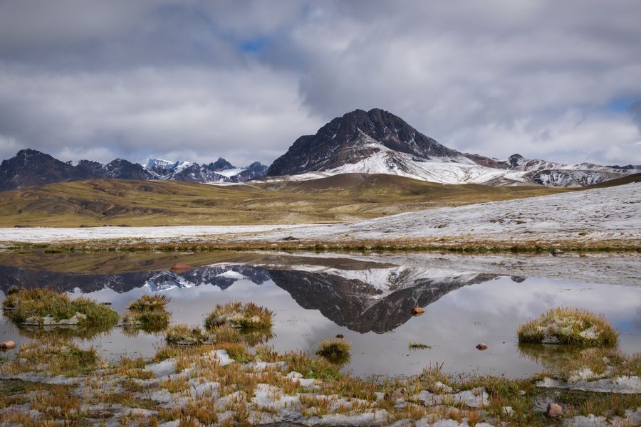
All twelve summits, side by side:
| # | Mountain | Elevation | Country |
|---|---|---|---|
| 1 | Aconcagua | 6,961 m / 22,838 ft (6,960.8–6,962) | Argentina |
| 2 | Ojos del Salado | 6,893 m / 22,615 ft (newer 6,879) | Chile / Argentina |
| 3 | Monte Pissis | 6,793 m / 22,287 ft (older 6,882) | Argentina |
| 4 | Huascarán | 6,768 m / 22,205 ft | Peru |
| 5 | Cerro Bonete | 6,759 m / 22,175 ft | Argentina |
| 6 | Tres Cruces | 6,758 m / 22,172 ft | Chile / Argentina |
| 7 | Llullaillaco | 6,739 m / 22,110 ft (newer 6,723) | Chile / Argentina |
| 8 | Mercedario | 6,720 m / 22,047 ft | Argentina |
| 9 | Cazadero (Walther Penck) | 6,670 m / 21,883 ft | Argentina |
| 10 | Incahuasi | 6,638 m / 21,778 ft | Chile / Argentina |
| 11 | Sajama | 6,542 m / 21,463 ft (older 6,572) | Bolivia |
| 12 | Chimborazo | 6,263 m / 20,549 ft (older 6,267–6,310) | Ecuador |
💡 Tip: If you want to tick off the highest mountain of several countries in one trip, the neat combination is Peru (Huascarán), Bolivia (Sajama) and Ecuador (Chimborazo) — they sit relatively close together on a route most backpackers travel anyway.
Famous Andean mountains that are not the highest
Ranking by height is one thing; fame is another. Some Andean mountains are known worldwide and would never make the top twelve. They are worth knowing:
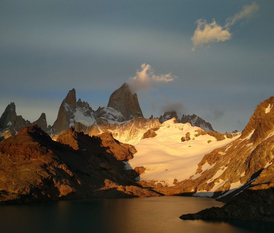
- Fitz Roy (3,405 m, Argentina/Chile) — the icon of Patagonia and the emblem of Santa Cruz province. Its granite towers above the village of El Chaltén rank among the hardest technical climbs in the world. For most visitors, though, it is above all an unreasonably photogenic skyline — and a silhouette you may recognise from a certain outdoor brand’s logo.
- Cerro Torre (3,128 m, Argentina/Chile) — Fitz Roy’s neighbour and one of the most intimidating walls on Earth. A slender spire, often plastered in rime ice, that nobody dared climb in clean style for decades. A myth among alpinists, a jaw-dropping view from a distance for everyone else.
- Cotopaxi (5,897 m, Ecuador) — one of the highest active volcanoes in the world and a visually perfect glacier-capped cone south of Quito. Not among the highest, but a favourite for anyone after their first “almost 6,000er”.
- Alpamayo (5,947 m, Peru) — the symmetrical ice pyramid of the Cordillera Blanca, voted “the most beautiful mountain in the world” in a 1966 poll run by the German magazine Alpinismus. The climb up its steep névé flutings is purely technical and avalanche-exposed, and it is still one of the most sought-after objectives for commercial expeditions.
- Yerupajá (6,635 m, Peru) — the second-highest mountain in Peru and the crown of the Cordillera Huayhuash. Its steep, knife-edged walls earned it the nickname “the Andean razor blade”, and it counts among the hardest technical summits in the whole range. It misses our top twelve by literally three metres.
The lesson? When you are planning a trip, do not let the numbers do all the deciding. The Patagonian towers and Cotopaxi will never make an elevation ranking — and they are still among the best the Andes have to offer.
Which of these can you actually climb?
It depends on the mountain — and honestly, most of this ranking is out of reach for an ordinary traveller because of remoteness and logistics. There are two pieces of good news.
The first is Aconcagua. The Normal (northern) Route is regarded as the highest non-technical ascent in the world — no rope, no ice-axe work on a steep face. But be careful with the word “non-technical”: this is still a near-7,000-metre mountain where only 30–40% of those who set out reach the summit, and where cold, wind and altitude sickness do the deciding. The climb usually takes two to three weeks including acclimatisation, starts from Mendoza, and the Plaza de Mulas base camp sits at 4,370 m — reputedly the second-largest base camp in the world after Everest. You need a paid permit from Mendoza province; the price varies sharply by season and is set in US dollars. This is a serious mountaineering undertaking for fit, well-prepared people, not a weekend outing.
The second “traveller-accessible” high peak is Cotopaxi in Ecuador. It is not among the highest, but its glaciated summit just under 5,900 m is within reach of confident hikers with a guide, crampons and an ice axe once they are properly acclimatised. One caveat: Cotopaxi is an active volcano, and after the eruptive episodes of 2015 and 2022–2023 the summit route has been closed repeatedly. Always check the current status before you commit.
💡 Tip: Whichever high peak you are heading for, acclimatisation and a guide are what make it work. Expeditions and local guides for Aconcagua and the surrounding summits are arranged out of Mendoza — browse guided trips and treks around Mendoza on GetYourGuide →
Even if the summit is not the point, the high Andes are superb to travel “from below” — to base camps, into national parks or simply for the views. The usual gateways are Santiago de Chile and Buenos Aires, both served by long-haul flights from Europe and North America; from Santiago it is about 360 km east to Mendoza, the staging town for Aconcagua. Compare flights and fares to Santiago de Chile here →
Where next
Frequently asked questions
What is the highest mountain in South America? The highest mountain in South America is Aconcagua in Argentina, at 6,961 m (22,838 ft), or between 6,960.8 and 6,962 m depending on the survey. It is also the highest summit in the entire Western and Southern Hemispheres and the highest mountain on Earth outside Asia.
Why do sources give different heights for Andean peaks? Because older values come from triangulation and barometric readings while newer ones come from satellite GPS, which different sources then convert using different geoid models. The most extreme case is Monte Pissis: an Argentine expedition measured it at 6,882 m in 1994, while differential GPS surveys in 2005 and 2007 both settled on 6,793 m. Ojos del Salado (6,893 versus 6,879 m) and Chimborazo (6,267 m historically, 6,263 m after the 2016 survey) show the same pattern.
How many mountains over 6,000 metres are there in South America? The Andes contain around one hundred summits above 6,000 metres and nearly 900 above 5,000 metres. The greatest concentration of the highest ones lies along the Argentina–Chile frontier.
What is the highest volcano in the world? Ojos del Salado, on the border between Chile and Argentina — 6,893 m by the classic figure, or 6,879 m by newer GPS measurements. It is also the second-highest mountain in South America, immediately behind Aconcagua.
Are Chile’s highest mountain and Argentina’s highest mountain the same peak? No, though it is an easy mistake to make. Chile’s highest summit is Ojos del Salado, which sits exactly on the border, so Argentina counts it in its own list as well. Argentina, however, has a higher peak of its own: Aconcagua, which lies entirely on Argentine soil about 15 km from the frontier. Four of the continent’s twelve highest mountains are border peaks (Ojos del Salado, Tres Cruces, Llullaillaco and Incahuasi), which is why they appear in both countries’ rankings.
What is the highest mountain in Peru? Huascarán, at 6,768 m, in the Cordillera Blanca. It is the highest summit anywhere in the tropics and also the place on Earth with the weakest gravitational pull.
Why is Chimborazo the furthest point from the centre of the Earth? Because the Earth is not a perfect sphere — it bulges at the equator. Chimborazo stands close to the equator, so its summit is about 2.1 kilometres further from the planet’s centre than the summit of Everest, even though Everest is more than two and a half kilometres higher above sea level.
Can you climb Aconcagua without mountaineering experience? The Normal Route on Aconcagua is the highest non-technical ascent in the world, so it involves no roped climbing. It is still extreme altitude, though — only 30–40% of those who attempt it reach the summit. You need excellent fitness, proper acclimatisation, a paid permit from Mendoza province and ideally a guide; the climb takes two to three weeks.
Are Fitz Roy and Cerro Torre the highest mountains in Patagonia? No. Neither Fitz Roy (3,405 m) nor Cerro Torre (3,128 m) comes anywhere near the highest mountains on the continent — but they are world-famous for their difficulty and their shape, and rank among the hardest technical climbs anywhere.
When is the best time to travel to the high Andes? For the highest peaks in Argentina and Chile the main season is the southern summer, roughly December to February, which is the climbing season on Aconcagua. For Peru, Bolivia and Ecuador the dry season from May to September works better.
What is the most beautiful mountain in South America? Alpamayo (5,947 m) in Peru’s Cordillera Blanca is the usual answer. The German magazine Alpinismus voted it “the most beautiful mountain in the world” in a 1966 poll, on the strength of its perfectly symmetrical ice pyramid. It is nowhere near the highest summits on the continent.
Potřebujete pomoct s cestováním?
-
Ubytování 🏨
Vyberte si to nejlepší ubytování, ať už jste kdekoliv, přes Booking.com. -
Půjčení auta 🚗
Auto si snadno najdete přes Booking.com, kde máte často slevu díky ubytování, nebo Rentalcars.com, kde porovnáte nabídky většiny půjčoven. -
Zážitky 🎟️
Přes GetYourGuide.com si vyberete z nejrůznějších výletů i zážitků po celém světě, navíc se zrušením zdarma do 24 h předem.