Lipno Lake, Czech Republic: 10 Hikes and Bike Rides Around the Lake
Last updated 23.10.2026
Lipno Lake is the largest body of water in the Czech Republic, a forty-kilometre reservoir on the Vltava River tucked into the far southern corner of South Bohemia, right against the Austrian border. Czechs call it “the Czech sea”, and its great advantage for anyone planning a trip is that the same holiday can hold an afternoon stroll with a pushchair on flat tarmac and a full-day climb to the highest peak of the Czech Šumava. Three completely different landscapes stack up around the lake: a flat left bank with a cycle path, a hilly right bank with border ridges, and above it all a national park with its own rules about where you may walk.Lipno sits 210 km from Prague (about 2 hours 35 minutes by car) and just 31 km from Český Krumlov, which is how most international visitors reach it. From the Austrian side it is even closer, Linz is 54 km away and Vienna 237 km. We have put together ten routes and day trips around Lipno Lake, each with distance, elevation gain, the trail markings you follow, where to leave the car and what parking or the ferry costs. Trips with children, with a pushchair, in winter, in the rain and with a dog are covered separately, because each of those versions takes a different line.
Lipno Lake in brief
Easiest start: the cycling and inline skating path from Lipno nad Vltavou to Frymburk, 11.5 km of tarmac completely separated from road traffic.
The long classic: the loop around the whole reservoir by bike, roughly 79 km and 724 m of climbing, mostly on the Šumavská 33 cycle route.
Highest goal: Plechý (1,378 m) with Plešné Lake, climbed from Nová Pec.
Best view for least effort: Vítkův Hrádek (1,035 m), the highest castle in the Czech Republic, only 400 m from the car park at Svatý Tomáš.
With a pushchair: the Lipno to Frymburk cycle path and the Treetop Walkway, which is step-free throughout.
Ferries: Frymburk to Frýdava (adult €1.50, bike €1.20, pushchair €0.60), Horní Planá to Bližší Lhota, Dolní Vltavice to Kyselov.
Mind the rules: inside the quiet zones of Šumava National Park you may walk only on marked trails and cycle only on marked cycle routes.
In winter: around 40 km of groomed cross-country tracks and a skating track on the frozen surface, up to 11 km long.
How to choose a route around Lipno
Lipno behaves differently from what the map suggests. Distances along the shore look short, but the reservoir has no bridge, so getting from one bank to the other means either a ferry or a detour via the dam or via Černá v Pošumaví. So pick your bank first, then your route.
The left bank (Lipno nad Vltavou, Frymburk, Černá v Pošumaví, Horní Planá) is flatter, more densely settled and carries the main cycle path. Look here for family routes, cycling and pushchairs.
The right bank (Přední Výtoň, Svatý Tomáš, Zvonková) is emptier and hillier. This is where the views, the border ridges and the castle of Vítkův Kámen are.
The southern and western part (Nová Pec, Jelení Vrchy, Stožec) already belongs to Šumava National Park. Real mountains start here, and so do stricter rules.
Trail markings and rules worth knowing
The Czech KČT marking system is one of the best in Europe: coloured stripes painted on trees and rocks, with signposts giving times rather than distances. Just expect to meet green and yellow more often than red on the Šumava. Red here is mainly the Šumava Long-Distance Trail, which runs along the ridge from Trojmezná over Plechý and on to Smrčina.One thing plenty of visitors miss: the park’s old division into zones one to four has changed, and movement is now governed not by zones but by quiet areas (klidová území in Czech). They are marked with boards on the ground and one simple rule applies. On foot you may move inside them only on marked hiking trails. Outside quiet areas walkers may go anywhere in the park, including off the marked trails.For cyclists it is stricter and applies everywhere: outside public and local roads you may cycle only in built-up areas and on marked cycle routes. A forest path carrying a blue hiking marker is therefore not open to bikes. Dogs must be kept under control at all times so they do not disturb wildlife. On top of that come seasonal closures for nesting, roughly March to May for black grouse and March to July for peregrine falcons. Current closures are posted on the Šumava National Park administration website, and that is the only place worth checking them.
💡 Tip: If you are planning anything around Nová Pec, Stožec or Plešné Lake, check the Výstrahy a uzavírky (warnings and closures) section on npsumava.cz before you set off. It will save you a pointless drive to a closed barrier.
10 routes and trips around Lipno Lake
Where can you go and what are the best routes around Lipno?
1. Lakeside cycling and skating path: Lipno nad Vltavou to Frymburk
Distance: 11.5 km one way, 24 km there and back · Elevation gain: minimal, only short rises and descents · Time: about 45 minutes one way by bike, 3 hours on foot · Difficulty: the easiest route in the area · Start and finish: Lipno nad Vltavou (or Frymburk in reverse) · Type: out and back, or one way with a return by boat
Landmark
Distance
Lipno nad Vltavou, car park by the Bikepark
0.0 km
Slupečná, turn-off to the beach
approx. 2 km
Kobylnice, mid-route access point
approx. 6 km
Frymburk, square and boat pier
11.5 km
The route: The path is completely separated from road traffic along its whole length and follows the left bank of the lake. You do not need to look for hiking markers here, this is a dedicated tarmac path with its own signage and direction posts. The profile is not entirely flat, rolling rises alternate with short descents, but none of it will stop even a beginner on skates. Getting lost is practically impossible, the only surprise is the Frymburk end, where the path spills into village traffic.Getting there and parking: There are three access points: at Bikepark Lipno, in Frymburk and at Kobylnice roughly halfway. In Lipno nad Vltavou you park in the central paid car park (GPS 48.644036N, 14.220378E), prices change in season, check them on the spot. If you would rather not ride back, take the boat from Frymburk to Lipno, but only some Lipno Line services carry bikes, specifically the green and pink lines.Food and drink: Densest at both ends, in Lipno nad Vltavou and on Frymburk’s square. In between, expect seasonal kiosks by the beaches at best, so carry water.Worth knowing:The eight-kilometre section between Lipno and Frymburk is floodlit, so you can ride it after dark. Frymburk itself deserves a stop, it has one of the prettiest squares in the area and the ferry to the other bank leaves straight from it.You can compare places to stay at either end in Frymburk →.
2. The big loop around Lipno by bike
Distance: about 79 km · Elevation gain: around 724 m of climbing and descent · Time: a full day, 6 to 8 hours with breaks · Difficulty: moderate, technically easy · Start and finish: any village on the loop, most often Lipno nad Vltavou, Frymburk or Horní Planá · Type: loop
Landmark
Distance
Lipno nad Vltavou
0.0 km
Frymburk
approx. 12 km
Černá v Pošumaví
approx. 27 km
Horní Planá
approx. 37 km
Nová Pec
approx. 50 km
Přední Výtoň
approx. 68 km
Lipno nad Vltavou
79 km
The route: The spine of the loop is cycle route Šumavská number 33, which runs along the left bank from Lipno through Frymburk, Černá v Pošumaví and Horní Planá all the way to Nová Pec. Roughly 95 percent of the route is tarmac, the rest forest and field tracks. The return half along the right bank through Zvonková and Přední Výtoň is hillier and emptier, and there you also ride minor roads with very little traffic. Signposting is solid, but at forest junctions watch the route number, because local cycle routes cross here.Getting there and parking: Leave the car in any village on the loop, the biggest car parks are in Lipno nad Vltavou, Frymburk and Horní Planá. The loop can be shortened at any point by ferry across the reservoir, which is its greatest charm. Three usually run: Horní Planá to Bližší Lhota, Dolní Vltavice to Kyselov and Frymburk to Frýdava, plus a seasonal bike shuttle from Hrdoňov to Svatý Tomáš.Food and drink: Densest on the left bank, where you go from village to village. On the right bank between Zvonková and Přední Výtoň expect a long stretch with no services, so top up water in Zvonková.Worth knowing: Past Valtrov there is a reported two-kilometre stretch of broken surface, not ideal on a road bike with narrow tyres. Zvonková with its church of St Anne is one of the places where you can see most clearly what became of the Czech borderlands after 1945, when the German-speaking population was expelled.
💡 Tip: Ride the loop anticlockwise, that is, take the flat left bank towards Horní Planá first. The hilly right-bank section then falls into the second half of the day, when the cycle path is crowded and you will have left the crowds behind.
3. Lipno nad Vltavou: the Treetop Walkway and the Kramolín loop
Distance: 3 to 5 km depending on the version · Elevation gain: about 200 m, avoidable by chairlift · Time: half a day including the walkway · Difficulty: easy, the whole walkway site is step-free · Start and finish: Lipno nad Vltavou · Type: loop
Landmark
Distance
Central car park, Lipno nad Vltavou
0.0 km
Bottom chairlift station
approx. 0.3 km
Treetop Walkway (entrance)
approx. 1.3 km
Walkway and viewing tower
+ 675 m along the walkway
Descent through the forest back to the village
approx. 4 km
The route: There are three ways up from the car park: the chairlift (in the summer season), the Stezkabus shuttle, or on foot, about 1 km on a marked path. The walkway itself is a wooden boardwalk 675 metres long that climbs among the treetops to a viewing tower 40 metres high. You can go down the same way or take the 52-metre dry slide in the middle of the tower. A comfortable forest track leads back to the village and even smaller children manage it.Getting there and parking: Park in the central car park in Lipno nad Vltavou, where the Stezkabus departs. Admission is dynamically priced and changes by day and demand, with online tickets bought in advance the cheapest. Discounts apply to holders of Czech ZTP and ZTP-P disability cards, and with two adult tickets a child pays half price. It is open daily except 24 December, roughly 10:00 to 19:00 in high season and until 17:00 in spring. Ticket sales stop an hour before closing.Food and drink: The Kramec bistro sits right by the walkway, with 260 seats and a terrace with a view. Down in the village the offering is what you would expect of a resort.Worth knowing: The walkway has been running since July 2012 and was the first of its kind in the country. There are eleven adventure elements for children along the route, including an aerial net some twenty-five metres above the ground, and a so-called bird trail with model nests. On Thursdays in summer there are evening concerts here, roughly 19:00 to 21:30.
💡 Tip:Dogs are not allowed on the walkway. The site has a kennel with its own rules, so if you are travelling with a dog, expect to take turns at the walkway or plan your day elsewhere.
4. Vítkův Hrádek from Frymburk by ferry
Distance: about 6 km one way from the ferry, 12 km there and back · Elevation gain: around 296 m uphill · Time: 4 hours including the visit · Difficulty: easy, a gently rising tarmac road through forest · Start: Frymburk, ferry pier · Finish: Vítkův Hrádek (1,035 m) · Type: out and back
Landmark
Distance
Frymburk, ferry
0.0 km
Frýdava, far bank
0.4 km (crossing)
Svatý Tomáš, church and car park
approx. 5.6 km
Vítkův Hrádek, castle tower
approx. 6.0 km
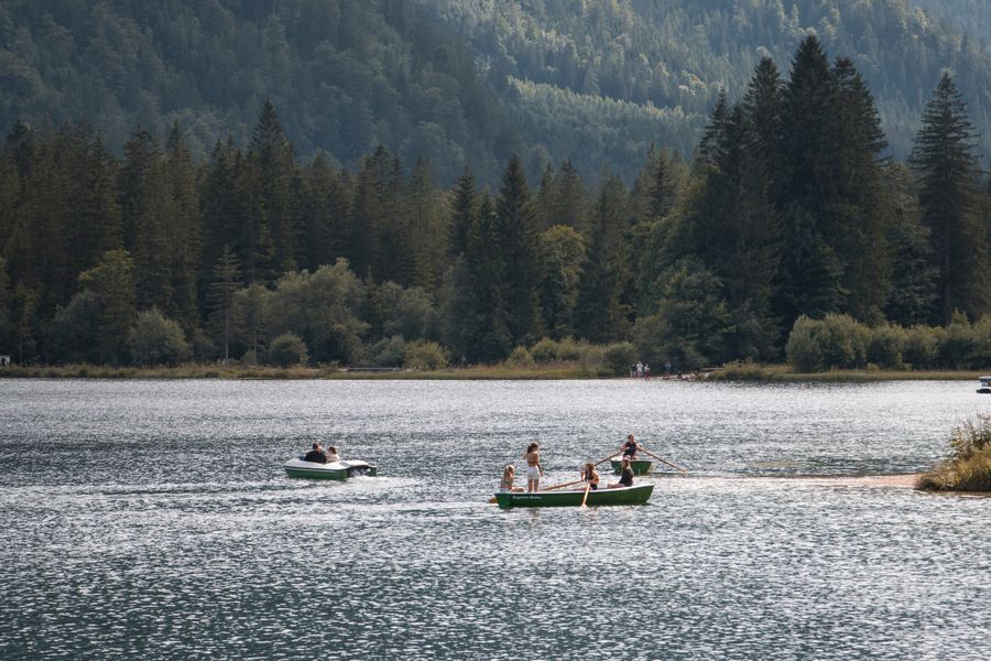
The route: From Frymburk you cross to Frýdava on the ferry, a crossing of just 0.4 km. From there a gently rising tarmac road leads through the forest, walkable and rideable, waymarked as cycle route 1021, or 1033. You reach the hamlet of Svatý Tomáš in about an hour and a half, and from its car park it is only some 400 metres and 42 metres of ascent to the castle. At the top you climb sixty-one steps of a wooden staircase to the viewing platform.Getting there and parking: The Frymburk to Frýdava ferry runs in season, roughly mid-April to the end of October, from 9:00 to 19:00 on the hour. An adult pays €1.50 (35 CZK), a child aged 3 to 10 €0.60 (15 CZK), under-threes travel free, a bike costs €1.20 (30 CZK), a pushchair €0.60 (15 CZK) and a car €3.50 (85 CZK). Dogs travel free. You pay in Czech crowns. If you are driving, you can go round the reservoir straight to Svatý Tomáš, where there is a free car park, open around the clock, with about 25 spaces. A bus comes here twice a day on weekdays.Food and drink: The offering in Svatý Tomáš is seasonal and thin, so rely on your own supplies. A proper meal waits back in Frymburk.Worth knowing: Vítkův Hrádek, properly Vítkův Kámen, is the highest-lying castle in the Czech Republic. The Vítkovci family founded it around 1347, the Rožmberks held it after them and later the Eggenbergs and Schwarzenbergs. After the Second World War it served as a military observation post, a civic association finished the restoration in 2005 and the municipality has looked after it since 2023. A new viewing platform opened in December 2024. Admission is €4 (100 CZK) full and €2 (50 CZK) reduced, children under six and ZTP card holders enter free, and it is usually open daily from around 9:00 to 18:00. In clear weather you can see the Šumava ridges, the Novohradské hory and even the Alps from here.Boating on the lake below forested hills. Illustrative photo: Pexels
5. Čertova stěna and the Devil’s Rapids: Vyšší Brod to Loučovice
Distance: about 6 km one way, 5.5 km along the cycle path · Elevation gain: roughly 150 to 250 m depending on the version · Time: 2.5 to 3 hours · Difficulty: easy to moderate, watch for slippery rock in the boulder field · Start: Vyšší Brod, monastery · Finish: Loučovice · Type: point to point, return by train or bus
Landmark
Distance
Vyšší Brod, monastery
0.0 km
Edge of the Čertova stěna-Luč reserve
approx. 2 km
Viewpoint over the Devil’s Rapids
approx. 3.5 km
Loučovice
approx. 6 km
The route: From Vyšší Brod you head upstream along the Vltava. The easier version follows the cycle path between Vyšší Brod and Loučovice, 5.5 km long, while the prettier one takes hiking markers higher up the slope to the viewpoints above the Devil’s Rapids. Čertova stěna, the Devil’s Wall, is a rocky summit about two kilometres from Vyšší Brod, below which lies a sea of boulders, granite blocks with no soil, covered only in moss and lichen. When wet the granite is exceptionally slippery, so do not scramble on it where you do not have to.Getting there and parking: Leave the car in Vyšší Brod by the monastery and come back from Loučovice on the train that runs this way, or by bus. If you want certainty, walk it out and back, about 12 km.Food and drink: Vyšší Brod and Loučovice both have the usual pubs and shops, in between expect nothing.Worth knowing: The Čertova stěna-Luč national nature reserve covers around 140 hectares, the original Luč reserve was declared as early as 1935 and the reserve took its present form in 1992. The Devil’s Rapids (Čertovy proudy) are a roughly eight-hundred-metre stretch of the Vltava full of boulders weighing several tonnes, today a magnet for white-water paddlers. From the summit of Luč (933 m) you look out over the whole Vltava valley. The Cistercian monastery in Vyšší Brod is also the best fallback when it starts to rain.If you want to make Vyšší Brod your base for a few days, look for accommodation in Vyšší Brod →.
6. Plešné Lake and Plechý from Nová Pec
Distance: roughly 6 to 7 km one way to the lake, 16 to 18 km in total with the climb to Plechý · Elevation gain: about 200 to 300 m to the lake, another 290 m or so to Plechý · Time: around 2 hours to the lake, 6 to 7 hours for the whole trip · Difficulty: moderate, rocky at the end · Start and finish: Nová Pec, Láz car park · Type: out and back, can be made into a loop
Landmark
Distance
Nová Pec, Láz car park
0.0 km
Junction below the lake
approx. 5 km
Plešné Lake (1,090 m)
approx. 6.5 km
Stifter Monument
approx. 7.5 km
Plechý (1,378 m)
approx. 9 km
The route: A green marked trail leads from Nová Pec to the lake, with a cycle route running parallel, so you can ride much of the way and leave the bike at the racks. The path climbs gently through forest, and the final stretch to the lake is rocky and unpleasant on a bike. From the lake a yellow trail continues up past the Stifter Monument to the summit of Plechý. On the ridge you join the red Šumava Long-Distance Trail, which runs on towards Trojmezná in one direction and Smrčina in the other. This is exactly where to watch for quiet areas, where leaving the marked trail is not allowed.Getting there and parking: The usual start is the Nová Pec car park in the Láz district. Nová Pec is also reachable by train, which is handy above all if you want to combine the route with the Bear Trail and return from a different station.Food and drink: Nothing on the route. The last certain water and food are in Nová Pec, there is no mountain hut at the lake or on the summit.Worth knowing:Plešné Lake is glacial, lies at 1,090 metres, covers 7.48 hectares and is up to 18.3 metres deep. Above it rise the cirque wall and a moraine dam 30 to 40 metres high. Set into the rock face is an obelisk 14.5 metres high, built between 1876 and 1877 in honour of the writer Adalbert Stifter, who was born in nearby Horní Planá. Plechý (1,378 m) is the highest peak of both the Czech and the Austrian part of the Šumava. The Trojmezná primeval forest grows on its northern slopes, with trees documented at over 600 years old.
7. The Bear Trail: Ovesná to Černý Kříž
Distance: 14 km · Elevation gain: about 330 m · Time: 5 to 6 hours · Difficulty: moderate to harder, the whole route is unsurfaced · Start: Ovesná railway halt (740 m) · Finish: Černý Kříž railway station · Type: point to point, return by train
Landmark
Distance
Ovesná, railway halt
0.0 km
Rock formations in the upper part of the trail
approx. 4 km
Perníkový vrch (1,049 m)
approx. 7 km
Jelení Vrchy, turn-off to the canal
approx. 9 km
Černý Kříž, railway station
14 km
The route: The trail is marked in yellow and is the oldest nature trail in the Šumava (Medvědí stezka in Czech). From Ovesná it climbs through forest to granite formations with information boards, crosses Perníkový vrch and drops to Jelení Vrchy, then continues to Černý Kříž. The ground is unsurfaced throughout, roots and stones, slippery after rain. A shorter version runs from Jelení to Ovesná and measures about 7 km.Getting there and parking: This is the ideal car-free route. You get on at one railway halt and off at another, both on the line around Lipno. If you do come by car, leave it in Nová Pec and take the train to Ovesná, or the other way round.Food and drink: In summer at Jelení Vrchy and Černý Kříž. Outside the season bring everything with you, this is a thinly populated part of the park.Worth knowing: The trail takes its name from the last bear shot in the Šumava, and its value is above all geological, you pass a whole gallery of granite rock forms. It is open year-round, but in winter it is not groomed.
8. The Schwarzenberg Canal: Jelení Vrchy and the tunnel
Distance: 9 km along the nature trail · Elevation gain: minimal, the canal follows a contour · Time: 3 hours on foot, considerably less by bike · Difficulty: easy · Start: Jelení Vrchy, car park at the lower tunnel portal · Finish: Raškov below Nová Pec · Type: point to point
Landmark
Distance
Jelení Vrchy, car park and lower tunnel portal
0.0 km
Timber rafting museum
approx. 0.3 km
Rosenauer Chapel
approx. 4 km
Raškov below Nová Pec
9 km
The route: The trail runs alongside the canal channel itself, so it is ruler-straight and navigation is trivial. There are four information panels along the way. A cycle route runs here too, and in winter the section is groomed for cross-country skiing, which makes it one of the few routes in the park usable all year. The main attraction, a tunnel roughly 397 metres long, starts right by the car park.Getting there and parking: Jelení Vrchy lies about 8 km from Nová Pec, and the car park is right at the lower tunnel portal. By car this is a dead end, so expect to come back the same road.Food and drink: A seasonal snack bar at Jelení Vrchy, otherwise nothing.Worth knowing:The canal is 52 km long in total, 44 km of it in the Vltava basin, and was built in two phases between 1789 and 1822. It was designed by the engineer Josef Rosenauer (1735 to 1804) and its purpose was to float timber from the Šumava all the way to Vienna. About 15 km has been restored. Since 1997 timber-floating demonstrations have been held here every year, the only chance to see the canal in action. The canal has two museums, in Chvalšiny, where Rosenauer was born, and at Jelení Vrchy itself.
9. The Olšina nature trail
Distance: 7.3 km · Elevation gain: negligible · Time: 2 to 2.5 hours with children · Difficulty: easy · Start and finish: Olšina near Polná na Šumavě · Type: loop around the pond
Landmark
Distance
Car park at the Olšina pond
0.0 km
Boardwalks across the peat bog
approx. 2 km
Viewpoint over the pond
approx. 4 km
Back at the car park
7.3 km
The route: The loop runs around the Olšina pond on wooden boardwalks and paths surfaced with wood chips, with its own trail-specific signage. These are not classic hiking markers, but you cannot get lost, you keep the water on one side the whole way. The surface is soft and turns muddy when wet, so do not come in plimsolls.Getting there and parking: The trail is managed by the Czech Military Forests and Estates and runs through land that was closed to the public for decades because it belonged to the Boletice military training area. Park at the trailhead, with access from Horní Planá and Černá v Pošumaví.Food and drink: Nothing on the route, the nearest facilities are in surrounding villages.Worth knowing: Olšina is one of the largest high-altitude ponds in the country, and the surrounding wetlands and peat bogs host species you will not meet anywhere else around Lipno. That is exactly why leaving the trail is forbidden here, and it is a rule worth respecting.
10. Boubín and the Boubín primeval forest
Distance: 10 to 19.5 km depending on the version · Elevation gain: roughly 400 to 600 m · Time: 4 to 7 hours · Difficulty: moderate · Start and finish: Idina Pila, Zátoň or Kubova Huť · Type: loop
Landmark
Distance
Idina Pila, car park and national park information centre
0.0 km
Boubín tarn
approx. 2 km
Edge of the Boubínský prales reserve
approx. 3 km
Boubín, viewing tower (1,362 m)
approx. 6 km
Back at Idina Pila
approx. 10 km
The route: The most common start is at Idina Pila, which also has a Šumava National Park information centre. From there you walk first to the Boubín tarn and then on a nature trail around the primeval forest up to the summit. Signposting is good, red, yellow and blue cross here, so watch the direction posts, because trails leave Boubín in every direction. The longer version from Kubova Huť measures 19.5 km and is a full-day undertaking.Getting there and parking: Boubín lies outside the immediate Lipno area, and from Lipno nad Vltavou you drive via Horní Planá and Volary. By train you can reach Zátoň halt, which shortens the walk nicely.Food and drink: Seasonal. Count on nothing at the summit or at the tarn, bring your own supplies.Worth knowing:The tower on Boubín is 21 metres high and stands at 1,362 metres, making it the highest viewing tower in the Šumava. The Boubínský prales national nature reserve is among the oldest protected areas in the country, and the trail goes around it rather than through it.
All Lipno routes in one table
Route
Distance
Elevation gain
Difficulty
Who it suits
Cycling and skating path Lipno to Frymburk
11.5 km (24 there and back)
minimal
easy
pushchairs, skates, families
Big loop around Lipno by bike
79 km
724 m
moderate
fit cyclists
Treetop Walkway and Kramolín loop
3 to 5 km
up to 200 m
easy
children, step-free
Vítkův Hrádek from Frymburk by ferry
12 km there and back
296 m
easy
families, cyclists
Čertova stěna, Vyšší Brod to Loučovice
approx. 6 km
150 to 250 m
easy to moderate
half-day trip
Plešné Lake and Plechý from Nová Pec
16 to 18 km
500 m and more
moderate
experienced hikers
Bear Trail, Ovesná to Černý Kříž
14 km
330 m
moderate to hard
car-free, by train
Schwarzenberg Canal from Jelení Vrchy
9 km
minimal
easy
year-round, also skiing
Olšina nature trail
7.3 km
negligible
easy
children, nature
Boubín and the primeval forest
10 to 19.5 km
400 to 600 m
moderate
full-day trip
Lipno with kids and a pushchair: honestly, where it works
Lipno sells itself as a family destination and at heart that is true, but only some routes work with a pushchair. We will save you the disappointment and say it plainly.Passable with a pushchair:
The Lipno nad Vltavou to Frymburk cycle path, all 11.5 km of tarmac with no steps and no cars. The best choice in the whole area.
The Treetop Walkway, because the whole site is step-free and the boardwalk rises gently. You get up by chairlift or Stezkabus.
The Schwarzenberg Canal nature trail from Jelení Vrchy, which is flat and also suitable for wheelchairs.
The promenades and beaches in Frymburk, Černá v Pošumaví and Horní Planá.
Do not attempt with a pushchair:
The Bear Trail. Fourteen kilometres of roots, stones and rock. Not even an all-terrain pushchair gets through.
Plešné Lake and Plechý. The last stretch to the lake is rocky and the climb to the summit is steep.
The boulder field below Čertova stěna. The cycle path between Vyšší Brod and Loučovice yes, the viewpoints on the slope no.
The Olšina nature trail. The boardwalks and wood chips look smooth, but with a pushchair it is hard work and impossible after rain. A carrier is the better option.
💡 Tip: The Frymburk ferry takes a pushchair for €0.60 (15 CZK), so getting from the left bank to the right with one is no problem. Just bear in mind that the climb starts beyond Frýdava, and with a pushchair it makes itself felt.
Lipno in winter: cross-country, skating and what works without snow
Winter Lipno is a different destination from the summer one, and some of the routes described change beyond recognition. Around 40 km of cross-country tracks are groomed for both classic and skating technique, mainly around Lipno nad Vltavou and Frymburk. One of the few routes on our list that is maintained in winter is the section along the Schwarzenberg Canal. There is also a proper ski resort on the slopes of Kramolín, well set up for families and beginners.The strangest winter attraction, though, is the skating track on the frozen surface of the reservoir. It is usually 6 to 8 metres wide and up to 11 kilometres long, linking Frymburk, Přední Výtoň and Lipno nad Vltavou. In an exceptional winter it stretched to 38 km from Lipno nad Vltavou to Perneky, and in 2012 it was billed as the longest groomed skating track in the world. There is one catch: it only forms when the ice is thick enough, so you cannot plan a holiday around it in advance. Track current conditions at ledovamagistrala.cz.The winter rule for walking routes: the higher ground around Plechý and Trojmezná is not groomed in winter, and snow adds the risk of straying off the marked trail, which is a problem inside a quiet area. The safest winter choices are the left-bank cycle path and the canal.
Lipno in the rain: where to go when it pours all day
A rainy day at Lipno does not have to mean sitting in your apartment. Reliable fallbacks:
The Treetop Walkway works in the rain too, it is just slippery and viewless. You can wait out a shower in the Kramec bistro.
The Cistercian monastery in Vyšší Brod, with guided tours and its library.
The Schwarzenberg Canal museums, in Chvalšiny and at Jelení Vrchy.
Adalbert Stifter’s birthplace in Horní Planá, which pairs neatly with a trip to Plešné Lake, where his monument stands.
The aquapark in Lipno nad Vltavou, the classic answer for families with small children.
Český Krumlov, about 31 km away and the best thing in the area on a wet afternoon.
One more practical point about rain: the granite boulders around Čertova stěna and the rocky sections by Plešné Lake are dangerously slippery when wet, so save those two routes for another day.Sunset over the lake. Illustrative photo: Pexels
Lipno with a dog
Most routes around Lipno are fine with a dog, but there are three things you will run into.
Šumava National Park: the dog must be under control at all times so it does not disturb wildlife. In practice that means a lead anywhere you might meet game, which is essentially everywhere. Only assistance dogs are exempt from the ban on moving in a groomed ski track.
The Treetop Walkway: dogs are not allowed on the boardwalk, the site has a kennel.
Ferries and boats: dogs travel free on the Frymburk to Frýdava ferry and are allowed on Lipno Line cruise boats. That makes the ferry the simplest way to cross to the other bank with a dog.
The nicest routes with a dog are the Bear Trail and the canal from Jelení Vrchy, both shaded and with enough water in the streams for most of the year. The cycle path to Frymburk, by contrast, is baking tarmac full of skaters in summer, which no dog will thank you for.
Getting there, ferries, boats and bike hire
Most visitors reach Lipno from Prague, 210 km and about 2 hours 35 minutes by car, usually via České Budějovice (66 km from the lake) and Český Krumlov (31 km). From the Austrian side it is much closer: Linz 54 km, Salzburg 186 km, Vienna 237 km, Munich 294 km, and the Austrian border crossing is inside the Schengen area, so there is no routine control. Linz is the nearest airport, though Prague and Vienna have far better connections and both work well with a hire car. Trains reach Lipno nad Vltavou, Horní Planá and Nová Pec on the local line around the lake, which is slow but scenic.Ferries are the cheapest and quickest way to hop from bank to bank at Lipno. Prices change and you pay in Czech crowns, this is a rough overview:
Ferry
Season
Person
Bike
Car
Frymburk to Frýdava
roughly April to October
€1.50 (35 CZK)
€1.20 (30 CZK)
€3.50 (85 CZK)
Horní Planá to Bližší Lhota
year-round (outside hard winters)
€1 (25 CZK)
€1.50 (35 CZK)
€3.30 (80 CZK)
Dolní Vltavice to Kyselov
roughly May to October
€2.10 (50 CZK)
€1.20 (30 CZK)
€5.40 (130 CZK)
Bike shuttle Hrdoňov to Svatý Tomáš
seasonal, walkers and bikes only
€2.50 (60 CZK)
€0.80 (20 CZK)
does not carry cars
Boat services run under the Lipno Line brand and serve six piers: Lipno nad Vltavou, Přední Výtoň, Frymburk, Dolní Vltavice, Černá v Pošumaví and Horní Planá. Fares depend on how long you sail, roughly €8 (200 CZK) adult and €4.50 (110 CZK) child for a thirty-minute cruise, €18 (440 CZK) and €10 (250 CZK) for a two-hour one, with family tickets working out better. Only some services carry bikes, worth checking in advance so a one-way plan does not fall apart.Bike hire is available in every larger village on the left bank. Indicative day rates are around €12 to €21 (300 to 500 CZK) for a mountain bike, €29 to €45 (700 to 1,100 CZK) for an e-bike and €6 to €12 (150 to 300 CZK) for a child’s bike. Book ahead in high season, e-bikes go first.Parking in Lipno nad Vltavou is centralised in one large paid car park, from which the Stezkabus runs and from which you can walk to the chairlift. In Frymburk, Černá v Pošumaví and Horní Planá you park in the village as normal, for a fee in season. The car park below Vítkův Hrádek in Svatý Tomáš is free.Choose a multi-day base according to what you want to walk. For the cycle path and family outings, accommodation in Lipno nad Vltavou →, for a quieter stay in the middle of the reservoir accommodation in Horní Planá →, and for the national park routes accommodation in Nová Pec →.
What to bring
A paper or offline map. Signal is patchy around Plechý, Stožec and on the Bear Trail.
Water for the whole day. On most of the routes described there is nowhere to refill outside the villages.
A waterproof jacket. The Šumava is wet, with 1,400 to 1,700 mm of rainfall a year quoted for Plechý.
Boots with a proper sole for the Bear Trail, Boubín and the walk to Plešné Lake.
Some cash in Czech crowns for the ferries and seasonal snack bars, cards are not accepted everywhere.
A bike lock if you plan to combine cycling with a walk to a summit.
Frequently asked questions about routes around Lipno
What are the best routes around Lipno for a first visit?
For a first visit, a combination of three things works well: the cycle path from Lipno nad Vltavou to Frymburk (11.5 km on tarmac away from traffic), the Treetop Walkway with its 675-metre boardwalk and 40-metre tower, and the short walk up to Vítkův Hrádek from the car park at Svatý Tomáš, only 400 metres to the highest castle in the Czech Republic.How do I get to Lipno Lake from Prague?
By car it is 210 km and about 2 hours 35 minutes, usually via České Budějovice and Český Krumlov, which is 31 km from the lake. There is also a slow but scenic train line around Lipno serving Lipno nad Vltavou, Horní Planá and Nová Pec. From the Austrian side the lake is much closer, with Linz just 54 km away and Vienna 237 km, so a hire car from either Prague or Vienna works well.Can you cycle around Lipno in one day?
Yes. The loop around the entire reservoir is about 79 km with roughly 724 metres of climbing, follows the Šumavská 33 cycle route for most of the way and is about 95 percent tarmac. A fit cyclist needs six to eight hours with breaks. If you want less, shorten the loop using one of the ferries across the lake.Which routes around Lipno are passable with a pushchair?
Reliably the Lipno nad Vltavou to Frymburk cycle path, the entire Treetop Walkway site (it is step-free) and the nature trail along the Schwarzenberg Canal from Jelení Vrchy. The Bear Trail, the climb to Plešné Lake and the viewpoints above Čertova stěna, by contrast, are unsuitable for a pushchair, and a carrier is the better choice there.What are the rules in Šumava National Park?
The old division into zones one to four has changed, and the key concept today is the quiet area. Inside one, walkers may move only on marked hiking trails, while outside quiet areas they may walk off the trails as well. On a bike, outside roads and built-up areas you may ride only on marked cycle routes. Dogs must be kept under control at all times, and seasonal closures apply during the nesting season.How much does the ferry across Lipno cost?
On the Frymburk to Frýdava ferry an adult pays €1.50 (35 CZK), a child aged 3 to 10 pays €0.60 (15 CZK), a bike is €1.20 (30 CZK), a pushchair €0.60 (15 CZK) and a car €3.50 (85 CZK), while dogs travel free. Horní Planá to Bližší Lhota works out at roughly €1 (25 CZK) per person and €3.30 (80 CZK) per car, and Dolní Vltavice to Kyselov at €2.10 (50 CZK) per person and €5.40 (130 CZK) per car. You pay in Czech crowns and price lists change, so check before you travel.What is there to do at Lipno when it rains?
The Treetop Walkway works in the rain, and you can drive to the Cistercian monastery in Vyšší Brod, the Schwarzenberg Canal museums in Chvalšiny and at Jelení Vrchy, Adalbert Stifter’s birthplace in Horní Planá or the aquapark in Lipno nad Vltavou. Český Krumlov is only about 31 km away as well. In the rain, skip the boulder field below Čertova stěna and the rocky stretch to Plešné Lake, because granite is slippery when wet.What can you do around Lipno in winter?
With good snow, around 40 km of cross-country tracks are groomed around Lipno nad Vltavou and Frymburk, and the section along the Schwarzenberg Canal is maintained too. When the ice is thick enough, a skating track 6 to 8 metres wide and up to 11 km long forms on the surface between Frymburk, Přední Výtoň and Lipno nad Vltavou. There is also a ski resort on the slopes of Kramolín. Check current conditions at ledovamagistrala.cz.Where can I walk a dog around Lipno?
Best on the Bear Trail from Ovesná to Černý Kříž and on the nature trail along the Schwarzenberg Canal, both of which run in shade. Inside the national park a dog must be under control at all times. Dogs are not allowed on the Treetop Walkway boardwalk, where the site has a kennel. The Frymburk ferry carries dogs free and they are permitted on Lipno Line boats.How long is the hike to Plechý and Plešné Lake?
A green marked trail leads from Nová Pec to Plešné Lake, roughly 6 to 7 km one way. The lake sits at 1,090 metres. From there a yellow trail continues past the Stifter Monument to the summit of Plechý (1,378 m), the highest mountain of the Czech Šumava. The whole trip out and back comes to about 16 to 18 km and six to seven hours.
Potřebujete pomoct s cestováním?
Ubytování 🏨
Vyberte si to nejlepší ubytování, ať už jste kdekoliv, přes Booking.com.
Půjčení auta 🚗
Auto si snadno najdete přes Booking.com, kde máte často slevu díky ubytování, nebo Rentalcars.com, kde porovnáte nabídky většiny půjčoven.
Zážitky 🎟️
Přes GetYourGuide.com si vyberete z nejrůznějších výletů i zážitků po celém světě, navíc se zrušením zdarma do 24 h předem.
Abychom poskytli co nejlepší služby, používáme k ukládání a/nebo přístupu k informacím o zařízení, technologie jako jsou soubory cookies. Souhlas s těmito technologiemi nám umožní zpracovávat údaje, jako je chování při procházení nebo jedinečná ID na tomto webu. Nesouhlas nebo odvolání souhlasu může nepříznivě ovlivnit určité vlastnosti a funkce.
Funkční
Always active
Technické uložení nebo přístup je nezbytně nutný pro legitimní účel umožnění použití konkrétní služby, kterou si odběratel nebo uživatel výslovně vyžádal, nebo pouze za účelem provedení přenosu sdělení prostřednictvím sítě elektronických komunikací.
Předvolby
Technické uložení nebo přístup je nezbytný pro legitimní účel ukládání preferencí, které nejsou požadovány odběratelem nebo uživatelem.
Statistiky
Technické uložení nebo přístup, který se používá výhradně pro statistické účely.Technické uložení nebo přístup, který se používá výhradně pro anonymní statistické účely. Bez předvolání, dobrovolného plnění ze strany vašeho Poskytovatele internetových služeb nebo dalších záznamů od třetí strany nelze informace, uložené nebo získané pouze pro tento účel, obvykle použít k vaší identifikaci.
Marketing
Technické uložení nebo přístup je nutný k vytvoření uživatelských profilů za účelem zasílání reklamy nebo sledování uživatele na webových stránkách nebo několika webových stránkách pro podobné marketingové účely.