Last updated 1.9.2026
There is one thing about lakes in Slovakia that catches almost every British visitor off guard, so let’s get it out of the way in the first paragraph: you are not allowed to swim in the mountain lakes of the High Tatras. Not in any of them. Not a quick dip, not a wild swim at dawn, not even a paddle. Wild swimming has become a national hobby back home, and the photographs coming out of the Tatras look exactly like the sort of water you would strip off for. Do it and you are looking at an on-the-spot fine of up to 300 €, roughly £250.
The good news is that Slovakia has plenty of water you can swim in, and quite a lot of it is warmer than anything in the Lake District. It just happens to be in completely different places. Slovak lakes split into four groups that behave nothing like each other: glacial mountain lakes in the Tatras (look, photograph, walk away), enormous reservoirs that carry the country’s entire lakeside holiday industry, flooded gravel pits with beaches and turnstiles, and a handful of natural oddities such as Morské oko under the Vihorlat hills.
This guide goes through all of them: where each one is, whether you can get in the water, whether you can get there without a car, what it costs and when to go. Slovakia uses the euro, which surprises people who assume Central Europe still runs on its own currencies, so every price below is in euros with an approximate sterling figure at a rate of 0.84 GBP to the euro.
Lakes in Slovakia at a glance
- Four types: glacial mountain lakes, dam reservoirs, flooded gravel pits and natural dammed or underground lakes.
- Swimming in the Tatra mountain lakes is banned. On-the-spot fine up to 300 € (about £250), and up to 3,319.39 € (about £2,790) in formal proceedings.
- Largest and deepest natural lake: Veľké Hincovo pleso, 20.08 hectares, 53.7 m deep, at 1,946 m above sea level.
- Largest body of water: Oravská priehrada, 35 km² holding 375.5 million m³.
- Best for swimming: Zemplínska šírava, Slnečné jazerá at Senec, Zlaté piesky, Domaša.
- Easiest from Bratislava: Zlaté piesky, on a city transport route, open daily 9:00 to 22:00.
- Season: mountain lakes July to September, swimming June to August. High-altitude trails are closed from 1 November to 15 June.
Four kinds of lake in Slovakia, and which ones you can swim in
A lake is not just a lake here. Some hold meltwater at a temperature that will take your breath away in August, some are engineered reservoirs the size of a small sea, and a few you would not want to get into even if you were allowed. These are the four groups.
- Plesá (pronounced roughly “ple-sah”) are the glacial lakes of the Tatras. There are over a hundred of them inside Tatra National Park, which was declared on 1 January 1949 and covers 738 km². British readers would call them tarns, though the Slovak ones sit far higher and far colder than anything in Cumbria. They are for looking at, not for swimming in.
- Priehrady are dam reservoirs, built through the 20th century for hydroelectric power and flood control. They hold every size record in the country and carry almost all of Slovakia’s lakeside holiday trade.
- Flooded gravel pits are artificial lakes left behind by aggregate extraction, concentrated in the flat south-west. Beaches, boat hire, changing rooms, an admission fee at the gate.
- Natural dammed and underground lakes are the curiosities: Morské oko in the east, and the cave waters of the Slovak Karst.
One clarification before we go further, because it trips up a lot of first-time visitors: thermal pools and aquaparks are not lakes. Bešeňová, Tatralandia and Podhájska are geothermal spa complexes with heated outdoor pools, an entirely separate category, and they get their own guide on this site.
Getting to the lakes: flights, trains and the motorway vignette trap
Slovakia is small, roughly the size of Denmark, and you can drive from one end to the other in about five hours. That does not mean everything is close together, because the mountain lakes and the swimming lakes sit at opposite ends of the country.
Flying in. Bratislava (BTS) is the obvious arrival point, but the busiest gateway is actually Vienna Schwechat, only about 60 km away with a direct bus link to Bratislava. Budapest, Kraków and Katowice all work well if you are heading for the mountains, and Kraków in particular puts you on the northern side of the Tatras. Košice (KSC) has seasonal connections and is the sensible choice for the eastern lakes, Zemplínska šírava and Domaša especially. Almost nobody flies into Poprad.
By train. Slovak trains are cheap, reliable and go to more of the good places than you would expect. Bratislava to Poprad-Tatry takes about 4 hours, Bratislava to Košice about 5 hours. From Poprad, the narrow-gauge Tatra Electric Railway climbs to Štrbské Pleso, which means you can reach a genuine high-mountain lake by public transport without ever touching a steering wheel. That is unusual in Europe and it is the single strongest argument for doing the Tatras by rail.
By car. Here is the trap. Slovak motorways require a vignette, which is now purely electronic and registered against your number plate at eznamka.sk. A 10-day vignette costs 10.80 € (about £9), which is nothing, but hire car companies usually do not include it. People collect a car at Bratislava or Vienna airport, join the D1 towards the Tatras, and are fined without ever seeing a toll booth, because there are no booths and no barriers, just cameras. Buy it online before you set off. There is nothing to stick on the windscreen.
💡 Tip: If you are crossing from Vienna and picking the car up in Austria, remember that Austria has its own vignette system and the two are completely separate. Neither one covers the other.
Lakes near Bratislava: the easiest swim in the country
If you have flown into BTS or Vienna and want to be in the water the same afternoon, this is your section. The south-west corner of Slovakia is flat, warm and riddled with flooded gravel pits, and two of them are properly set up as swimming resorts. This is the part of the country where a lake behaves the way a British visitor expects a lake to behave: you pay, you walk in, you swim.
Slnečné jazerá, Senec
The Sunny Lakes at Senec are Slovakia’s best-known summer lake, half an hour from Bratislava. They were created by gravel extraction as far back as 1845, during construction of the railway from Bratislava to Galanta, and there were originally five separate lakes that later merged into one. Today the water covers over 100 hectares and reaches around 12 metres deep.
The resort is divided into three zones and has beaches, an aquapark, playgrounds, boat and pedalo hire, restaurants and cabins to rent. Admission in 2026: adults 5 € at the gate or 4 € online (about £4.20 and £3.35), concessions 3 € and 2 €, and a family bundle for two adults and two children at 12 € online only (about £10). Tickets are normally collected between 9:00 and 18:00, which is worth knowing, because arriving in the early evening often means walking straight in.
Getting there without a car is easy: Senec is on the main railway line east out of Bratislava and trains run frequently, with the lakes a short walk from the station. Find places to stay in Senec →
Zlaté piesky, Bratislava
Zlaté piesky, the “Golden Sands”, is a city lake inside Bratislava itself, in the Ružinov district, left behind by gravel works in the 1950s. It is a kilometre long, between 340 and 900 metres wide and a maximum of 11 metres deep. You reach it on city public transport, stop Zlaté piesky, which makes it the single most accessible open-water swim in Slovakia.
It is open daily from 9:00 to 22:00, and from 19:00 entry is free, though with no lifeguard cover and entirely at your own risk. During the day in season there is a water rescue service on the beach. Facilities include boat hire, a cable tow for water skiing, tennis courts, playgrounds and a campsite with cabins. It is not wilderness and it never pretends to be, but on a 33-degree July afternoon in the city, it does the job.
Kunovská priehrada and the gravel pits of Žitný ostrov
The reservoir on the little river Teplica near Senica, in the Záhorie region, was built between 1952 and 1964 and is a good example of the ordinary regional Slovak lake: no aquapark, no ticket office worth mentioning, just water, grass, shade and quiet, within reach of both Bratislava and southern Moravia.
The flat Žitný ostrov (Rye Island), the great river island between the branches of the Danube, is dotted with flooded gravel pits and some of them are used for swimming. The best known is Šulianske jazero near the village of Šuľany in the Horný Bar municipality. Facilities are more modest than at Senec and the operating arrangements change from year to year, so check what is actually open before you commit to the drive.
💡 Tip: Water quality at open-air bathing sites is monitored by the Slovak public health authority. Before you travel, look up the current monitoring results for the specific lake. On the big reservoirs the picture shifts through the summer, particularly after heatwaves and when blue-green algae bloom.
Lakes in Slovakia for swimming: the big reservoirs in the east
If you want a full week by the water rather than an afternoon, you go east. The eastern reservoirs sit low, in the warmest part of the country, and they warm up faster and hold their temperature longer than anything in the mountains. This is where Slovaks themselves go for a fortnight with the family, and it is the least visited part of the country by foreign tourists, which is precisely why the prices are what they are.
One important cultural difference before you pick a spot. British beaches come with the RNLI as a background assumption. Slovak reservoirs mostly do not have lifeguards at all, and where they do, cover is partial and seasonal. Read the notes below carefully.
Zemplínska šírava: the warmest big water
A reservoir in the far east, 33 km² holding 335 million m³, built between 1961 and 1965. Slovaks call it the “Slovak sea”, and it earns the nickname twice over: once on size, and once because it sits low in the warm south-eastern lowlands, so it heats up faster than any other large body of water in the country.
Seven separate holiday centres line the shore: Biela hora, Hôrka, Medvedia hora, Kaluža, Kamenec, Klokočov and Paľkov. Kaluža and Hôrka are the busiest and have the most accommodation. One warning that matters more than anything else here: Šírava has no water rescue service and no lifeguards. You swim at your own risk, on a body of water big enough to generate a real chop when the wind gets up.
Getting there: Michalovce is the gateway town, reachable by train from Košice in about an hour, with local buses out to the resorts. With a car it is roughly 40 minutes from Košice.
Veľká Domaša
The reservoir on the river Ondava was completed in December 1967 and covers 1,422 hectares with a volume of 187.5 million m³ and depths reaching 35 metres. Compared with Šírava it is far more indented, with fingers and bays reaching into the hills, and it is noticeably quieter. If your mental image is a Scottish loch with sunbathers, this is the closest Slovakia gets.
The main resorts are Dobrá, Valkov, Poľany, Nová Kelča, Tíšava and Eva near Holčíkovce, all with beaches and boat hire. There are also several campsites around the shore. Public transport reaches Vranov nad Topľou by train, and buses run from there to the resorts, though services thin out considerably at weekends, so check timetables rather than assuming.
Ružín
The reservoir on the river Hornád at Margecany, 3.9 km² holding 59 million m³, built between 1963 and 1970. The water body runs 14 kilometres long and reaches 54 metres deep, which makes it the deepest reservoir in Slovakia. It is rated one of the best fishing waters in the country, and it also draws water-skiers and windsurfers. Swimming is concentrated in Hámorská zátoka, the Hámor bay.
This is the nearest large body of water to Košice, which means it fills up fast on hot weekends. It is also one of the easiest reservoirs to reach by rail: Margecany is a junction station on the Košice to Žilina line.
Palcmanská Maša
The reservoir at the village of Dedinky, on the upper Hnilec, was completed in 1954 as part of the first pumped-storage hydroelectric scheme ever built in Slovakia. It covers 86.5 hectares and holds 11.063 million m³.
Its real value is as a base for Slovenský raj, the Slovak Paradise national park with its ladder-and-chain gorge routes. Gorge in the morning, water in the afternoon, and Dedinky is one of the few places where that combination genuinely works. The catch is altitude: the lake sits in a mountain basin and the water is distinctly colder than anything in the east. Dedinky has its own railway station on the Červená Skala line, which is one of the prettiest rail journeys in the country.
Nosice, the Priehrada mládeže
The reservoir on the Váh above Púchov, 5.7 km² and 36 million m³, built between 1949 and 1957. Its job is flow regulation, electricity generation and flood protection, and recreation here looks more like fishing and a cycle ride around the dam wall than a day on a beach. Worth knowing about if you are travelling the Váh valley, not worth a detour for swimming.
The biggest lakes in Slovakia: Orava and Liptovská Mara
Ask which is the largest lake in Slovakia and the answer is not a lake at all in the natural sense. Every size record in the country belongs to a reservoir, and the two giants sit in the north, in the valleys below the Tatras. Next to them the glacial lakes are puddles: the largest natural lake in the country would fit into Oravská priehrada more than 170 times over.
Both of these are swimmable, and both sit at altitude in the north, so the water is cooler than in the east. They are the obvious choice if you want mountains and water in the same holiday rather than a beach fortnight.
Oravská priehrada
At 35 km² and 375.5 million m³, Orava is the largest Slovak reservoir by both surface area and volume, completed in 1954. Several villages went under when it was filled, and from one of them a church survives on Slanický ostrov umenia, the Slanica Island of Art, now a museum of folk sculpture reached by boat from the shore. That boat trip is the thing most visitors remember.
Swimming is normal and popular here, with facilities at the Slanická osada settlement, the harbour and the beaches around Námestovo. The catch is the same one that applies to everything in Orava: the region is high and northerly, and the reservoir warms slowly. In a cool July it can stay bracing all month. Námestovo is served by buses from Dolný Kubín, which is on the rail network.
Liptovská Mara
Just under 27 km² and 360.5 million m³. For a long time Liptovská Mara was considered the largest reservoir in Slovakia, until a survey in 1993 handed the title to Orava. It was filled between 1965 and 1975, and there is a hard story underneath the water: 13 villages were flooded, 12 of them completely, and more than four thousand people had to be resettled.
Above the dam stands Havránok, a Celtic hillfort with a reconstructed druid sanctuary dating from the 1st century BC, which is worth an hour even if you have no particular interest in Iron Age archaeology. Solar-powered catamarans run trips on the lake, and the main recreation base is Liptovský Trnovec on the northern shore.
This is the practical choice for combining hiking with swimming. Liptovský Mikuláš, the regional town, is on the main Bratislava to Košice railway line, so you can arrive by train and use local buses from there. Find places to stay in Liptov →
Glacial lakes of the High Tatras
These are the lakes you have seen in photographs, and they are the reason most people search for lakes in Slovakia in the first place. They are also the ones with the rule that catches visitors out, so we will repeat it plainly: swimming in the Tatra mountain lakes is banned. All of them, without exception.
If you searched for High Tatras lake swimming and landed here hoping for a list of the ones where it is allowed, there isn’t one. The ban is not a local by-law at one lake or a seasonal restriction. It applies across the national park.
The reason is ecological rather than bureaucratic. The water is that startling clarity precisely because it is extremely poor in nutrients, and the organisms living in it survive on very fine margins. Sun cream, sweat, disturbed sediment and body heat all register in a way they would not in a lowland lake. The TANAP park authority signs this at the lakes themselves and steps up patrols in season. Most of the lakes also lie in the strictest protection zone, where leaving the marked path is itself an offence, so the “quiet spot round the far side” you are eyeing up is usually doubly illegal.
💡 Tip: This is not a formality. Breaching nature protection rules carries an on-the-spot fine of up to 300 € (about £250), and in formal proceedings it can reach 3,319.39 € (about £2,790).
Štrbské Pleso
The most visited lake in the Tatras and the only one you can reach by train, right to the shore. It sits at 1,346.6 m above sea level where the Furkotská and Mlynická valleys meet, covers 19.76 hectares and is up to 26 metres deep.
A rack railway has climbed up here since 1896, and today the Tatra Electric Railway runs from Starý Smokovec as well, with a connecting line down to Poprad. By car it is 7 kilometres up from Tatranská Štrba. That combination is what makes Štrbské Pleso unique in the range: a genuine high-mountain lake with no walking required at all.
A flat, surfaced circuit runs right round the water and is comfortable with a pushchair. There are hotels on the shore and the ski jumps built for the 1970 Nordic World Ski Championships standing above the trees. Boat hire on the lake is one of the most searched things about the place and it depends on the operator and the season, so treat it as something to check on the day rather than plan a trip around. It is simultaneously the easiest lake in the Tatras and by some distance the busiest place in the mountains, so if you want the reflection shot without a crowd in it, come before eight in the morning.
The classic walk from here is the Štrbské Pleso to Popradské pleso route, which follows the Tatranská magistrála ridge path and takes a couple of hours each way at an easy gradient. It is the single best introduction to the High Tatras for anyone who is not a serious hillwalker.
Weather note, because it is the most searched thing about this place after the lake itself: at nearly 1,350 metres the conditions are genuinely alpine, cloud can close in within half an hour, and afternoon thunderstorms in July and August are routine. Check the forecast the morning you go, not the week before.
Popradské pleso
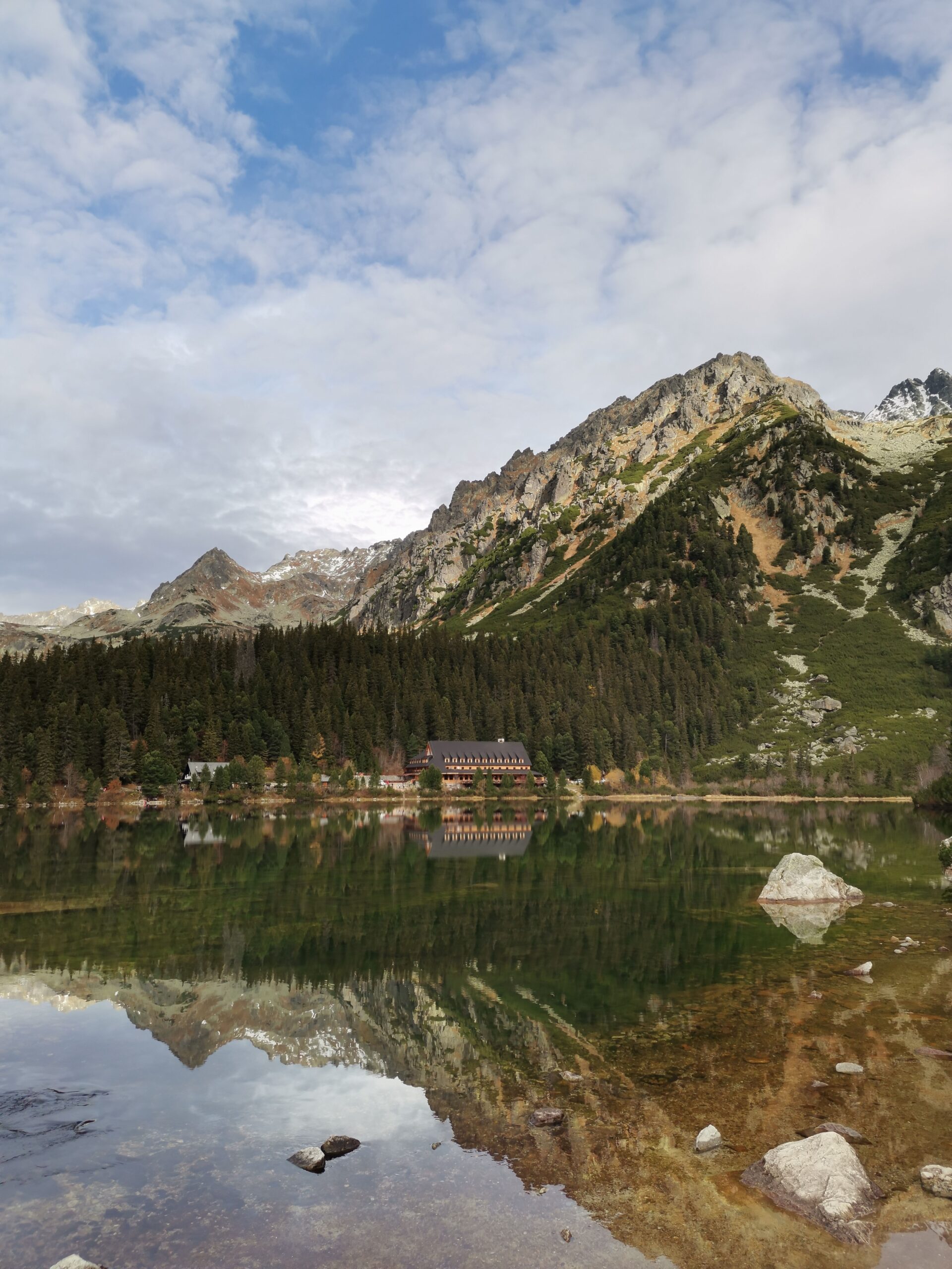
A lake of 6.88 hectares at 1,494.3 m, 17.6 metres deep, with a mountain hotel right on the shore. From the Popradské Pleso railway halt it is about 50 minutes on foot along a made-up track, which makes it one of very few Tatra destinations genuinely open to people with no mountain experience.
Just above the lake is the Symbolický cintorín, the Symbolic Cemetery, a quiet clearing of painted wooden crosses and plaques commemorating people who have died in the mountains. It is a striking place and it takes ten minutes to walk up to. The lake is accessible all year, and in winter it is a popular cross-country skiing destination.
Veľké Hincovo pleso: the largest and deepest
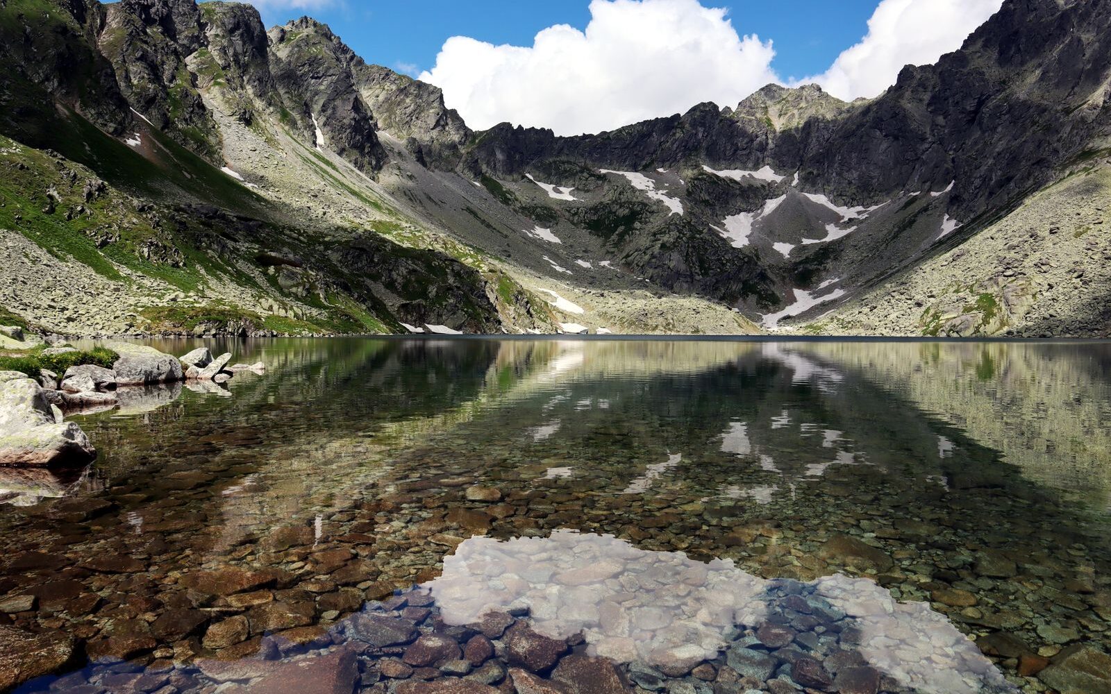
The record holder among Slovakia’s natural lakes. It lies in the Mengusovská valley at 1,946 m, covers 20.08 hectares, measures 740 by 370 metres and is 53.7 metres deep. The surface is frozen for roughly 270 days a year, which means you can still find ice floating on it in June.
Getting there is a proper full-day mountain walk. The path continues up from Popradské pleso and involves real ascent on rocky ground. This is not a stroll, it needs boots, and it needs the weather to be on your side. In exchange you get the largest natural lake in the country in a cirque of bare rock, and considerably fewer people than at Štrbské Pleso.
Zelené pleso
Veľké Zelené pleso, below the Jastrabia veža tower, is small at 1.77 hectares and only 4.5 metres deep, but it sits at 1,545 m beneath rock walls that are among the most photographed in the Tatras. On the northern shore stands Chata pri Zelenom plese, a mountain hut serving food where you can also stay the night.
The easiest approach is from the Kežmarská Biela voda bus stop on the yellow-marked trail. Routes in from Tatranská Lomnica are considerably longer. Staying at the hut and walking out at first light is one of the better things you can do in these mountains.
Skalnaté pleso
Small and shallow, 1.23 hectares and 2 metres deep, but at 1,754 m and served by a cable car straight up from Tatranská Lomnica. That makes it the least effortful way in Slovakia to get above the treeline, and it is the obvious choice on a day when the legs are not cooperating or the children have run out of patience. On foot, a blue-marked trail climbs from the Štart station and the Tatranská magistrála arrives from Hrebienok.
Roháčske plesá, the Western Tatras
Anyone who wants glacial lakes without the crowds heads for the Roháčska dolina in the Western Tatras, over on the Orava side. There are four main lakes here: the lower one, Veľké Roháčske pleso, at 1,562 m (2.22 hectares, 7 metres deep), two more at 1,650 and 1,653 m, and the highest at 1,719 m.
The walk starts from Zverovka, an hour up the Roháčska valley to the Ťatliakova chata hut and then on along the marked trail to the lakes, quoted at 5.4 km with 525 metres of ascent. Allow a full day. It is at its best in late September, when the larches turn and the whole valley goes copper.
Natural dammed lakes and water underground
A few Slovak lakes belong to neither camp. They are not glacial and they are not engineered, and two of them are among the most interesting water in the country.
Morské oko
The finest Slovak lake outside the Tatras lies in the Vihorlatské vrchy, the volcanic Vihorlat hills in the far east, at an altitude of 618 metres. The name means “sea eye”. It covers 13.8 hectares, runs 750 metres long and reaches 25.1 metres deep.
It formed when a landslide off the slopes of Motrogon and Jedlinka blocked the valley of the Okna stream. In the 1880s an artificial dam raised the water level by a further five metres. Since 1984 it has been a national nature reserve under the highest level of protection, and the surrounding old-growth beech forest is part of a UNESCO World Heritage listing. Fishing, swimming and boating are all banned.
The walk in is short and easy: from the Krivec car park it is about 15 minutes on the blue-marked trail. Realistically you need a car for this one, because public transport does not reach the car park. Combine it with a couple of days on Zemplínska šírava, which is in the same corner of the country, and you have the best of eastern Slovakia in one trip.
Cave lakes and the underground river Styx
The best place to see Slovakia’s underground water is Domica cave in the Slovak Karst, part of the UNESCO World Heritage list since 1995. The cave system continues across the border into Hungary as the Aggtelek caves, and the longer visitor circuit here includes a boat trip along the underground river Styx.
The circuit with the boat covers 930 metres, of which 150 metres are on the water, and takes 60 minutes. The shorter circuit is 780 metres and takes 45 minutes.
💡 Tip: Check the boat trip before you go. Since 1 February 2026 the circuit with the boat has been suspended because of water levels and only the dry circuit is running. Admission 2026: adults 10 € (about £8.40), students and over-60s 9 €, children aged 4 to 15 5 €. It is around 11 °C inside all year, so take a fleece even in August.
Which lakes in Slovakia can you swim in? The full table
The rules are not intuitive and they are not signposted in English everywhere, so here is the whole list in one place. If it says no, it means no.
| Lake | Type | Swimming | Region |
|---|---|---|---|
| Veľké Hincovo pleso | glacial lake | no, banned | High Tatras |
| Štrbské Pleso | glacial lake | no, banned | High Tatras |
| Popradské pleso | glacial lake | no, banned | High Tatras |
| Zelené pleso | glacial lake | no, banned | High Tatras |
| Skalnaté pleso | glacial lake | no, banned | High Tatras |
| Roháčske plesá | glacial lakes | no, banned | Western Tatras, Orava |
| Oravská priehrada | reservoir | yes | Orava |
| Liptovská Mara | reservoir | yes | Liptov |
| Zemplínska šírava | reservoir | yes, no lifeguards | Zemplín |
| Veľká Domaša | reservoir | yes | Upper Zemplín |
| Ružín | reservoir | yes, Hámorská zátoka | near Košice |
| Palcmanská Maša | reservoir | yes, cold water | Slovenský raj |
| Nosice | reservoir | not really, fishing water | Váh valley, Púchov |
| Slnečné jazerá Senec | gravel pit | yes, admission charged | Bratislava region |
| Zlaté piesky | gravel pit | yes, admission charged | Bratislava |
| Kunovská priehrada | reservoir | yes | Záhorie, Senica |
| Šulianske jazero | gravel pit | yes, check it is open | Žitný ostrov |
| Morské oko | dammed natural lake | no, banned | Vihorlat |
| Domica, the river Styx | underground water | no, boat trip only | Slovak Karst |
Lakes in Slovakia with children
Small children and high mountain lakes do not get on. The walk is long, swimming is forbidden and “look how beautiful it is” is not a currency a five-year-old accepts. These work far better.
- Slnečné jazerá, Senec. The most complete set-up in the country: shallow entry, beaches, an aquapark, playgrounds and food on site.
- Zlaté piesky, Bratislava. On the city transport network, open until 22:00, with a water rescue service on the beach during the day.
- Zemplínska šírava. The warmest large water in Slovakia, but no lifeguards. Only where you can keep a child within arm’s reach.
- Veľká Domaša. Sheltered bays, quieter than Šírava, a good choice for a full week.
- Štrbské Pleso. The one mountain lake that works with pre-schoolers, because the circuit is flat and the train goes to the shore.
💡 Tip: Want mountains and water in one trip? Base yourself in Liptov. Walk in the Tatras in the morning, swim at Liptovská Mara in the afternoon. The pairing of Slovenský raj and Palcmanská Maša works the same way.
Map of lakes in Slovakia, region by region
There is no single official map of Slovak lakes, and searching for one tends to produce a scatter of pins with no logic to them. Regions are a faster way to get your bearings, because Slovakia is long and thin and the lakes cluster.
- Orava and Liptov, the north: Oravská priehrada, Liptovská Mara, Roháčske plesá. Mountains and big water in the same valley.
- High Tatras: over a hundred glacial lakes, of which Štrbské, Popradské, Skalnaté and Zelené are the accessible four.
- Central Slovakia and Spiš: Palcmanská Maša at Dedinky, and the caves of the Slovak Karst including Domica.
- The east: Zemplínska šírava, Veľká Domaša, Ružín and Morské oko under the Vihorlat.
- The south-west: Slnečné jazerá, Zlaté piesky, the gravel pits of Žitný ostrov and Kunovská priehrada. This is the Bratislava swimming belt.
When you plot the mountain lakes on a map, check the grade of the marked path as well as the distance. Several trails often lead to the same lake with wildly different levels of difficulty, and the map alone will not tell you which is which.
When to visit the lakes in Slovakia
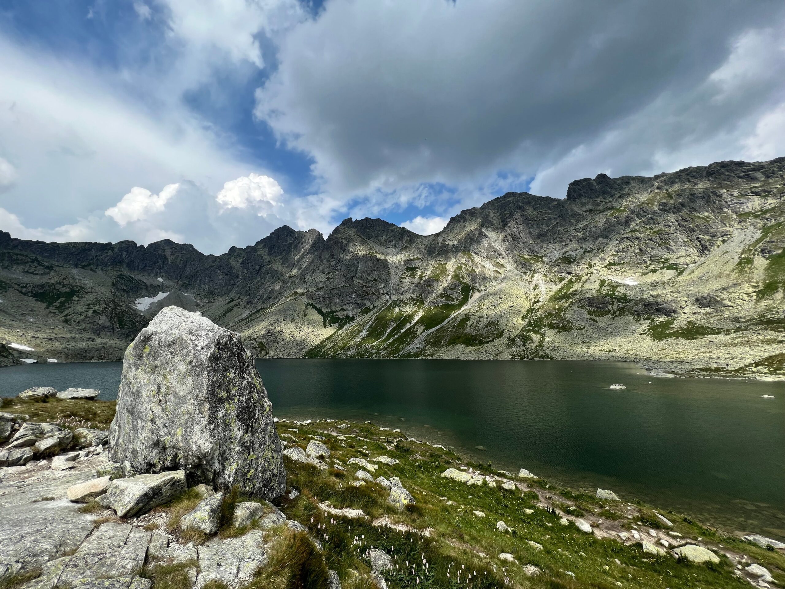
Mountain lakes have their main season from July to September. Before that there is still snow above 1,700 metres, and some of the high-altitude trails inside the national park are closed from 1 November to 15 June. The second half of September is usually the best of it: stable weather, autumn colour and far fewer people. Štrbské Pleso and Popradské pleso are reachable all year.
Swimming is worth it from mid-June to the end of August, and into September in the south-west. Zemplínska šírava and the lakes around Bratislava warm up fastest, Oravská priehrada and Palcmanská Maša slowest. Morské oko and the caves work in any month.
One thing to plan around: the Slovak school holidays run through July and August, and the eastern reservoirs fill with domestic visitors at weekends. Midweek in late June or early September gets you the same water with a fraction of the crowd.
Where to stay by the water
For the mountain lakes you stay in one of the Tatra settlements and walk to the water. For the reservoirs you pick a specific resort on a specific shore, because driving round a large reservoir takes far longer than the map suggests. For the south-western lakes you can simply stay in the nearest town.
For the High Tatras, the most practical bases are Štrbské Pleso itself or Starý Smokovec, both on the electric railway, which removes the parking problem entirely. Tatra car parks fill by mid-morning in season and are not cheap. Find places to stay in the High Tatras →
In the east, stay directly in one of the Šírava or Domaša resorts rather than in Michalovce or Vranov, since the whole point is to walk out of the door onto the beach. Holiday weekends sell out, so book ahead for late July and August.
More Slovakia guides
- Thermal baths in Slovakia: geothermal pools and aquaparks
- Castles in Slovakia: which ones are open and what they cost
- Camping in Slovakia: campsites and the rules on wild camping
- Things to see in Slovakia, region by region
- Slovakia by train: getting around without a car
- The Polish Tatras: the other side of the same mountains
Lakes in Slovakia: frequently asked questions
Can you swim in the lakes of the High Tatras?
No. Swimming is banned in every glacial lake in the Tatras, and the TANAP park authority signs it at the lakes and increases patrols in season. Entering the water damages a fragile high-altitude environment that survives on very fine margins. The on-the-spot fine is up to 300 € (about £250), and in formal proceedings it can reach 3,319.39 € (about £2,790).
What is the largest lake in Slovakia?
By surface area it is Oravská priehrada, a reservoir covering 35 km² and holding 375.5 million m³. Zemplínska šírava is second at 33 km², Liptovská Mara third. Among natural lakes the largest is Veľké Hincovo pleso in the High Tatras at 20.08 hectares, which is smaller than it sounds next to the reservoirs.
What is the deepest lake in Slovakia?
Veľké Hincovo pleso in the Mengusovská valley, at 53.7 metres deep. It sits at 1,946 m above sea level and its surface is frozen for roughly 270 days a year. Among the reservoirs the deepest is Ružín, at around 54 metres.
Which lakes in Slovakia are best for swimming?
Slnečné jazerá at Senec has the best facilities in the country, with beaches, an aquapark and admission from 4 € online. The warmest large water is Zemplínska šírava in the east, though it has no lifeguards. In Bratislava itself the most accessible option is Zlaté piesky, open daily from 9:00 to 22:00.
Are there lakes near Bratislava where you can swim?
Yes, and they are the easiest swimming in Slovakia to reach. Zlaté piesky is inside the city, on a public transport route, open daily 9:00 to 22:00 with free entry after 19:00 but no lifeguard cover. Slnečné jazerá at Senec is half an hour away by train, with 100 hectares of water and admission of 5 € at the gate or 4 € online.
What types of lakes are there in Slovakia?
Four. Glacial mountain lakes in the Tatras, of which there are over a hundred inside the national park. Dam reservoirs such as Oravská priehrada and Zemplínska šírava. Flooded gravel pits in the south-west. And natural dammed or underground lakes, the category Morské oko belongs to.
Can you get to Štrbské Pleso without a car?
Yes, and it is the only high mountain lake in Slovakia where the train stops on the shore. A rack railway has run up here since 1896, and the Tatra Electric Railway connects Štrbské Pleso with Starý Smokovec and Poprad, which is about 4 hours by train from Bratislava. The lake sits at 1,346.6 m and has a flat circuit all the way round.
When is the best time to visit the lakes in Slovakia?
For the mountain lakes, July to September, because some high-altitude trails in the national park are closed from 1 November to 15 June and the exact reopening date is announced by the park authority each year. For swimming, mid-June to the end of August, and into September in the south-west.
Is there a map of lakes in Slovakia?
There is no single official map, so the fastest way to orient yourself is by region. Orava and Liptov hold Oravská priehrada and Liptovská Mara, the High Tatras hold the glacial lakes, the east holds Šírava, Domaša, Ružín and Morské oko, and the south-west holds Slnečné jazerá and Zlaté piesky.
Do you need a motorway vignette to drive to the lakes?
Yes, if you use the motorways, which you almost certainly will heading north or east. A 10-day vignette costs 10.80 € (about £9) and is purely electronic, bought online at eznamka.sk and registered to your number plate. Hire cars usually do not include one, and there are no toll booths to remind you, only cameras.
Read next
Potřebujete pomoct s cestováním?
-
Ubytování 🏨
Vyberte si to nejlepší ubytování, ať už jste kdekoliv, přes Booking.com. -
Půjčení auta 🚗
Auto si snadno najdete přes Booking.com, kde máte často slevu díky ubytování, nebo Rentalcars.com, kde porovnáte nabídky většiny půjčoven. -
Zážitky 🎟️
Přes GetYourGuide.com si vyberete z nejrůznějších výletů i zážitků po celém světě, navíc se zrušením zdarma do 24 h předem.