Last updated 30.8.2026
There is no single path to Santiago de Compostela. There is a whole network of them, and the Camino de Santiago routes converge on the cathedral from four directions: down from France over the Pyrenees, up from Porto and Lisbon, north from Seville across the baking plains of Extremadura, and west along the cliffs of the Bay of Biscay. One pilgrim commits to 764 kilometres and five weeks of walking. Another flies to Porto, walks for twelve days and arrives just as legitimately. Both are the Camino, and both end at the same tomb.
This guide sets out ten routes to Santiago with distances, stage counts and honest difficulty ratings, then covers the practical decisions that actually make or break the walk: how the credencial works and how many kilometres you need for a Compostela, what a day on the Camino costs, how albergues really function, how to reach each starting point, and what belongs in the rucksack.
Camino de Santiago routes at a glance
- The famous one: the Camino Francés from Saint-Jean-Pied-de-Port, roughly 764 km in 33 stages, so budget 30 to 35 days.
- The best short option: the Camino Portugués from Porto, 241 km in 10 stages, meaning 11 to 13 walking days.
- The quickest Compostela: the Camino Inglés from Ferrol, around 112 km, 5 to 6 days.
- For the certificate you need the final 100 km walked continuously (200 km by bike) with stamps in your credencial.
- Daily budget: roughly 30 to 50 € a day (about £26 to £43), and 30 € is genuinely doable if you are frugal.
- Beds: albergues cost 6 to 15 € in the municipal and parish network, 15 to 30 € privately.
- When to go: April to June and September to October. Avoid July and August in the south and on the Francés.
- Waymarking: the yellow arrow and the scallop shell, plus red and white GR 65 flashes on the French section.
How the Camino de Santiago routes are waymarked
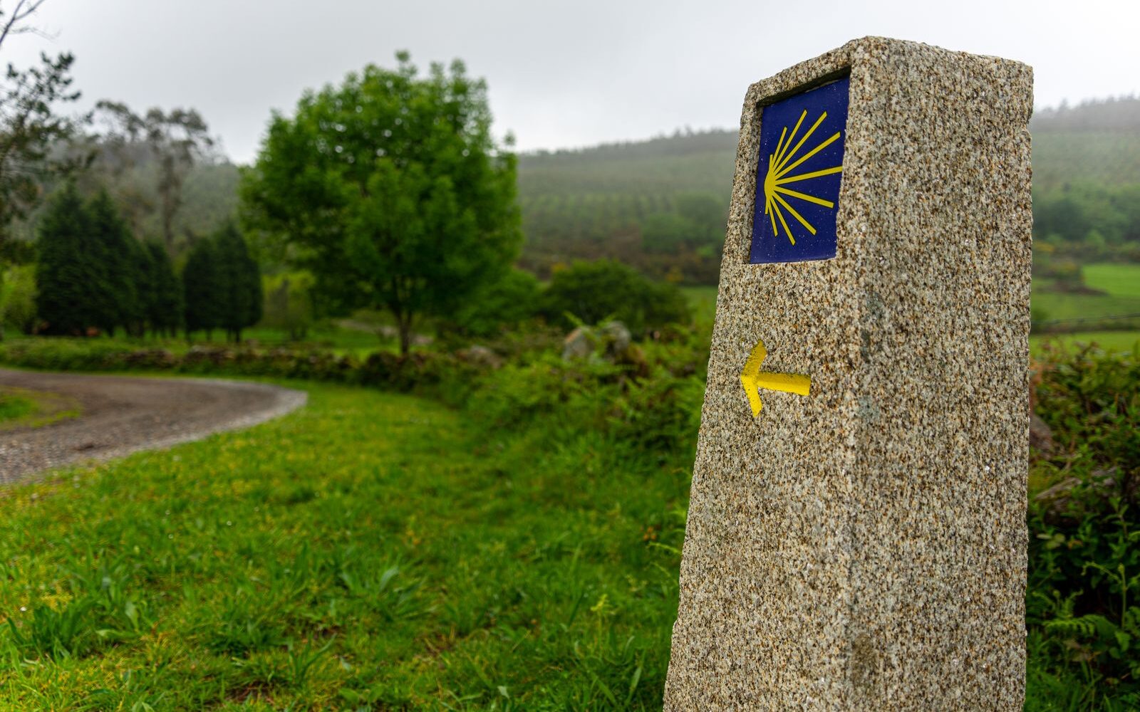
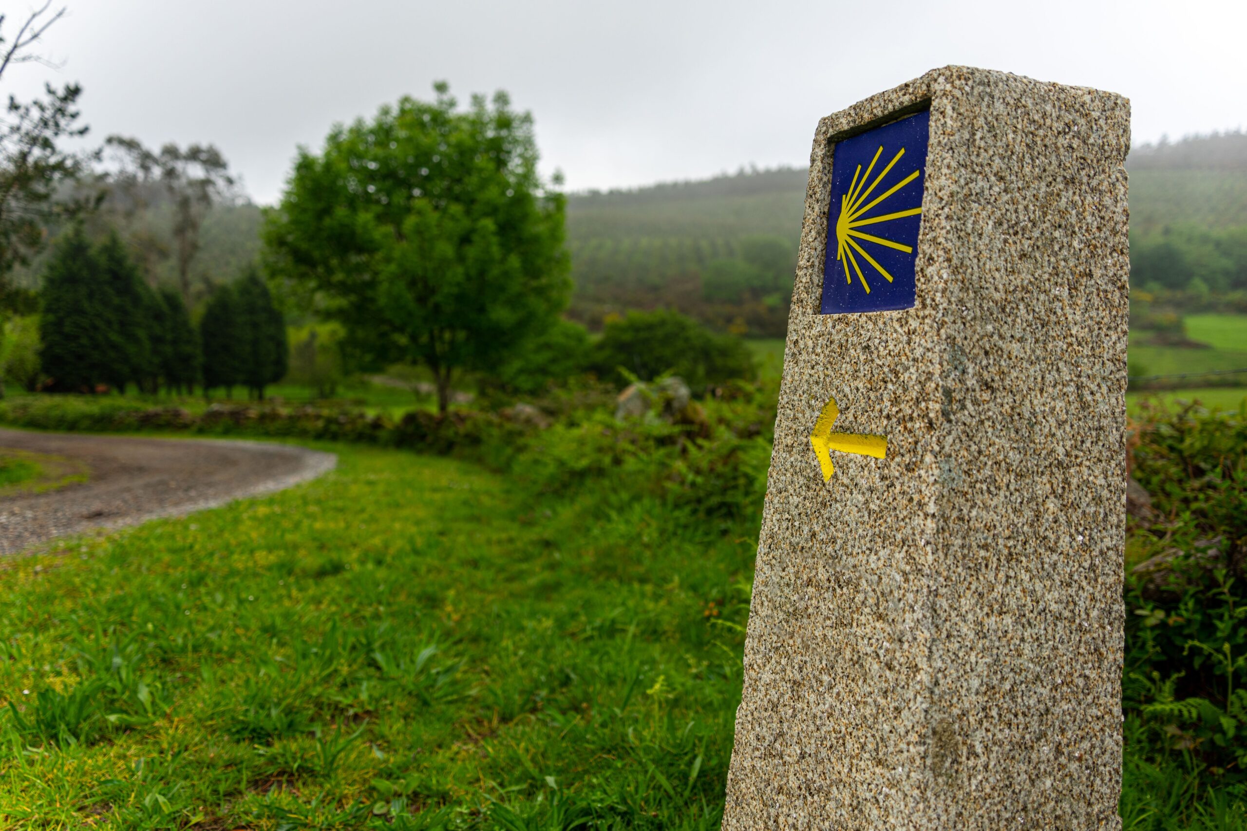
You will learn the whole system inside the first hour of walking. The yellow arrow is the informal one: daubed on kerbstones, barn walls, pavements, lamp posts and boulders by whoever felt like doing it, and always pointing towards Santiago. The scallop shell of Saint James is the official version, cast into concrete markers, set into cobbles and glazed onto ceramic tiles.
There is one catch worth knowing before you set off. The arrow is unambiguous, but the shell is not drawn consistently across Spain. In Galicia the direction of travel is indicated by the open fan of the ribs; elsewhere it is the pointed hinge that shows the way. The working rule is simple: if an arrow and a shell sit side by side, trust the arrow.
Galicia adds a third layer, stone markers counting down the kilometres to Santiago. The most photographed of them all stands in Sarria and reads a little over 111 km, which is precisely why the town is so busy: it is the last place you can start and still qualify for a Compostela.
France works differently again. The Via Podiensis follows the GR 65 long-distance footpath, waymarked with red and white horizontal flashes, and the pilgrim shells there are more decoration than navigation. On the Portuguese side, watch out where the Camino Portugués crosses paths running the other way, towards Fátima. Those carry blue arrows, so if you find yourself following blue, you are walking away from Santiago rather than towards it.
Which Camino de Santiago route should you walk?
The choice really comes down to three things: how much time you can take off, how fit you are, and which month you can get away. Time is usually the binding constraint, so start there.
- One week. The Camino Inglés from Ferrol, the final section of the Camino Francés from Sarria, the Camino Portugués from Tui, or the walk out to Finisterre. All except Finisterre clear the 100 km threshold, so the Compostela is within reach.
- Two weeks. The Camino Portugués from Porto is the obvious answer, either by the central route or along the coast. The Camino Primitivo also fits, but it is a far hillier fortnight.
- A month or more. The Camino Francés, the Camino del Norte, the Vía de la Plata, or the French Via Podiensis from Le Puy.
- First Camino, walking solo. The Francés or the Portugués. Dense accommodation, a bar every few kilometres and plenty of company whether you want it or not.
- You want solitude. The Vía de la Plata, the Camino Aragonés, or the Camino del Norte outside the peak months.
One statistic is worth having in your head before you commit. Around 530,000 pilgrims reached Santiago in 2025, and almost half of them walked the Camino Francés. The Portuguese routes together took over a third. In practice that means you will never be alone for a single hour on those two, whereas on the Vía de la Plata you might pass five people in a day.
All 10 Camino de Santiago routes in detail
Here are the ten routes people actually walk, with the numbers that matter. Some will be crowded, others almost empty, and a lot of that depends less on the route itself than on the month you pick.
1. Camino Francés: the one everybody has heard of
The basics: Saint-Jean-Pied-de-Port (France) → Santiago de Compostela · roughly 764 km in 33 stages · 30 to 35 days · moderate overall, with one genuinely hard day right at the start · linear, not a loop · landmark points: Alto del Perdón, Cruz de Ferro (around 1,500 m) and O Cebreiro (around 1,300 m).
| Milestone | Km from the start | Left to Santiago |
|---|---|---|
| Saint-Jean-Pied-de-Port | 0.0 km | 764 km |
| Roncesvalles | 24.2 km | 740 km |
| Pamplona | 66.0 km | 698 km |
| Logroño | 160.4 km | 603 km |
| Burgos | 281.3 km | 482 km |
| León | 459.2 km | 305 km |
| Ponferrada | 560.1 km | 204 km |
| O Cebreiro | 611.1 km | 153 km |
| Sarria | 649.5 km | 114 km |
| Santiago de Compostela | 763.7 km | 0 km |
How the route unfolds. Day one is the hardest day of the entire walk, which is a strange way to start a five-week hike. From Saint-Jean-Pied-de-Port the path climbs over the Pyrenees to Roncesvalles by the so-called Napoleon route, 24.2 km with more than 1,200 metres of ascent. In winter and in bad weather that variant is closed and everyone is sent down the lower Valcarlos option instead, which measures 23.4 km. After that come Navarre and La Rioja: hilly, green, laced with vineyards, and punctuated by Pamplona, Estella and Logroño.
Beyond Burgos the path enters the Meseta, two hundred kilometres of high plateau between Burgos and León. Flat, planted with cereals, almost shadeless and very straight. Some pilgrims skip it by bus; others name it the single most powerful stretch of the whole Camino. Past León the ground rises again, over Cruz de Ferro, where tradition says you leave a stone carried from home, then down into Ponferrada and the El Bierzo valley. Next comes the climb to O Cebreiro, the second hardest day, with over 1,000 metres of ascent packed into 27.8 km. The last 150 km roll through Galicia, and past Sarria the number of people on the path multiplies overnight.
Getting to the start. There is no direct public transport into Saint-Jean-Pied-de-Port, so plan on two legs. The usual approach is to fly into Biarritz, Bordeaux or Toulouse and take a train to Bayonne, where a branch line runs up to Saint-Jean-Pied-de-Port several times a day. Biarritz is the shortest hop of the three, since it is barely 40 minutes from Bayonne. An alternative is to fly to Bilbao and use an Alsa coach to Pamplona and on from there. If you are only walking the final 114 km from Sarria, fly to Santiago de Compostela and take a Renfe train or a coach out to Sarria.
Food, water and albergues. The densest network of any route. Every second village has a bar serving a pilgrim menu, a municipal albergue and usually two private ones as well. Public fountains keep your bottle full, with one exception: on the Meseta between Carrión de los Condes and Terradillos there are 17 km without a single settlement, so fill up before you leave.
Worth stopping for: Burgos cathedral, the stained glass in the Gothic cathedral at León, the Templar castle at Ponferrada, the bridge at Puente la Reina, the wine country of La Rioja, and the mountain hamlet of O Cebreiro with its stone-and-thatch pallozas.
Best for: a first Camino, for solo walkers who would rather not actually be alone, and for anyone who wants the logistics to look after themselves. Find a bed in Saint-Jean-Pied-de-Port →
2. Camino Portugués: the Camino de Santiago from Porto
The basics: Porto → Santiago de Compostela · 241.4 km in 10 stages · 11 to 13 days · low to moderate difficulty · from Lisbon it is roughly 598 km in 25 stages, from Tui 115.8 km in 5 stages · linear.
| Stage | Distance |
|---|---|
| Porto → Vilarinho | 26.5 km |
| Vilarinho → Barcelos | 28.1 km |
| Barcelos → Ponte de Lima | 34.5 km |
| Ponte de Lima → Rubiães | 17.4 km |
| Rubiães → Tui | 19.1 km |
| Tui → Redondela | 31.9 km |
| Redondela → Pontevedra | 19.8 km |
| Pontevedra → Caldas de Reis | 21.1 km |
| Caldas de Reis → Padrón | 18.6 km |
| Padrón → Santiago de Compostela | 24.4 km |
How the route unfolds. Leaving Porto is the least attractive part of the whole walk, because you spend several hours in the suburbs alongside busy roads. Anyone who would rather skip it takes the metro out to Vilar do Pinheiro and saves the first 20 km or so. Beyond Vilarinho the path settles into the farmland of northern Portugal, past vinho verde vineyards and the stone granaries known as espigueiros. The hardest day is Barcelos to Ponte de Lima, 34.5 km, and the fact that it is flat makes it worse for your feet rather than better.
Just after Ponte de Lima comes the only serious climb on the route, the crossing of Alto da Portela Grande near Rubiães. Then you cross the river Minho on the bridge between Valença in Portugal and Tui in Spain, and the Galician half begins. It is rolling, green, and increasingly busy over the last few days, because pilgrims from the coastal route join in at Redondela.
Getting to the start. The easiest of all ten. Porto is served by direct flights from London and several regional UK airports on Ryanair, easyJet, TAP and others, and metro line E runs from the airport into the centre in under an hour. If you are only walking the final 115 km from Tui, fly to Porto, take a train up to Valença and walk across the bridge.
Food, water and albergues. The Portuguese half has a thinner public albergue network than Spain, but plenty of private ones at 15 to 20 € (about £13 to £17). In Galicia the Xunta’s public network takes over. Cafés and bakeries are everywhere, and a pilgrim menu in Portugal often costs less than the Spanish equivalent.
Worth stopping for: the medieval bridge and causeway at Ponte de Lima, the fortress at Valença, the old town of Pontevedra, the Santiaguinho chapel at Padrón and the cathedral at Tui.
Best for: the strongest choice for a two-week holiday, and for anyone who would rather not do hills. Find a bed in Porto →
3. Camino Portugués da Costa: the coastal route from Porto
The basics: Porto → Redondela along the coast 188 km in 9 stages, then a further 83.9 km on the central route into Santiago, so roughly 272 km in total · 12 to 14 days · low difficulty, very little climbing · linear.
| Stage | Distance |
|---|---|
| Porto → Labruge | 24.5 km |
| Labruge → Póvoa de Varzim | 14.0 km |
| Póvoa de Varzim → Marinhas | 24.5 km |
| Marinhas → Viana do Castelo | 20.8 km |
| Viana do Castelo → Caminha | 26.8 km |
| Caminha → Porto Mougás | 23.5 km |
| Porto Mougás → A Ramallosa | 16.0 km |
| A Ramallosa → Vigo | 21.5 km |
| Vigo → Redondela | 15.4 km |
How the route unfolds. You leave Porto along the bank of the Douro, reach the sea and turn north on timber boardwalks laid over the dunes. For the first five days the Atlantic is almost always in view, past the fishing towns of Vila do Conde, Esposende and Viana do Castelo. At Caminha you cross the mouth of the Minho by ferry to A Guarda in Spain, the one point on any Camino where you are at the mercy of a timetable and the weather. The boat does not run in strong winds, and the fallback is a bus round to the bridge at Valença.
The Spanish half follows the Rías Baixas coast past Baiona, where the caravel Pinta made landfall in 1493 with news that America existed, then through industrial Vigo to Redondela. There the coastal path merges with the central route and the last four days are identical to the Camino Portugués.
There is one more layer to know about: the Senda Litoral, a literal beach-by-beach variant that peels off the main coastal path and rejoins it repeatedly. It is prettier, but walking on sand is slower.
Getting to the start: exactly as for the central route, a direct flight into Porto.
Food, water and albergues. This is a holiday coast, so there are plenty of beds, but in summer they fill up with ordinary holidaymakers as well as pilgrims. Booking ahead makes more sense here than anywhere else. The food, on the other hand, is the best on any Camino: sardines and shellfish straight off the boats.
Worth stopping for: the Santiago da Barra fortress at Viana do Castelo, the Minho ferry crossing, Baiona with its replica caravel, and the Cíes islands on the horizon off Vigo.
Best for: people who want the sea, couples, and anyone who finds inland walking monotonous.
4. Camino del Norte: the Bay of Biscay coast
The basics: Irún → Santiago de Compostela · approximately 820 to 835 km in around 34 stages · 32 to 38 days · high difficulty, because of the relentless climbing and descending between inlets · linear · UNESCO-listed since 2015.
| Milestone | Km from Irún (approximate) |
|---|---|
| Irún | 0 km |
| San Sebastián | 25 km |
| Bilbao | 147 km |
| Santander | 273 km |
| Gijón | 480 km |
| Avilés | 505 km |
| Ribadeo (entering Galicia) | around 640 km, 190 km left to Santiago |
| Santiago de Compostela | 820–835 km |
How the route unfolds. The path starts on the French-Spanish border and hugs the coast of the Basque Country, Cantabria and Asturias. Do not expect anything level: it keeps climbing onto headlands and dropping back into bays, so the daily ascent is often higher than on the Camino Francés even though you are walking beside the sea. Stages are long too, several of them over 30 km, and Santander to Santillana del Mar comes in at 36.3 km.
Past Ribadeo the route swings inland through Galicia and merges with the Camino Francés at Arzúa for the final 40 km or so. If you want, you can branch off the Norte onto the Camino Primitivo while still in Asturias, usually at Villaviciosa or Sebrayo.
Getting to the start. Bilbao is the practical gateway, with direct flights from the UK on easyJet, Vueling and Ryanair, and from Bilbao an Alsa coach or a train reaches Irún in about an hour and a half. Starting in San Sebastián instead saves you a first day spent walking through urban sprawl.
Food, water and albergues. The albergue network is thinner than on the Francés and fills up in summer. In exchange you get the best eating on any Camino: Basque pintxos bars in San Sebastián and Asturian cider houses where the sidra is poured into the glass from arm’s length above your head.
Worth stopping for: La Concha beach in San Sebastián, the Guggenheim in Bilbao, the cliffs near Comillas, the Altamira caves outside Santillana del Mar, and the cathedral at Oviedo if you take the branch.
Best for: experienced, fit pilgrims who have already walked one Camino and now want fewer people and more landscape.
5. Camino Primitivo: the oldest and the hilliest
The basics: Oviedo → Melide 281.8 km in 11 stages, then a further 53 km on the Camino Francés, so roughly 335 km in total · 13 to 15 days · high difficulty · linear · UNESCO-listed since 2015. Note that other sources quote 320 km; the figures differ depending on which variants you take.
| Stage | Distance |
|---|---|
| Oviedo → Grado | 25.2 km |
| Grado → Salas | 22.3 km |
| Salas → Tineo | 19.8 km |
| Tineo → Borres | 15.9 km |
| Borres → Berducedo via Hospitales | 24.1 km |
| Berducedo → Grandas de Salime | 20.4 km |
| Grandas de Salime → A Fonsagrada | 25.2 km |
| A Fonsagrada → O Cádavo | 24.3 km |
| O Cádavo → Lugo | 29.5 km |
| Lugo → A Ponte Ferreira | 26.5 km |
| A Ponte Ferreira → Melide | 20.0 km |
How the route unfolds. This is the original pilgrimage to Santiago, walked according to tradition by King Alfonso II in the 9th century. It runs through inland Asturias and its mountains, and you feel every metre of it. The decisive day is the fifth, the Ruta de los Hospitales: 24.1 km along a bare ridge at around 1,100 metres, with no village, no water and nowhere to shelter. Nobody sensible walks it in fog or heavy rain, and there is a lower alternative via Pola de Allande measuring 28.6 km.
Beyond Grandas de Salime you cross into Galicia and descend through A Fonsagrada to Lugo, a city still ringed by its complete Roman walls. From there it is two more days to Melide, where the Primitivo joins the Camino Francés.
Getting to the start. Asturias airport, which serves Oviedo, is reached from most of Europe with a change in Madrid or Barcelona. The alternative is to fly into Bilbao and take an Alsa coach west, which takes roughly four hours.
Food, water and albergues. The network is reasonable but the beds are few, so in summer people set off very early. On the Ruta de los Hospitales carry two litres of water and food for the whole day, because between Borres and Berducedo there is nothing at all.
Worth stopping for: the pre-Romanesque churches of Oviedo, the Grandas de Salime dam, the Roman walls of Lugo and the ethnographic museum at Grandas.
Best for: fit pilgrims who want something shorter but genuinely mountainous. Find a bed in Oviedo →
6. Camino Inglés: the shortest route to a Compostela
The basics: Ferrol → Santiago de Compostela · 111.5 km in 5 stages · 5 to 6 days · moderate, thanks to rolling Galician terrain · linear · the variant from A Coruña measures 72.4 km.
| Stage | Distance |
|---|---|
| Ferrol → Pontedeume | 27.7 km |
| Pontedeume → Betanzos | 19.7 km |
| Betanzos → Hospital de Bruma | 24.0 km |
| Hospital de Bruma → Sigüeiro | 24.4 km |
| Sigüeiro → Santiago de Compostela | 15.7 km |
| Variant: A Coruña → Hospital de Bruma | 32.3 km in 2 stages |
How the route unfolds. The name is not decoration. This is the path taken by pilgrims who arrived by ship from England, Ireland and Flanders and walked the rest of the way, which makes it the obvious choice if you like your history close to home. It starts at the harbour in Ferrol, curls around the estuary and climbs inland through Pontedeume, with its long medieval bridge, and Betanzos and its old town. Day three is the hardest, with around 500 metres of ascent up to Hospital de Bruma, where the two variants meet. The final two days pass through eucalyptus plantations and the outskirts of Santiago.
One crucial caveat about the A Coruña variant: at 72.4 km it does not reach the 100 km threshold on its own. If you want the Compostela, you have to start in Ferrol.
Getting to the start. Santiago de Compostela has its own airport with direct flights from several UK and Irish airports, and from Santiago a coach reaches Ferrol in about two hours, with the train taking much the same. The neat trick here is to leave your main bag at your Santiago accommodation, since you will be walking back to it within the week.
Food, water and albergues. There is exactly as much infrastructure as you need and no more, and capacities are small. Hospital de Bruma has essentially one albergue, so sort that night out in advance. Bars appear in every town of any size.
Worth stopping for: the harbour and naval arsenal at Ferrol, the bridge and Andrade tower at Pontedeume, the historic core of Betanzos and the views over the Rías Altas inlets.
Best for: a one-week holiday, a first taste of the Camino, and anyone who wants a Compostela without taking a month off. Find a bed in Ferrol →
7. Vía de la Plata: the longest and the loneliest
The basics: Seville → Santiago de Compostela · depending on the variant 900 to 1,000 km in around 38 stages · 38 to 45 days · high difficulty, though because of the distances and the heat rather than the gradients · linear.
| Section | Distance |
|---|---|
| Seville → Mérida | 208.7 km (9 stages) |
| Mérida → Salamanca | 290.1 km (10 stages) |
| Salamanca → Granja de Moreruela | 109.8 km (4 stages) |
| Granja de Moreruela → Ourense (Camino Sanabrés) | 209.3 km (8 stages) |
| Ourense → Santiago de Compostela | 82.5 km (4 stages) |
How the route unfolds. The path traces the old Roman road from Mérida to Astorga, crossing Andalusia, Extremadura and Castile. This is country where the gaps between settlements are enormous and 30-kilometre stages are routine rather than exceptional. Between Almadén and Monesterio you walk 33.6 km with nothing much in between.
At Granja de Moreruela the route splits. Take the Camino Sanabrés and you head through Ourense straight to Santiago. Carry on north instead and you reach Astorga and join the Camino Francés, which means spending your final 250 km in a crowd. Most people choose the Sanabrés.
When to walk it. This is the one route where picking the right month is not a preference but a safety decision. July and August regularly bring temperatures over 40 degrees with virtually no shade. March to May is ideal, or October.
Getting to the start. Seville has direct low-cost flights from a good spread of British airports, which makes this one of the easiest starts of all to reach, ironic given how remote the walking feels.
Food, water and albergues. The thinnest network of any route here. Albergues tend to be municipal, cheap and sometimes empty. Water is the serious topic: plan for two to three litres a day and top up at every single opportunity.
Worth stopping for: the Roman theatre and aqueduct at Mérida, the medieval core of Cáceres, Salamanca with its university and Plaza Mayor, the ruined monastery at Granja de Moreruela and the thermal springs at Ourense.
Best for: experienced pilgrims who have done the crowds and want the opposite. Not a route for a first Camino.
8. Camino Finisterre and Muxía: walking on past Santiago
The basics: Santiago de Compostela → Fisterra (and optionally Muxía) · 89.4 km to the lighthouse at Fisterra, or roughly 116.5 km if you loop in Muxía · 3 to 5 days · moderate · the only route that leads out of Santiago rather than into it.
| Stage | Distance |
|---|---|
| Santiago de Compostela → Negreira | 20.6 km |
| Negreira → Olveiroa | 33.6 km |
| Olveiroa → Corcubión | 21.4 km |
| Corcubión → Fisterra | 10.6 km |
| Fisterra → Cabo Fisterra lighthouse | 3.2 km |
How the route unfolds. From Santiago you head west across rolling inland Galicia. Day two is the long one, 33.6 km between Negreira and Olveiroa with limited services on the way. Past Olveiroa the path divides, either to Fisterra or to Muxía. Most people walk to Fisterra first, sleep there, and cross to Muxía along the coast the following day, roughly 30 km.
The reward is the lighthouse on Cabo Fisterra, taken in the Middle Ages to be the end of the known world, and a stone marker reading 0.00 km. The old tradition of burning your boots at the cape is now banned, because it kept starting fires.
Certificates. Each destination issues its own document: the Fisterrana at Fisterra and the Muxiana at Muxía.
Transport. There is nothing to organise at the start, because you simply walk out of Santiago. Coming back, coaches run to Santiago from both Fisterra and Muxía and take roughly two to three hours.
Worth stopping for: the Ponte Maceira bridge, the Ézaro waterfall where a river drops straight into the sea, the church of Virxe da Barca at Muxía and the wild Costa da Morte shoreline.
Best for: tacking onto any longer route, or as a short walk in its own right. It cannot earn you a Compostela by itself, since it runs in the wrong direction.
9. Via Podiensis: the French way from Le Puy
The basics: Le Puy-en-Velay → Saint-Jean-Pied-de-Port · roughly 738 km in 29 stages · 30 to 34 days · moderate to high difficulty · waymarked as the GR 65 long-distance path with red and white flashes.
| Milestone | Position on the route |
|---|---|
| Le Puy-en-Velay | start, Auvergne |
| Conques | after stage 9 |
| Cahors | after stage 14 |
| Moissac | after stage 17 |
| Saint-Jean-Pied-de-Port | stage 29, joins the Camino Francés |
How the route unfolds. The first documented pilgrimage along this path dates from 950 to 951, when Bishop Godescalc walked it. The route crosses the volcanic Auvergne, the Aubrac plateau, the Lot valley and the farmland of south-west France. The terrain is hillier than most people expect and a lot of the walking is on field and forest tracks.
Accommodation is a different world from Spain. Instead of albergues you stay in gîtes d’étape and chambres d’hôtes, usually booked ahead and often on a demi-pension basis, meaning bed, dinner and breakfast. It costs more than a Spanish albergue, so budget nearer 35 to 50 € per person including meals (about £30 to £43). In return you eat dinner communally at one long table, and the atmosphere beats a sixty-bunk dormitory.
Getting to the start. Le Puy-en-Velay is reached by train via Lyon or Saint-Étienne, and Lyon has direct flights from the UK on easyJet and others.
Worth stopping for: the cathedral and the statue on the rock at Le Puy, the abbey of Sainte-Foy at Conques, the Valentré bridge at Cahors and the Romanesque portal of the abbey at Moissac. Several of these are UNESCO-listed.
Best for: people who already know the Camino Francés and want to walk the whole thing from its historical beginning, plus anyone who loves rural France and its food.
10. Camino Aragonés: the quiet way into Spain
The basics: Somport (the French-Spanish border) → Puente la Reina · 182.2 km in 6 stages · 7 to 9 days · moderate, and the whole section descends from the Pyrenean pass · linear, feeding into the Camino Francés.
| Stage | Distance |
|---|---|
| Somport → Jaca | 30.2 km |
| Jaca → Arrés | 24.8 km (38.6 km via San Juan de la Peña) |
| Arrés → Ruesta | 27.4 km |
| Ruesta → Sangüesa | 22.0 km |
| Sangüesa → Monreal | 27.2 km |
| Monreal → Puente la Reina | 30.6 km |
How the route unfolds. This is the Spanish continuation of the French Via Tolosana from Arles, and it begins at the Pyrenean pass of Somport at around 1,630 metres. The first day drops down to Jaca and its Romanesque cathedral. The path then follows the river Aragón past the Yesa reservoir and the half-abandoned village of Ruesta, still partly deserted because of the dam that flooded its farmland. At Puente la Reina the Aragonés merges with the main route coming down from Roncesvalles.
Getting to the start. Somport is reached by bus from Jaca, and Jaca by train or coach from Zaragoza. Zaragoza itself is usually reached with a change in Madrid or Barcelona.
Food, water and albergues. A sparse network, but a functioning one. Stages are long and villages few, so check in advance what is actually open, especially out of season.
Worth stopping for: the cathedral at Jaca, the monastery of San Juan de la Peña built under an overhanging cliff, the Gothic church of Santa María at Sangüesa and the bridge over the Arga at Puente la Reina.
Best for: a calm week as a warm-up before joining the Camino Francés, or for anyone who wants to cross the Pyrenees somewhere other than Roncesvalles.
💡 Tip: Plan your stages around your feet, not around a guidebook or an app. Most Camino injuries happen in the first week, because people try to keep to somebody else’s schedule. Walk 15 to 18 km a day for the first five days and let your body adapt. Then add distance.
Camino de Santiago routes compared
| Route | Start | Distance | Days | Difficulty |
|---|---|---|---|---|
| Camino Francés | Saint-Jean-Pied-de-Port | 764 km | 30–35 | moderate |
| Camino Portugués | Porto | 241 km | 11–13 | low to moderate |
| Camino Portugués da Costa | Porto | 272 km | 12–14 | low |
| Camino del Norte | Irún | 820–835 km | 32–38 | high |
| Camino Primitivo | Oviedo | 335 km | 13–15 | high |
| Camino Inglés | Ferrol | 112 km | 5–6 | moderate |
| Vía de la Plata | Seville | 900–1,000 km | 38–45 | high |
| Camino Finisterre and Muxía | Santiago de Compostela | 89–116 km | 3–5 | moderate |
| Via Podiensis (Le Puy) | Le Puy-en-Velay | 738 km | 30–34 | moderate to high |
| Camino Aragonés | Somport | 182 km | 7–9 | moderate |
Credencial and Compostela: how many kilometres you need
The credencial is the pilgrim passport you collect stamps in as you walk. It does two jobs: it gets you into albergues at the pilgrim rate, and it proves you actually covered the ground. Stamps come from accommodation, churches, bars, town halls and tourist offices.
Only churches and recognised pilgrim associations may issue one. In the UK that is the Confraternity of Saint James, the only accredited British distributor, which supplies the pilgrim record free to its members and for £6 to non-members and posts it out, so order it a few weeks before you fly rather than the week of departure. You can also buy one on arrival, in parish offices and pilgrim offices at the start of most routes, for a couple of euros.
The conditions for a Compostela, the Latin certificate issued by the cathedral in Santiago, are set by the pilgrim office as follows:
- On foot or on horseback: at least 100 continuous kilometres along one route heading towards Santiago.
- By bicycle: at least 200 kilometres.
- Starting outside Spain on one of the recognised routes: at least 70 kilometres on Spanish soil is enough. In practice that means anyone setting off from Valença in Portugal qualifies.
- Stamps: over the final 100 kilometres you are advised to collect at least two a day, or you risk the office refusing to certify your walk.
You collect the Compostela at the Oficina de Acogida al Peregrino at Rúa Carretas 33, open daily from 9:00 to 19:00 and closed only on 25 December and 1 January. In peak season there is a queue, and the office itself warns that at the busiest times it cannot guarantee same-day issue. If you also want a document stating your distance walked and your starting point, you can pay extra for a certificate of distance.
Two footnotes people rarely mention. The Compostela is also issued to pilgrims who arrive in Santiago by sailing boat. And if you are walking the Camino in sections across several years, that is perfectly acceptable, as long as the final 100 km are done in one continuous go.
Camino de Santiago cost: per day and per route
The Camino is one of the cheapest ways to spend a month abroad. What decides your budget is whether you sleep in dormitories or private rooms, and whether you cook or eat in bars. The sterling figures below are rough guides at a rate of 1 € ≈ £0.85 and will move with the exchange rate.
| Item | Cost per day | Roughly in £ |
|---|---|---|
| Municipal or parish albergue | 6–15 € | £5–13 |
| Private albergue | 15–30 € | £13–26 |
| Guesthouse or hotel room | 25–60 € | £21–51 |
| Pilgrim menu (menú del peregrino) | around 15 € | about £13 |
| Breakfast and coffee in a bar | 3–6 € | £2.50–5 |
| Shopping and self-catering | 8–12 € | £7–10 |
| Frugal day, total | 30–35 € | £26–30 |
| Comfortable day, total | 45–60 € | £38–51 |
And what does a whole route cost?
- Camino Inglés (6 days): roughly 200 to 300 € on the ground, about £170 to £255.
- Camino Portugués from Porto (13 days): roughly 400 to 650 €, about £340 to £555.
- Camino Primitivo (14 days): roughly 450 to 700 €, about £385 to £595.
- Camino Francés (33 days): roughly 1,000 to 1,800 €, about £850 to £1,530.
- Vía de la Plata (42 days): roughly 1,200 to 2,000 €, about £1,020 to £1,700.
Then add your flights on top. Porto and Seville come out cheapest, because low-cost carriers fly there direct, while Saint-Jean-Pied-de-Port and Oviedo cost the most, because both need a connection and a train or coach at the far end. Fares swing enormously with the season and with how far ahead you book, so price the journey before you commit to a route rather than after.
💡 Tip: The biggest hidden line in a Camino budget is not beds, it is coffee and beer. Three stops a day at 3 € each adds up to nearly 300 € over a month. Make your coffee in the albergue kitchen and stop in a bar once a day instead, and on the Camino Francés you will save more than the flight cost you.
Albergues on the Camino: types, prices and booking
An albergue is a pilgrim hostel: usually a bunk in a room sleeping anything from 4 to 60 people, shared showers, a kitchen corner and a microwave. Without a credencial most of them will not take you.
- Municipales and the Xunta’s public network: the cheapest option at roughly 6 to 15 €. They do not take bookings, so it is first come, first served. Usually you can stay only one night, and doors close behind you by eight in the morning.
- Parroquiales and donativo houses: parish hostels run on a voluntary donation. The convention is around 10 € for the bed and about 5 € for a shared meal. Leaving nothing is not the custom, however often people misread the word donativo.
- Private albergues: 15 to 30 €, better facilities, smaller rooms, often a washing machine and a dryer. They do take bookings, which is a decisive advantage in high season.
- Pensiones, hostales and hotels: 25 to 60 € for a twin room. Worth slotting in once a week, for one night without snoring and a proper chance to wash everything.
When to book. On the Camino Francés and the Portugués outside the peak months you can simply turn up. In July and August, and on the final 100 km from Sarria or Tui, we would book, because beds evaporate before lunchtime. On the Camino del Norte, the Primitivo and the Vía de la Plata capacity is limited year-round, so booking makes sense almost always.
If you would rather finish in a room than a bunk, have a look at where to stay in Santiago de Compostela →. Prices in the city spike around 25 July, the feast of Saint James, so if you are aiming to arrive for that, book early.
On the last section of the Camino Francés the best base is Sarria, the launch point for a huge share of all pilgrims. Find a bed in Sarria →
How to get to the start of the Camino
Almost every start point needs two legs: a flight, then a train or a coach. Two names cover most of the second leg. Alsa runs the long-distance coach network across northern Spain and is usually cheaper and more frequent than the train, and Renfe covers the rail side, including the slow regional lines into Sarria and Ferrol. In France it is SNCF, and the branch line from Bayonne is the one that matters.
| Route start | Nearest airport | Onward connection |
|---|---|---|
| Saint-Jean-Pied-de-Port | Biarritz, Bordeaux, Toulouse, Bilbao | train to Bayonne, then the branch line to SJPP |
| Porto | Porto (direct flights from the UK) | metro line E into the centre |
| Tui | Porto | train to Valença, then walk across the bridge |
| Irún | Bilbao (direct flights from the UK) | Alsa coach or train, around 1.5 hours |
| Pamplona (Camino Francés, skipping the Pyrenees) | Pamplona (domestic), or Bilbao | Alsa coach from Bilbao, about 2 hours |
| Oviedo | Asturias (via Madrid or Barcelona) | bus from the airport, about 45 minutes |
| Ferrol | Santiago de Compostela | coach or train, about 2 hours |
| Sarria | Santiago de Compostela | Renfe train or coach, about 2 hours |
| Seville | Seville (direct flights from the UK) | airport bus into the centre |
| Le Puy-en-Velay | Lyon | train via Saint-Étienne |
| Somport | Madrid or Barcelona | train to Zaragoza, coach to Jaca and on to Somport |
Direct flights from British airports serve Porto, Lisbon, Madrid, Barcelona, Bilbao, Seville, Biarritz, Toulouse, Bordeaux and Santiago de Compostela itself, which is the single most useful fact in this article if you are short of time: Santiago has its own airport, so the Camino Inglés and the last stretch of the Francés need only one flight. Schedules and the mix of airlines shift by season, though, so check current timetables before you build an itinerary around them.
Getting home. From Santiago there are direct flights to Madrid, Barcelona and a number of European cities, plus seasonal UK and Irish services. If you finish at Fisterra or Muxía, take a coach back to Santiago. One piece of advice worth taking seriously: do not book a flight for the same afternoon you expect to arrive in Santiago. People routinely reach the cathedral later than they planned, and the final morning is not one you want to spend watching the clock.
Rucksack, kit and luggage transfer
The golden rule is that your pack should weigh no more than a tenth of your body weight, and ideally less. For a 70-kilo walker that is seven kilos including water. Every extra kilo shows up in your knees and shoulders around day ten, not on day one, which is exactly why people overpack.
- A 30 to 40 litre rucksack with a proper hip belt. Anything bigger simply invites you to fill it.
- Boots or shoes broken in beforehand. Low trail shoes are ample for the Francés, the Portugués and the Inglés. On the Norte, the Primitivo and in the mountains, ankle support earns its keep.
- Two pairs of socks, two shirts, two pairs of trousers. You wash every evening and wear the other set while the first dries.
- Sleeping bag or liner. Albergues usually have blankets, but not always. In summer a light liner is enough.
- Compeed and zinc oxide tape for blisters. Blisters are the single most common reason people abandon the walk.
- Earplugs and an eye mask. In a sixty-bunk dormitory these are not luxuries, they are equipment.
- Walking poles. They spare your knees on the descents, above all on the Primitivo and the Norte.
- Documents: passport, your health insurance card (a GHIC or EHIC for UK and EU travellers), the credencial, and travel insurance that actually covers hiking.
Luggage transfer. If your back or your knees give out, you do not have to abandon the walk. The Spanish post office, Correos, runs a service called Paq Mochila that moves your rucksack from one night’s accommodation to the next. The terms are: maximum 15 kg per bag, maximum 60 km between the two points, and you must book by 20:00 the day before. Bags are collected before 8:00 and guaranteed to arrive by 14:30. You pay by card, through PayPal or at a post office, and you can cancel free of charge up to the day before.
The service covers the main routes, including the Camino Francés from Roncesvalles, the Portugués from Porto, the Primitivo from Oviedo and the Norte from Irún. Outside the main season the coverage narrows, and over the winter months only the Sarria to Santiago and Tui to Santiago sections stay open. Private operators also work individual routes alongside Correos, and prices are always quoted by the booking form for the specific section you need.
Best time to walk the Camino de Santiago
- April to June: the best combination of weather and crowds. Green countryside, bearable temperatures, everything open.
- September and October: the second-best window. It rains more in the north by then, but the paths are calmer and the grape harvest is on.
- July and August: the most people and the most heat. Over 40 degrees on the Vía de la Plata and in Castile, and queues for beds on the Francés. If summer is your only option, start walking at four in the morning.
- November to March: some albergues close, the Napoleon route over the Pyrenees on the Francés is shut, and the Hospitales variant on the Primitivo is dangerous in fog. In exchange, the Camino is almost empty.
What to avoid: planning your stages off somebody else’s schedule, brand-new boots, a pack over ten kilos, walking through the middle of the day in Castile, and expecting to cover as much ground in the first five days as in the last five. And if you are walking in July or August, do not assume a free bed will still exist at five in the afternoon.
Camino de Santiago maps and apps
You do not need a paper map on the Camino, because the waymarking is denser than on any other long-distance path in Europe. What you do need is a reliable breakdown of stages and beds. The most useful resource is the Spanish site Gronze, which lists every route stage by stage with elevation profiles and albergue directories including prices, and the Xunta’s official portal caminodesantiago.gal, which covers the public albergue network in Galicia.
For offline navigation, OsmAnd, Maps.me or Mapy.com all carry the main routes as marked trails. For planning stages, we would rather recommend a simple spreadsheet on your phone than a rigid app, because you will rearrange your stages during the first week regardless of what you wrote down before you left.
Where next
Camino de Santiago routes: frequently asked questions
Which Camino route is best for a first-timer?
For a first Camino the strongest choices are the Camino Francés if you have a month, and the Camino Portugués from Porto if you have a fortnight. Both have a dense albergue network, waymarking on every corner and plenty of other pilgrims, so you are never far from help or company. With only a week, the Camino Inglés from Ferrol covers roughly 112 km, which is enough to qualify for a Compostela.
How many kilometres do you have to walk to get the Compostela?
On foot or on horseback you need at least 100 continuous kilometres along a single route heading towards Santiago, or 200 kilometres by bicycle. If you start outside Spain on one of the recognised routes, at least 70 kilometres on Spanish soil is enough. Over the final 100 kilometres you need at least two stamps in your credencial for every day walked.
How much does the Camino de Santiago cost?
Walking frugally costs 30 to 35 € a day (about £26 to £30), and comfortably 45 to 60 € (about £38 to £51). The full Camino Francés over 33 days works out at roughly 1,000 to 1,800 € (about £850 to £1,530), and a fortnight from Porto at 400 to 650 € (about £340 to £555). Flights are extra and vary hugely by season and booking date.
How long does the Camino de Santiago take from Porto?
The central route from Porto measures 241.4 km over ten stages, so most people take 11 to 13 days including one rest day. The coastal variant is longer, roughly 272 km, and works out at 12 to 14 days. If you have less time, start at Tui on the Spanish border, which leaves 115.8 km and five stages.
Do I need to book albergues in advance?
Public albergues do not take bookings at all, so it is first come, first served. Private albergues do. Outside the peak months you can manage without reservations, but in July and August, and over the final 100 kilometres from Sarria or Tui, beds fill up around midday, so booking there is worth it.
When is the best time to walk the Camino de Santiago?
April to June and September to October are the best windows. July and August bring the biggest crowds on the main routes and temperatures over 40 degrees in Castile and on the Vía de la Plata. In winter the Camino is almost deserted, but a share of albergues close and the Napoleon route over the Pyrenees is usually shut.
Which airport do you fly into for the Camino de Santiago?
It depends on the route. Porto is the simplest, with direct flights from the UK and a metro line running from the airport into the city. Bilbao serves the Camino del Norte, Seville the Vía de la Plata, and Santiago de Compostela has its own airport, which covers the Camino Inglés and the last stretch of the Francés. For Saint-Jean-Pied-de-Port, fly to Biarritz, Bordeaux or Toulouse and take the train via Bayonne.
Where do I get a credencial and what does it cost?
In the UK the Confraternity of Saint James is the only accredited issuer: the pilgrim record is free to members and £6 to non-members, and it comes by post, so allow time. You can also pick one up on arrival at parish offices, pilgrim offices and some albergues at the start of a route for a couple of euros. Without a credencial most albergues will turn you away and the cathedral will not issue a Compostela.
Can I walk the Camino without training?
You can, but it will hurt. The most sensible preparation is a handful of full-day walks in the pack you will actually carry and the shoes you will actually wear. Long days on waymarked ridge paths are the ideal training ground. On the Camino itself, keep the first five days short until your body has adapted.
Potřebujete pomoct s cestováním?
-
Ubytování 🏨
Vyberte si to nejlepší ubytování, ať už jste kdekoliv, přes Booking.com. -
Půjčení auta 🚗
Auto si snadno najdete přes Booking.com, kde máte často slevu díky ubytování, nebo Rentalcars.com, kde porovnáte nabídky většiny půjčoven. -
Zážitky 🎟️
Přes GetYourGuide.com si vyberete z nejrůznějších výletů i zážitků po celém světě, navíc se zrušením zdarma do 24 h předem.